
File:Site of disused railway line close to Shiptonthorpe facing York. - geograph.org.uk - 1100604.jpg
No higher resolution available.
Site_of_disused_railway_line_close_to_Shiptonthorpe_facing_York._-_geograph.org.uk_-_1100604.jpg (576 × 363 pixels, file size: 209 KB, MIME type: image/jpeg)
| This is a file from the Wikimedia Commons. Information from its description page there is shown below. Commons is a freely licensed media file repository. You can help. |
Summary
| Description |
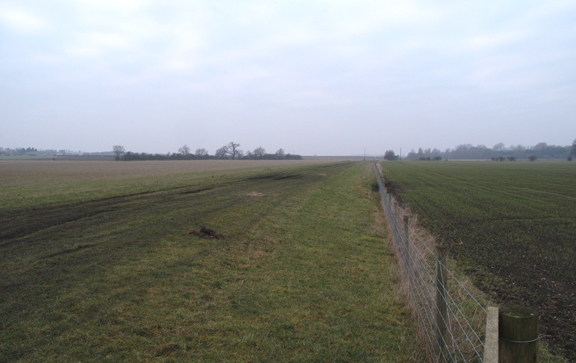
English: Site of disused railway line close to Shiptonthorpe, East Riding of Yorkshire, England. Facing York. The railway station at Shiptonthorpe didn't bear the name of the village but was called Londesborough Park. Londesborough is the next village towards the north east. Londesborough Hall was owned by George Hudson the man who was called the Railway King. The station, or more properly, Halt, was primarily built for his personal use. |
| Date | |
| Source | From geograph.org.uk |
| Author | John Wheater |
| Permission (Reusing this file) |
Creative Commons Attribution Share-alike license 2.0 |
| Attribution (required by the license) | John Wheater / Site of disused railway line close to Shiptonthorpe facing York. / |
| Camera location | | View this and other nearby images on: OpenStreetMap |
|---|
_heading:315.00&language=en)
| Object location | | View this and other nearby images on: OpenStreetMap |
|---|
_heading:315.00&language=en)
Licensing

|
This image was taken from the Geograph project collection. See this photograph's page on the Geograph website for the photographer's contact details. The copyright on this image is owned by John Wheater and is licensed for reuse under the Creative Commons Attribution-ShareAlike 2.0 license.
|
This file is licensed under the Creative Commons Attribution-Share Alike 2.0 Generic license.
Attribution: John Wheater
- You are free:
- to share – to copy, distribute and transmit the work
- to remix – to adapt the work
- Under the following conditions:
- attribution – You must give appropriate credit, provide a link to the license, and indicate if changes were made. You may do so in any reasonable manner, but not in any way that suggests the licensor endorses you or your use.
- share alike – If you remix, transform, or build upon the material, you must distribute your contributions under the same or compatible license as the original.
File history
Click on a date/time to view the file as it appeared at that time.
| Date/Time | Thumbnail | Dimensions | User | Comment | |
|---|---|---|---|---|---|
| current | 18:49, 24 February 2011 | | 576 × 363 (209 KB) | GeographBot | == {{int:filedesc}} == {{Information |description={{en|1=Site of disused railway line close to Shiptonthorpe facing York. The railway station at Shiptonthorpe didn't bear the name of the village but was called Londesborough Park. Londesborough is the next |
File usage
The following pages on the English Wikipedia use this file (pages on other projects are not listed):
Global file usage
The following other wikis use this file:
- Usage on www.wikidata.org