
File:TACA International Airlines route map (1940).jpg

Size of this preview: 632 × 599 pixels. Other resolutions: 253 × 240 pixels | 506 × 480 pixels | 810 × 768 pixels | 1,160 × 1,100 pixels.
Original file (1,160 × 1,100 pixels, file size: 331 KB, MIME type: image/jpeg)
| This is a file from the Wikimedia Commons. Information from its description page there is shown below. Commons is a freely licensed media file repository. You can help. |
.jpg)
Summary
| Description |
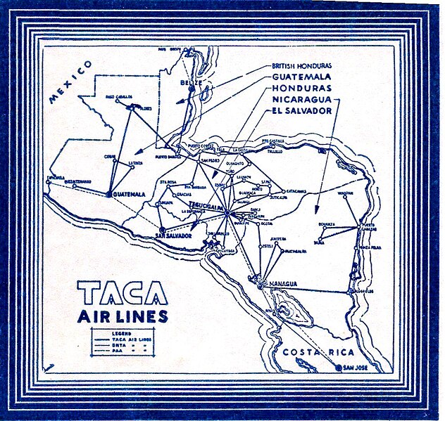
English: A map of the airline routes operated by TACA International Airlines in 1940 |
| Date | |
| Source | Internet Archive identifier: s-l-1600-21 |
| Author | Transportes Aéreos Centroamericanos |
Licensing
| This file is made available under the Creative Commons CC0 1.0 Universal Public Domain Dedication. | |
| The person who associated a work with this deed has dedicated the work to the public domain by waiving all of their rights to the work worldwide under copyright law, including all related and neighboring rights, to the extent allowed by law. You can copy, modify, distribute and perform the work, even for commercial purposes, all without asking permission.
|
File history
Click on a date/time to view the file as it appeared at that time.
| Date/Time | Thumbnail | Dimensions | User | Comment | |
|---|---|---|---|---|---|
| current | 22:24, 17 January 2024 | | 1,160 × 1,100 (331 KB) | PizzaKing13 | Uploaded a work by TACA International Airlines from {{Internet Archive link|s-l-1600-21}} with UploadWizard |
File usage
The following pages on the English Wikipedia use this file (pages on other projects are not listed):
.jpg)