
File:Table Mountain 2634s.JPG
Size of this preview: 645 × 600 pixels. Other resolutions: 258 × 240 pixels | 516 × 480 pixels | 826 × 768 pixels | 1,102 × 1,024 pixels | 2,203 × 2,048 pixels | 7,829 × 7,277 pixels.
Original file (7,829 × 7,277 pixels, file size: 10.18 MB, MIME type: image/jpeg)
| This is a file from the Wikimedia Commons. Information from its description page there is shown below. Commons is a freely licensed media file repository. You can help. |
Summary
| Warning | The original file is very high-resolution. It might not load properly or could cause your browser to freeze when opened at full size. |
|---|
| Description |
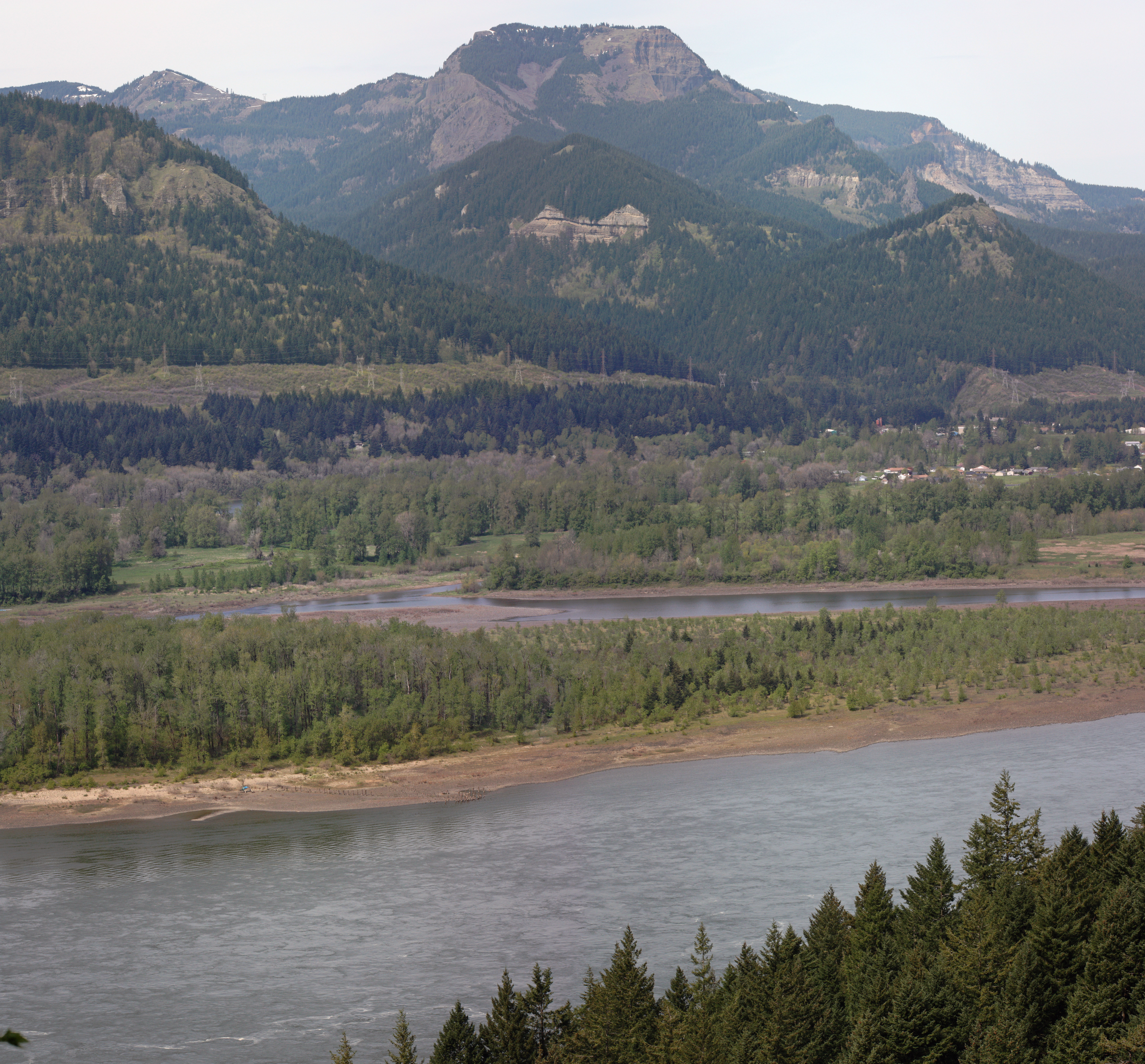
English: Table Mountain (Skamania County, Washington) (3417 ft, 1042 m; center skyline); Hamilton Mountain (2438 feet, in Beacon Rock State Park, left skyline); Ives Island in the Columbia River; Aldrich Butte (1141 feet) immediately above the buildings of North Bonneville; stitched panorama from other versions This image was created with Hugin. |
| Date | 18 April 2010, 22:06:01 +00:00 |
| Source | Own work |
| Author | Walter Siegmund (talk) |
| Other versions |
|


| Camera location | | View this and other nearby images on: OpenStreetMap |
|---|
- Location source: Garmin GPSmap 60CSx
- Location Datum: WGS84
- Viewpoint location: Gorge Trail #400; Elowah Falls Trail, John B. Yeon State Park
- Viewpoint elevation: 197 meter (647 ft)
- View direction: NbE°
- Camera: Canon EOS DIGITAL REBEL XSi
- F Number: f/0.0
- Focal Length: 0.0
©2010 Walter Siegmund
Licensing
I, the copyright holder of this work, hereby publish it under the following licenses:

|
Permission is granted to copy, distribute and/or modify this document under the terms of the GNU Free Documentation License, Version 1.2 or any later version published by the Free Software Foundation; with no Invariant Sections, no Front-Cover Texts, and no Back-Cover Texts. A copy of the license is included in the section entitled GNU Free Documentation License. |
This file is licensed under the Creative Commons Attribution-Share Alike 3.0 Unported, 2.5 Generic, 2.0 Generic and 1.0 Generic license.
- You are free:
- to share – to copy, distribute and transmit the work
- to remix – to adapt the work
- Under the following conditions:
- attribution – You must give appropriate credit, provide a link to the license, and indicate if changes were made. You may do so in any reasonable manner, but not in any way that suggests the licensor endorses you or your use.
- share alike – If you remix, transform, or build upon the material, you must distribute your contributions under the same or compatible license as the original.
You may select the license of your choice.
File history
Click on a date/time to view the file as it appeared at that time.
| Date/Time | Thumbnail | Dimensions | User | Comment | |
|---|---|---|---|---|---|
| current | 04:10, 28 May 2010 | | 7,829 × 7,277 (10.18 MB) | Wsiegmund | {{Information |Description = {{en|Table Mountain (3417 ft, 1042 m; center skyline); Hamilton Mountain (2438 feet, in Beacon Rock State Park, left skyline); Ives Island in the Columbia River; Aldrich Butte (1141 feet) immediately above the buildings of |
File usage
The following pages on the English Wikipedia use this file (pages on other projects are not listed):
Global file usage
The following other wikis use this file:
- Usage on ceb.wikipedia.org
- Usage on lld.wikipedia.org
- Usage on ur.wikipedia.org
- Usage on www.wikidata.org