
File:The Upton Marshes - geograph.org.uk - 1110306.jpg
No higher resolution available.
The_Upton_Marshes_-_geograph.org.uk_-_1110306.jpg (640 × 454 pixels, file size: 156 KB, MIME type: image/jpeg)
| This is a file from the Wikimedia Commons. Information from its description page there is shown below. Commons is a freely licensed media file repository. You can help. |
Summary
| Description |
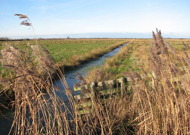
English: The Upton Marshes Upton Broad and Marshes - in the care of the Norfolk Wildlife Trust - is undergoing a major restoration programme, drawing together several acquired parcels of land so that they can be managed as one new large area. This is believed to take many years. The area consists of 300 hectares of open water, fen, reed beds, carr, woodland, grazing marshes and arable land, and most of the site is nationally and internationally recognised for its rich assemblage of wetland habitats and species. |
| Date | |
| Source | From geograph.org.uk |
| Author | Evelyn Simak |
| Attribution (required by the license) | Evelyn Simak / The Upton Marshes / |
| Camera location | | View this and other nearby images on: OpenStreetMap |
|---|
_heading:337.00&language=en)
| Object location | | View this and other nearby images on: OpenStreetMap |
|---|
_heading:337.00&language=en)
Licensing

|
This image was taken from the Geograph project collection. See this photograph's page on the Geograph website for the photographer's contact details. The copyright on this image is owned by Evelyn Simak and is licensed for reuse under the Creative Commons Attribution-ShareAlike 2.0 license.
|
This file is licensed under the Creative Commons Attribution-Share Alike 2.0 Generic license.
Attribution: Evelyn Simak
- You are free:
- to share – to copy, distribute and transmit the work
- to remix – to adapt the work
- Under the following conditions:
- attribution – You must give appropriate credit, provide a link to the license, and indicate if changes were made. You may do so in any reasonable manner, but not in any way that suggests the licensor endorses you or your use.
- share alike – If you remix, transform, or build upon the material, you must distribute your contributions under the same or compatible license as the original.
File history
Click on a date/time to view the file as it appeared at that time.
| Date/Time | Thumbnail | Dimensions | User | Comment | |
|---|---|---|---|---|---|
| current | 22:34, 24 February 2011 | | 640 × 454 (156 KB) | GeographBot | == {{int:filedesc}} == {{Information |description={{en|1=The Upton Marshes Upton Broad and Marshes - in the care of the Norfolk Wildlife Trust - is undergoing a major restoration programme, drawing together several acquired parcels of land so that they ca |
File usage
The following pages on the English Wikipedia use this file (pages on other projects are not listed):