
File:USCAE Bay Model - San Francisco Bay Detail.jpg

Size of this preview: 800 × 600 pixels. Other resolutions: 320 × 240 pixels | 640 × 480 pixels | 1,024 × 768 pixels | 1,280 × 960 pixels | 2,560 × 1,920 pixels | 3,648 × 2,736 pixels.
Original file (3,648 × 2,736 pixels, file size: 2.49 MB, MIME type: image/jpeg)
| This is a file from the Wikimedia Commons. Information from its description page there is shown below. Commons is a freely licensed media file repository. You can help. |
Summary
| Description |
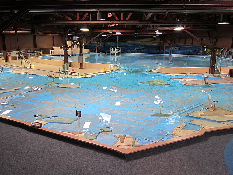
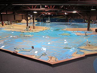
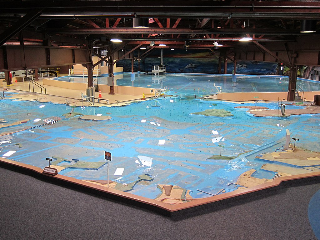
English: View of the U.S. Army Corps of Engineers Bay Model looking across the San Francisco Bay towards the Golden Gate and the Pacific Ocean. The closest land feature from this perspective is the Point Isabel Regional Shoreline in Richmond. Bay landmarks visible, from left to right, are the San Francisco – Oakland Bay Bridge, Yerba Buena Island, Treasure Island, Alcatraz Island, Golden Gate Bridge, and Angel Island. Photo taken February 9, 2012. |
| Date | |
| Source | http://en.wikipedia.org/w/index.php?title=File%3AUSCAE_Bay_Model_-_San_Francisco_Bay_Detail.jpg |
| Author | Something Original |
Licensing
This work is in the public domain in the United States because it is a work prepared by an officer or employee of the United States Government as part of that person’s official duties under the terms of Title 17, Chapter 1, Section 105 of the US Code.
Note: This only applies to original works of the Federal Government and not to the work of any individual U.S. state, territory, commonwealth, county, municipality, or any other subdivision. This template also does not apply to postage stamp designs published by the United States Postal Service since 1978. (See § 313.6(C)(1) of Compendium of U.S. Copyright Office Practices). It also does not apply to certain US coins; see The US Mint Terms of Use.
|
 | |
| This file has been identified as being free of known restrictions under copyright law, including all related and neighboring rights. | ||
File history
Click on a date/time to view the file as it appeared at that time.
| Date/Time | Thumbnail | Dimensions | User | Comment | |
|---|---|---|---|---|---|
| current | 08:16, 10 December 2013 | | 3,648 × 2,736 (2.49 MB) | Webverbesserer~commonswiki | {{Information |Description ={{en|1=View of the en:U.S. Army Corps of Engineers Bay Model looking across the en:San Francisco Bay towards the en:Golden Gate and the en:Pacific Ocean. The closest land feature from this perspect... |
File usage
The following pages on the English Wikipedia use this file (pages on other projects are not listed):
Global file usage
The following other wikis use this file:
- Usage on ca.wikipedia.org
- Usage on de.wikipedia.org
- Usage on en.wikivoyage.org
- Usage on www.wikidata.org