
File:Uchhali Wetlands Complex Landsat 8 Image.jpg
Size of this preview: 800 × 496 pixels. Other resolutions: 320 × 199 pixels | 640 × 397 pixels | 1,024 × 635 pixels | 1,486 × 922 pixels.
Original file (1,486 × 922 pixels, file size: 798 KB, MIME type: image/jpeg)
| This is a file from the Wikimedia Commons. Information from its description page there is shown below. Commons is a freely licensed media file repository. You can help. |
Summary
| Description |
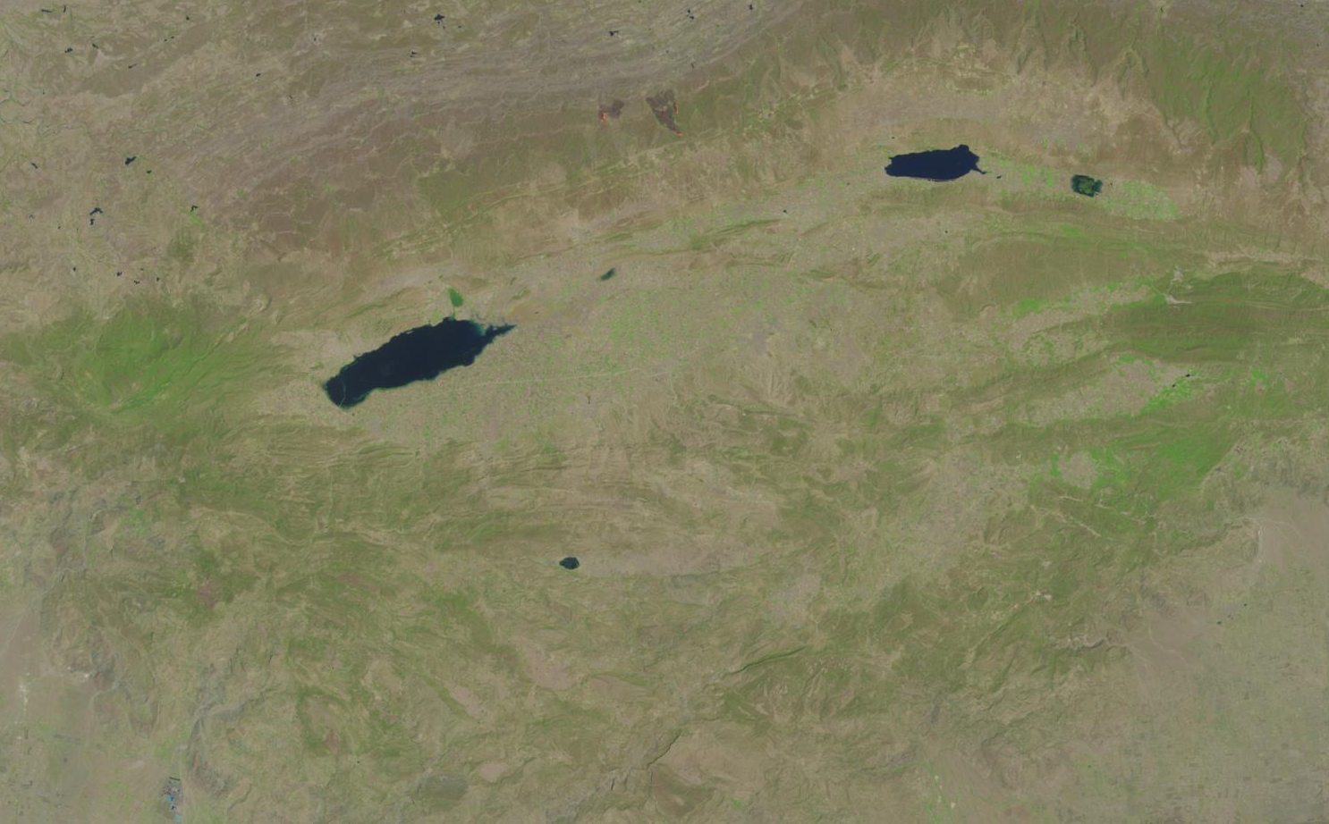
English: This natural image captured by Landsat 8 shows Uchhali Wetlands Complex in Soon Valley (also known as Soon Sakesar Valley) in Salt Range of Pakistan. The image acquired on May 17, 2016, shows three lakes (Uchhali Lake, Khabbeki Lake & Jahlar Lake) comprising this complex. It is one of the 19 Ramsar designated sites in Pakistan. |
| Date | |
| Source | http://earthexplorer.usgs.gov//browse/full/landsat_8/LC81500382016138LGN00 |
| Author | “USGS/NASA Landsat” |
| Camera location | | View this and other nearby images on: OpenStreetMap |
|---|
This image was cropped from the original image at http://earthexplorer.usgs.gov//browse/full/landsat_8/LC81500382016138LGN00
Licensing
| This file is in the public domain in the United States because it was solely created by NASA. NASA copyright policy states that "NASA material is not protected by copyright unless noted". (See Template:PD-USGov, NASA copyright policy page or JPL Image Use Policy.) | ||
 |
Warnings:
|
| Annotations | This image is annotated: View the annotations at Commons |
File history
Click on a date/time to view the file as it appeared at that time.
| Date/Time | Thumbnail | Dimensions | User | Comment | |
|---|---|---|---|---|---|
| current | 17:23, 28 July 2016 | | 1,486 × 922 (798 KB) | Sigmoid01 | User created page with UploadWizard |
File usage
The following pages on the English Wikipedia use this file (pages on other projects are not listed):
Global file usage
The following other wikis use this file:
- Usage on fr.wikipedia.org
- Usage on pa.wikipedia.org
- Usage on ur.wikipedia.org