
File:View from Hardley Windpump - geograph.org.uk - 2037603.jpg
No higher resolution available.
View_from_Hardley_Windpump_-_geograph.org.uk_-_2037603.jpg (800 × 531 pixels, file size: 117 KB, MIME type: image/jpeg)
| This is a file from the Wikimedia Commons. Information from its description page there is shown below. Commons is a freely licensed media file repository. You can help. |
Summary
| Description |
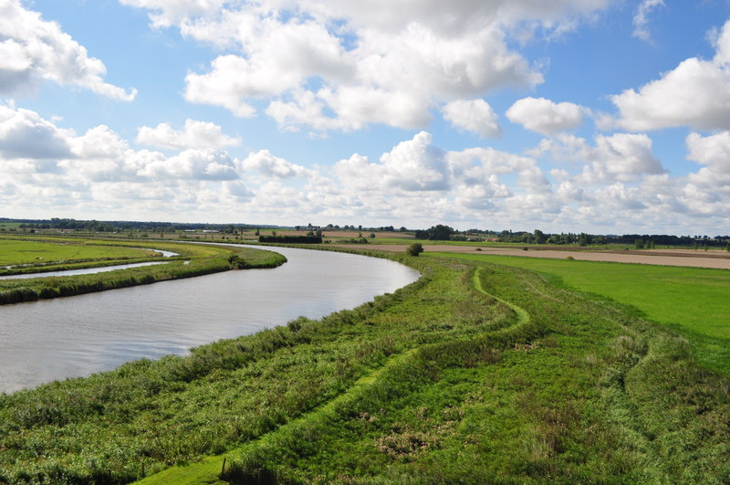
English: View from Hardley Windpump, near to Hardley Street, Norfolk, Great Britain.
See also <a href="https://www.geograph.org.uk/photo/467516">SP0937 : Broadway High Street</a>. The River Yare can be seen at at meander nearing the junction with the Chet. I didn't know it but there was once a drainage complex here, an earlier mill was sited between the little tree and the conifers. If you took an opposite look towards Cantley then you would be looking at the site of another now demolished mill and steam pumping station. Rather oddly this mill replaced the steam engine! |
| Date | |
| Source | From geograph.org.uk; transferred by User:Rubberstamp using geograph_org2commons. |
| Author | Ashley Dace |
| Permission (Reusing this file) |
Creative Commons Attribution Share-alike license 2.0 |
| Camera location | | View this and other nearby images on: OpenStreetMap |
|---|
| Object location | | View this and other nearby images on: OpenStreetMap |
|---|
_region:GB-GBN_heading:202.00&language=en)
Licensing

|
This image was taken from the Geograph project collection. See this photograph's page on the Geograph website for the photographer's contact details. The copyright on this image is owned by Ashley Dace and is licensed for reuse under the Creative Commons Attribution-ShareAlike 2.0 license.
|
This file is licensed under the Creative Commons Attribution-Share Alike 2.0 Generic license.
Attribution: Ashley Dace
- You are free:
- to share – to copy, distribute and transmit the work
- to remix – to adapt the work
- Under the following conditions:
- attribution – You must give appropriate credit, provide a link to the license, and indicate if changes were made. You may do so in any reasonable manner, but not in any way that suggests the licensor endorses you or your use.
- share alike – If you remix, transform, or build upon the material, you must distribute your contributions under the same or compatible license as the original.
File history
Click on a date/time to view the file as it appeared at that time.
| Date/Time | Thumbnail | Dimensions | User | Comment | |
|---|---|---|---|---|---|
| current | 13:36, 8 September 2010 | | 800 × 531 (117 KB) | File Upload Bot (Magnus Manske) | == {{int:filedesc}} == {{Information |Description={{en|1=View from Hardley Windpump, near to Hardley Street, Norfolk, Great Britain. See also <a href="http://www.geograph.org.uk/photo/467516">SP0937 : Broadway High Street</a>. The River Yare can be seen a |
File usage
The following pages on the English Wikipedia use this file (pages on other projects are not listed):
Global file usage
The following other wikis use this file: