
File:Wm Harvey House.JPG

Size of this preview: 800 × 600 pixels. Other resolutions: 320 × 240 pixels | 640 × 480 pixels | 1,024 × 768 pixels | 1,280 × 960 pixels | 2,560 × 1,920 pixels | 3,698 × 2,773 pixels.
Original file (3,698 × 2,773 pixels, file size: 3.11 MB, MIME type: image/jpeg)
| This is a file from the Wikimedia Commons. Information from its description page there is shown below. Commons is a freely licensed media file repository. You can help. |
|
This is an image of a place or building that is listed on the National Register of Historic Places in the United States of America. Its reference number is 71000690. |
Summary
| Description |
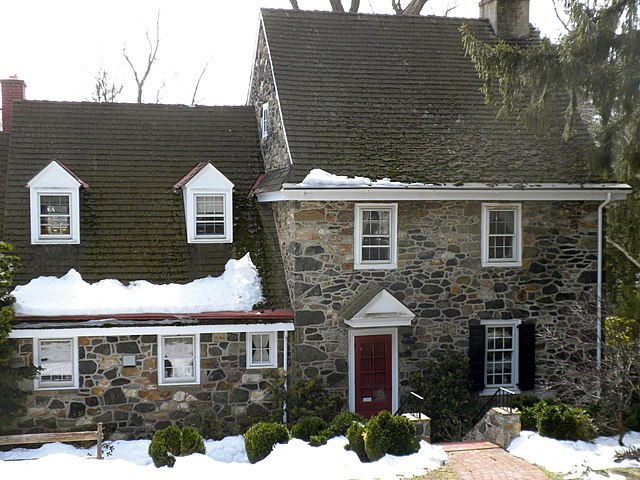
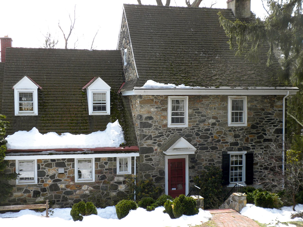
English: William Harvey House on NRHP since May 27, 1971. Northwest of Chadds Ford on Brinton's Bridge Road off U.S. Route 1 but in Pennsbury Township, Chester County. Near Brinton-King Building |
| Date | |
| Source | Own work |
| Author | Smallbones |
| Camera location | | View this and other nearby images on: OpenStreetMap |
|---|
Licensing
| I, the copyright holder of this work, release this work into the public domain. This applies worldwide. In some countries this may not be legally possible; if so: I grant anyone the right to use this work for any purpose, without any conditions, unless such conditions are required by law. |
File history
Click on a date/time to view the file as it appeared at that time.
| Date/Time | Thumbnail | Dimensions | User | Comment | |
|---|---|---|---|---|---|
| current | 01:22, 5 March 2010 | | 3,698 × 2,773 (3.11 MB) | Smallbones | {{Information |Description={{en|1=William Harvey House on NRHP since May 27, 1971. Northwest of Chadds Ford on Brinton's Bridge Road off U.S. Route 1 but in Pennsbury Township, Chester County. Near Brinton-King Building}} |Source={{own}} |Author=[[User:S |
File usage
The following pages on the English Wikipedia use this file (pages on other projects are not listed):
Global file usage
The following other wikis use this file:
- Usage on www.wikidata.org