
File:YaldingTwyford0529.JPG
Size of this preview: 800 × 600 pixels. Other resolutions: 320 × 240 pixels | 640 × 480 pixels | 1,024 × 768 pixels | 1,280 × 960 pixels | 2,016 × 1,512 pixels.
Original file (2,016 × 1,512 pixels, file size: 776 KB, MIME type: image/jpeg)
| This is a file from the Wikimedia Commons. Information from its description page there is shown below. Commons is a freely licensed media file repository. You can help. |
Summary
| Description |
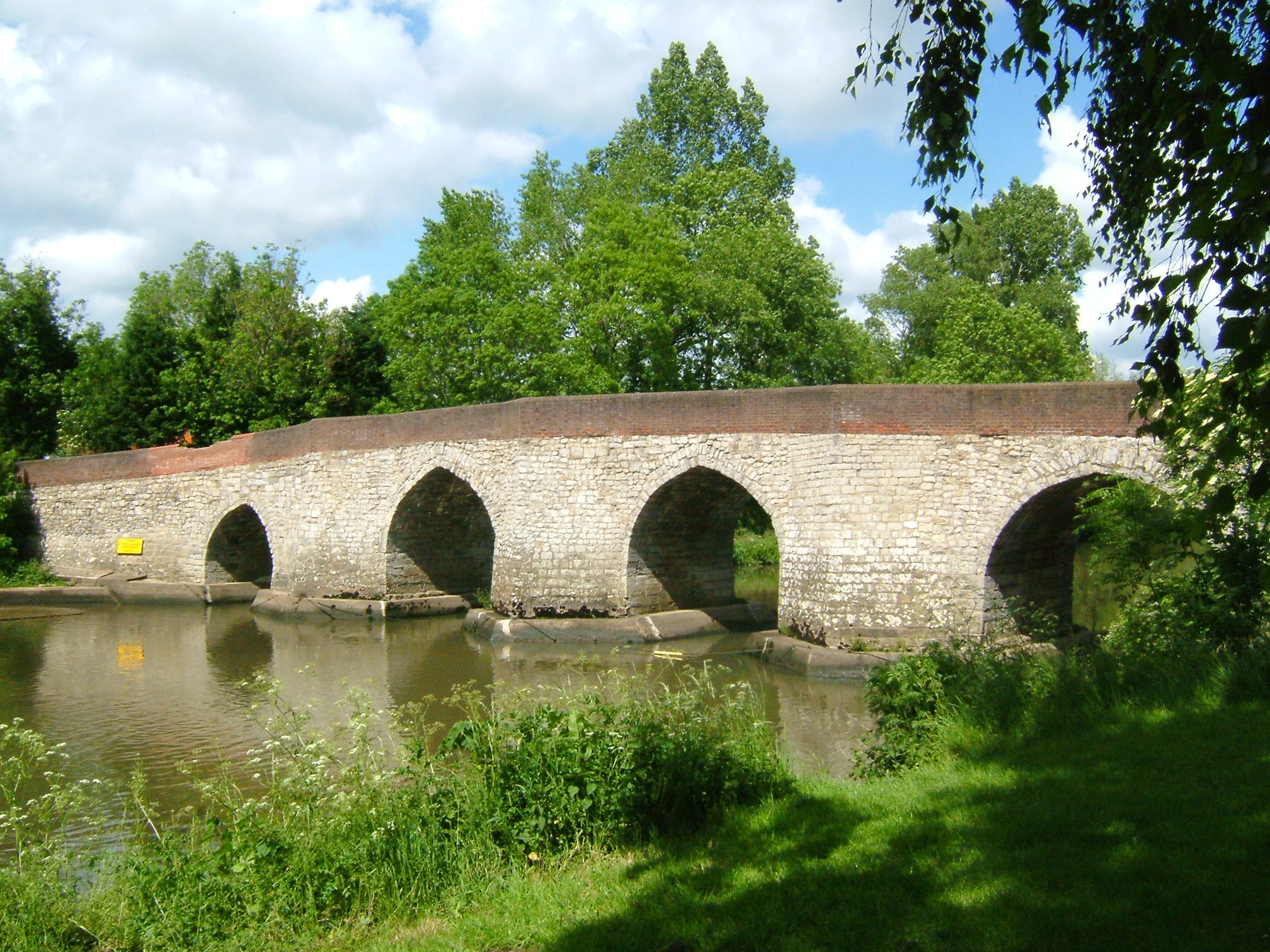
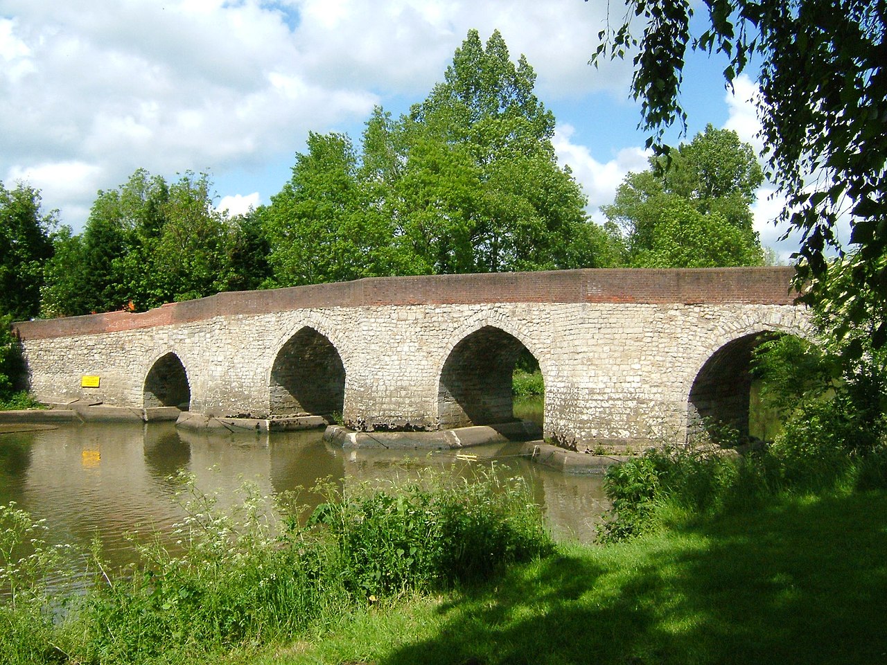
English: Twyford Bridge on the River Medway near Yalding, Kent. It is just downstream of the automatic sluice where the river drops from +11.2m to +7.41m above mean sea level. The navigation bears left through Hampstead Road Canal and Hampstead Lock; the main stream drops over the weir and sluice and is joined by the River Teise (Lesser Teise) and both pass under Twyford Bridge. The river then flows in a loop towards Yalding, where it is joined by the River Beult which has been joined by the River Teise (the other bit!) and has passed under Town Bridge. Twyford Bridge is not navigable. Twyford bridge is 10 miles from Allington.
|
||||
| Date | |||||
| Source | Own work | ||||
| Author | Clem Rutter, Rochester, Kent. |
Licensing
I, the copyright holder of this work, hereby publish it under the following licenses:

|
Permission is granted to copy, distribute and/or modify this document under the terms of the GNU Free Documentation License, Version 1.2 or any later version published by the Free Software Foundation; with no Invariant Sections, no Front-Cover Texts, and no Back-Cover Texts. A copy of the license is included in the section entitled GNU Free Documentation License. |
| This file is licensed under the Creative Commons Attribution-Share Alike 3.0 Unported license. | ||
| ||
| This licensing tag was added to this file as part of the GFDL licensing update. |
This file is licensed under the Creative Commons Attribution 2.5 Generic license.
- You are free:
- to share – to copy, distribute and transmit the work
- to remix – to adapt the work
- Under the following conditions:
- attribution – You must give appropriate credit, provide a link to the license, and indicate if changes were made. You may do so in any reasonable manner, but not in any way that suggests the licensor endorses you or your use.
You may select the license of your choice.
File history
Click on a date/time to view the file as it appeared at that time.
| Date/Time | Thumbnail | Dimensions | User | Comment | |
|---|---|---|---|---|---|
| current | 19:00, 1 June 2007 | | 2,016 × 1,512 (776 KB) | ClemRutter | == Summary == {{Information |Description= Twyford Bridge at Yalding on the River Medway. It is just downstream if the automatic sluice where the river drops from +11.2m to +7.41m above mean sea level, the navigation bears left through the Hampstead Rd Ca |
File usage
The following pages on the English Wikipedia use this file (pages on other projects are not listed):