
Kagoshima Prefecture
Kagoshima Prefecture
鹿児島県 | |
|---|---|
| Japanese transcription(s) | |
| • Japanese | 鹿児島県 |
| • Rōmaji | Kagoshima-ken |
 Kagoshima City, Kagoshima Prefecture and the active volcano Sakurajima | |
 Flag  Symbol | |
| Anthem: Kagoshima kenmin no uta | |
 | |
| Country | |
| Region | Kyushu |
| Island | Kyushu |
| Capital | Kagoshima |
| Subdivisions | Districts: 8, Municipalities: 43 |
| Government | |
| • Governor | Kōichi Shiota |
| Area | |
| • Total | 9,187.01 km2 (3,547.12 sq mi) |
| • Rank | 10th |
| Population (September 1, 2022) | |
| • Total | 1,564,175 |
| • Rank | 24th |
| • Density | 170/km2 (440/sq mi) |
| GDP | |
| • Total | JP¥ 5,773 billion US$ 53.0 billion (2019) |
| ISO 3166 code | JP-46 |
| Website | www |
| Symbols of Japan | |
| Bird | Lidth's jay (Garrulus lidthi) |
| Flower | Miyamakirishima (Rhododendron kiusianum) |
| Tree | Camphor laurel (Cinnamomum camphora) |
Kagoshima Prefecture (鹿児島県, Kagoshima-ken) is a prefecture of Japan located on the island of Kyushu and the Ryukyu Islands.[2] Kagoshima Prefecture has a population of 1,564,175 (1 September 2022) and has a geographic area of 9,187 km2 (3,547 sq mi). Kagoshima Prefecture borders Kumamoto Prefecture to the north and Miyazaki Prefecture to the northeast.
Kagoshima is the capital and largest city of Kagoshima Prefecture, with other major cities including Kirishima, Kanoya, and Satsumasendai.[3] Kagoshima Prefecture is located at the southernmost point of Kyūshū and includes the Satsunan Islands group of the Ryukyu Islands. Kagoshima Prefecture's mainland territory extends from the Ariake Sea to Shibushi Bay on the Pacific Ocean coast, and is characterized by two large peninsulas created by Kagoshima Bay. Kagoshima Prefecture formed the core of the Satsuma Domain, ruled from Kagoshima Castle, one of the most important Japanese domains of the Edo period and the Meiji Restoration.
History[edit]
Kagoshima Prefecture corresponds to the ancient Japanese provinces Ōsumi and Satsuma, including the northern part of the Ryukyu Islands (Satsunan).[4] This region played a key role in the Meiji Restoration (Saigō Takamori), and the city of Kagoshima was an important naval base during Japan's 20th century wars and the home of admiral Tōgō Heihachirō. More recent incidents are the sinking of a North Korean spy ship (100 ton class) in 2001 by the Coast Guard, which was later salvaged and exhibited in Tokyo, and the abduction of an office clerk from a Kagoshima beach in 1978 by agents from the same country. This became known only recently under the Koizumi administration.
Demographics[edit]
The two main ethnic groups of Kagoshima Prefecture are the Japanese and the Ryukyuans (Amami Islands).
Geography[edit]
Kagoshima Prefecture is located at the southwest tip of Kyushu on the Satsuma Peninsula and Ōsumi Peninsula. This prefecture also includes a chain of islands stretching further to the southwest of Kyushu for a few hundred kilometers. The most important group is the Amami Islands. Surrounded by the East China Sea to the west, Okinawa Prefecture in the south, Kumamoto Prefecture to the north, and Miyazaki Prefecture to the east, it has 2,632 km (1,635 mi) of coastline (including the 28 islands). It has a bay called Kagoshima Bay (Kinkowan), which is sandwiched by two peninsulas, Satsuma and Ōsumi. Its position made it a 'gateway' to Japan at various times in history. While Kyushu has about 13 million people, there are less than 2 million in this prefecture.
The prefecture boasts a chain of active and dormant volcanoes, including the great Sakurajima, which towers out of the Kagoshima bay opposite Kagoshima city. A steady trickle of smoke and ash emerges from the caldera, punctuated by louder mini-eruptions on an almost daily basis. On active days in Kagoshima city an umbrella is advisable to ward off the ash. Sakurajima is one of Japan's most active volcanoes. Major eruptions occurred in 1914, when the island mountain spilled enough material to become permanently connected to the mainland, and a lesser eruption in 1960. Volcanic materials in the soil make Sakurajima a source for record daikon radishes, roughly the size of a basketball. Many beaches around the Kagoshima Bay are littered with well-worn pumice stones. A crater lake in the southwestern tip of the prefecture, near the spa town of Ibusuki, is home to a rare species of giant eel.
As of 31 March 2019, 13% of the total land area of the prefecture was designated as Natural Parks, namely the Amami Guntō, Kirishima-Kinkowan, Unzen-Amakusa, and Yakushima National Parks; Koshikishima and Nichinan Kaigan Quasi-National Parks; and Akune, Bōnoma, Fukiagehama, Imutaike, Ōsumi Nanbu, Sendaigawa Ryūiki, Takakumayama, and Tokara Rettō Prefectural Natural Parks.[5][6]
-

-
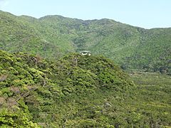 Mangrove native forest in Amami Island
 -
 A crane observation centre in Izumi crane migration grounds
 -
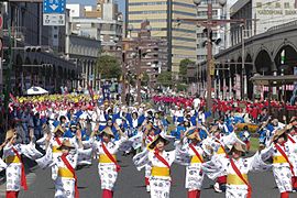 Ohara style folk dance in Kagoshima Ohara Festival in November
 -
 Sand bath style in Ibusuki Spa
 -
 Map of Kagoshima Prefecture


Economy[edit]
Most of the economic sector is focused in Kagoshima City and the surrounding area, corresponding to the extent of the former Satsuma Province. The eastern part of the prefecture, the former Ōsumi Province, is mostly rural and shows a general population decline.
The prefecture has strong agricultural roots, which are reflected in its most well-known exports: green tea, sweet potato, radish, Pongee rice, Satsuma ware, Berkshire pork ("kurobuta") and local Black Wagyu beef. Kagoshima prefecture's production of bonito flakes is second only to that of Shizuoka. In addition, it produces Japan's largest volume of unagi eels. Kagoshima is also largest beef and pork producing prefecture in Japan.
The Japan Aerospace Exploration Agency (JAXA) has several facilities within the prefecture, including the country's main launch facility on Tanegashima and the Uchinoura Space Center.
The prefecture's gross domestic product is approximately 5,548.7 trillion yen, with a work force of about 791,000 people (2018)[7]
Municipalities[edit]
City Town Village
The following is a list of Kagoshima Prefecture's cities, and its administrative districts with their constituent towns and villages:
Cities[edit]


Nineteen cities are located in Kagoshima Prefecture:
| Name | Area (km2) | Population | Map | |
|---|---|---|---|---|
| Rōmaji | Kanji | |||
| 姶良市 | 231.32 | 75,665 | ||
| 阿久根市 | 134.3 | 23,887 | ||
| 奄美市 | 308.15 | 42,718 | ||
| 日置市 | 253.06 | 51,819 | ||
| 指宿市 | 149.01 | 43,931 | ||
| いちき串木野市 | 112.04 | 30,551 | ||
| 伊佐市 | 392.36 | 30,070 | ||
| 出水市 | 330.06 | 56,205 | ||
| 鹿児島市 | 547.58 | 595,049 | ||
| 鹿屋市 | 448.33 | 104,148 | ||
| 霧島市 | 603.18 | 124,763 | ||
| 枕崎市 | 74.88 | 21,960 | ||
| 南九州市 | 357.85 | 39,738 | ||
| 南さつま市 | 283.3 | 39,012 | ||
| 西之表市 | 205.75 | 16,418 | ||
| 薩摩川内市 | 683.5 | 96,411 | ||
| 志布志市 | 209.01 | 33,724 | ||
| 曽於市 | 390.39 | 37,038 | ||
| 垂水市 | 161.86 | 14,847 | ||
Districts[edit]
These are the towns and villages in each district:
| Name | Area (km2) | Population | District
[subprefecture (if any)] |
Type | Map | |
|---|---|---|---|---|---|---|
| Rōmaji | Kanji | |||||
| 天城町 | 80.35 | 6,350 | Ōshima District | Town | ||
| 知名町 | 53.29 | 5,976 | Ōshima District | Town | ||
| 東串良町 | 27.69 | 7,122 | Kimotsuki District | Town | ||
| 伊仙町 | 62.7 | 6,594 | Ōshima District | Town | ||
| 喜界町 | 56.94 | 7,657 | Ōshima District | Town | ||
| 肝付町 | 308.12 | 15,169 | Kimotsuki District | Town | ||
| 錦江町 | 163.15 | 9,328 | Kimotsuki District | Town | ||
| 南大隅町 | 213.59 | 7,646 | Kimotsuki District | Town | ||
| 南種子町 | 110.4 | 5,925 | Kumage District | Town | ||
| 三島村 | 31.36 | 383 | Kagoshima District | Village | ||
| 長島町 | 116.13 | 10,124 | Izumi District | Town | ||
| 中種子町 | 137.78 | 8,439 | Kumage District | Town | ||
| 大崎町 | 100.82 | 13,488 | Soo District | Town | ||
| さつま町 | 303.43 | 23,842 | Satsuma District | Town | ||
| 瀬戸内町 | 239.92 | 9,379 | Ōshima District | Town | ||
| 龍郷町 | 82.08 | 5,992 | Ōshima District | Town | ||
| 徳之島町 | 104.87 | 11,673 | Ōshima District | Town | ||
| 十島村 | 101.35 | 688 | Kagoshima District | Village | ||
| 宇検村 | 103.07 | 1,843 | Ōshima District | Village | ||
| 和泊町 | 40.37 | 6,929 | Ōshima District | Town | ||
| 屋久島町 | 540.98 | 13,486 | Kumage District | Town | ||
| 大和村 | 88.15 | 1,638 | Ōshima District | Village | ||
| 与論町 | 20.49 | 5,263 | Ōshima District | Town | ||
| 湧水町 | 144.33 | 12,220 | Aira District | Town | ||
Mergers[edit]
Culture[edit]
Food[edit]
Kagoshima Prefecture has a distinct and rich food culture. The warm weather and diverse environments allow for the agriculture and aquaculture of Kagoshima to thrive. Numerous restaurants around Kagoshima feature Satsuma Province local cuisine. Popular cuisine incorporating local agriculture include sweet potato, kibinago sashimi (silver-striped herring), buri amberjack, kampachi yellowtail, "Black Label Products" such as kuro-ushi Wagyu beef, kuro-buta Berkshire pork dishes, and kuro-Satsuma jidori chicken (sometimes served as raw, chicken sashimi); smoked eel, keihan, and miki (fermented rice milk consumed among residents of the Amami Islands).[citation needed]
Satsuma-age[edit]
Satsuma-age, or deep-fried fish cake, comes in great variety in Kagoshima. Though the deep-fried fishcake can be found throughout the country, the Satsuma Domain (modern-day Kagoshima Prefecture) is commonly believed to be the birthplace of the snack. It is said, though, the concept was introduced from the Ryūkyū Kingdom (modern-day Okinawa Prefecture) by Satsuma Lord, Nariakira Shimazu.
Sweets[edit]
There are many types of sweets produced in Kagoshima Prefecture. Kagoshima-based Seika Foods Co., Ltd. (Seika shokuhin kabushiki-kaisha) has produced some of Japan's most popular and timeless sweets such as hyōroku mochi Bontan Ame (ボンタンアメ), Satsuma Imo Caramel (さつまいもキャラメル), and green tea-flavored Hyōroku mochi, Minami "shirokuma" shaved ice desserts, etc. Traditional treats outside of Seika Food Co., Ltd. products include karukan (sweet cakes made from steamed yams and rice flour), jambo-mochi, kokutō brown sugar from the Amami Islands, getanha brown sugar cake, etc.
Beverages[edit]
In 1559, at Kōriyama Hachiman Shrine (郡山八幡神社) in Isa City (伊佐市) a carpenter wrote atop a wooden board "the Shintō Priest of this shrine is too stingy to offer me Shōchū (焼酎) showing an early love for the spirits. Kagoshima Prefecture is officially recognized (by the World Trade Organization) as the home to one of the most traditional beverages of Japan, shōchū. In Kagoshima there are 113+ distilleries, producing about 1,500 highly acclaimed brands, placing Kagoshima in the top for production quantity and shipment. While visiting Kagoshima, one may notice labels reading Honkaku-shōchū (本格焼酎). Honkaku-shōchū is a distilled beverage produced with traditional skills using ingredients such as natural spring water, sweet potatoes, locally grown sugar cane, and grains. Varieties of honkaku-shōchū include Imo-jōchū (芋焼酎), shōchū distilled from sweet potatoes, Mugi-jōchū (麦焼酎), distilled from barley, and Kome-jōchū (米焼酎) distilled from rice. Another type of shōchū is Kokutō-shōchū (黒糖焼酎), shōchū distilled with brown sugar). Shōchū has long gained international favor and has come to be comparable to Bordeaux for wine, Scotch for whiskey, and Cognac for brandy. Also, the Amami Islands of Kagoshima Prefecture are the only areas sanctioned to bear the label of kokutō-shōchū.
Kurozu (黒酢) or black vinegar is another item of the "Black Label Products" of Kagoshima, the other of which is Kokutō-shōchū. There are a number of kurozu farms around Kagoshima, most of which are located around the Kirishima area. Most kurozu farms produce kurozu bottled vinegar (fermented for a single year, 2+ years) along with other items such as salad dressing, powders, capsules, spices, candy, etc. Kurozu also comes in different flavors such as grape, orange, ume plum, etc. though the most popular flavor by far is apple. The farms are open to visitations and often offer tours.
Dialect[edit]
Today, Kagoshima is home to a distinctive dialect of Japanese known as Satsugū dialect (薩隅方言, Satsugū Hōgen) or Kagoshima dialect (鹿児島弁, Kagoshima-ben, or Kagomma-ben), differing from the usual Kyushu dialects with its pronunciations of the yotsugana.
For the most part, Satsugū dialect is mutually unintelligible with Standard Japanese,[8] though most Satsugū speakers know both as a result of language standardization in Japan.
Sport and recreation[edit]

Kagoshima Rebnise, a professional basketball team, was founded in 2003 and currently competes in the second division of the national B.League. Kagoshima United FC, a football team, was founded in 2014 and competes in the J3 League. Although no major professional baseball teams are based in the prefecture, a number of Kagoshima's ballparks have hosted the spring training camps of Nippon Professional Baseball teams:
- Kamoike Ballpark, previous camp home of the Chiba Lotte Marines (NPB) and Lotte Giants (KBO League). Also hosts regular season games.
- Kamoike Citizen Stadium
- Ibusuki Municipal Ballpark (指宿市営球場), camp home of the Kokutesu Swallows
- Yunomoto Ballpark (湯之元球場), camp home of the Yakult Atoms
- Kagoshima Kamoike Stadium, camp home of Júbilo Iwata (football) and Toshiba Brave Lupus (rugby)
- Kagoshima Fureai Sportsland, camp home of Sagan Tosu (football)
The Kirishima-Yaku National Park is located in Kagoshima Prefecture.
Education[edit]
Universities and colleges[edit]
- Kagoshima University
- National Institute of Fitness and Sports in Kanoya
- The International University of Kagoshima
- Kagoshima Immaculate Heart University
- Daiichi Institute of Technology
- Shigakukan University
- Kagoshima Prefectural College
- Kagoshima Immaculate Heart College
- Kagoshima Women's Junior College
- Daiichi Junior College of Infant Education
High schools[edit]
Science and technology facilities[edit]
Museums[edit]
- Bansei Tokkō Peace Museum
- Chiran Peace Museum for Kamikaze Pilots
- Museum of the Meiji Restoration
- Reimeikan, Kagoshima Prefectural Center for Historical Material
- Uenohara site
Transportation[edit]
Rail[edit]
Trams[edit]
Roads[edit]
Expressways and toll roads[edit]
- Kyushu Expressway
- Miyazaki Expressway
- Ibusuki Toll Road
- Minamikyushu Expressway
- Higashikyushu Expressway (Hayato Road)
National Highways[edit]
- National Route 3 (Kitakyushu–Fukuoka–Kurume–Kumamoto–Minamata-Izumi-Satsuma Sendai-Kagoshima)
- National Route 10 (Kitakyushu-Nakatsu–Beppu–Saiki–Nobeoka–Miyazaki–Miyakonojo-Kagoshima)
- National Route 58 (disconnected segments in downtown Kagoshima and on the islands of Tanegashima and Amami Ōshima)
- Route 220 (Miyazaki-Nichinan-Shibushi-Kanoya-Tarumizu-Kirishima)
- Route 223
- Route 224
- Route 225
- Route 226
- Route 267 (Hitoyoshi-Isa-Satsuma Sendai)
- Route 268 (Minamata-Isa-Ebino–Kobayashi-Miyazaki)
- Route 269
- Route 270
- Route 328 (Kagoshima-Isa-Izumi)
- Route 389 (Ōmuta–Tamana–Unzen–Minamishimabara–Amakusa-Akune)
- Route 447 (Ebino-Isa-Izumi)
- Route 448
- Route 499
- Route 504 (Kanoya-Kirishima-Satsuma-Izumi)
Ports[edit]
- Kagoshima Port
- Domestic ferry route to Sakurajima, Kikai Island, Tokunoshima, Amami Island, Tanegashima, Yakushima, Yoron Island, Okinoerabu and Naha.
- High-speed craft route to Ibusuki, Tanegashima and Yakushima.
- International container hub port
- Shibushi Port
- Ferry route to Osaka, Tokyo, Naha and Amami Island
- International and domestic container hub port
- Naze Port
- Ferry Route to Osaka, Kobe, Kagoshima, Yakushima, Tanegashima, Tokunoshima and Naha.
- Yakushima Port
- Tanegashima Port
- Tokunoshima Port
Airports[edit]
- Kagoshima Airport
- Amami Airport
- Tokunoshima Airport
- Tanegashima Airport
- Yakushima Airport
- Okinoerabu Airport
- Yoron Airport
Notable people[edit]
- Isamu Akasaki, physicist and engineer, Nobel Prize in Physics laureate
- Hajime Chitose, singer
- Hayato Tani, actor
- Yasuhito Endo, football player
- Kosuke Fukudome, MLB player
- GO!GO!7188, rock band
- Masazumi Harada, doctor
- Goyō Hashiguchi, artist
- Utami Hayashishita, professional wrestler
- Tōgō Heihachirō, admiral of the fleet in the Imperial Japanese Navy
- Kota Ibushi, professional Wrestler
- Kazuo Inamori, industrialist turned philanthropist
- Junichi Inamoto, football player
- Takehiko Inoue, modern comic artist
- Shinobu Kaitani, modern comic artist
- Yuki Kashiwagi, AKB48 member
- Kunio Kato animator known especially for La Maison en Petits Cubes
- Yoichiro Kawaguchi, computer graphics artist
- Munenori Kawasaki, MLB player
- Kohei Miyauchi, voice actor
- Sakura Miyawaki, HKT48, Iz*One and LE SSERAFIM member
- Mika Nakashima, artist
- Shimazu Nariakira, feudal lord
- Yuya Osako, football player
- Robico, manga artist
- Jirō Sakagami, comedian
- Hiroyuki Sakai, Iron Chef cook
- Hitoshi Sakimoto, composer
- Nanami Sakuraba, actress
- Tokichi Setoguchi, composer
- Yoku Shioya, voice actor
- Kawasaki Shōzō, founder of Kawasaki Heavy Industries
- Kento Tachibanada, football player
- Nabi Tajima, oldest Japanese and Asian person ever, last living person born in the 19th century
- Saigō Takamori, samurai
- Seiji Tōgō, artist
- Ōkubo Toshimichi, statesman
- Yoshiyuki Tsuruta, swimmer, Olympic Games double gold medalist
- Wowaka, singer
Mythical creatures[edit]
Sister relations[edit]
- Jeollabuk-do, South Korea, October 1989 duo-declaration
- Georgia, United States November 28, 1966, became a sister state
- Jiangsu, China
- Gifu Prefecture July 27, 1971, became a sister prefecture
See also[edit]
Notes[edit]
- ^ "2020年度国民経済計算(2015年基準・2008SNA) : 経済社会総合研究所 - 内閣府". 内閣府ホームページ (in Japanese). Retrieved 2023-05-18.
- ^ Nussbaum, Louis-Frédéric. (2005). "Kagoshima prefecture" in Japan Encyclopedia, p. 447, p. 447, at Google Books.
- ^ Nussbaum, "Kagoshima prefecture" at p. 447, p. 447, at Google Books.
- ^ Nussbaum, "Provinces and prefectures" at p. 780, p. 780, at Google Books.
- ^ 自然公園都道府県別面積総括 [General overview of area figures for Natural Parks by prefecture] (PDF) (in Japanese). Ministry of the Environment. Retrieved 12 August 2019.
- ^ 自然公園 [Natural Parks] (in Japanese). Kagoshima Prefecture. Retrieved 12 August 2019.
- ^ "Data | Investment Opportunities in Japan's Regions - Investing in Japan - Japan External Trade Organization". 2024.
- ^ Okumura, Nao (July 26, 2016). "Japanese Dialect Ideology from Meiji to the Present". Portland State University. p. 9.
References[edit]
- Nussbaum, Louis-Frédéric and Käthe Roth. (2005). Japan Encyclopedia. Cambridge, Massachusetts: Harvard University Press. ISBN 0-674-01753-6; ISBN 978-0-674-01753-5; OCLC 58053128.
External links[edit]
 Geographic data related to Kagoshima Prefecture at OpenStreetMap
 Kagoshima (prefecture) travel guide from Wikivoyage
- Official Kagoshima Prefecture website Archived 2015-06-11 at the Wayback Machine (in English)
- Official Kagoshima Prefecture Promotional Website (in English)
- National Archives of Japan ... Kagoshima map (1891)
| Core city | |||||||||||
|---|---|---|---|---|---|---|---|---|---|---|---|
| Cities |
| ||||||||||
| Districts |
| ||||||||||

31°24′N 130°31′E / 31.400°N 130.517°E
| International | |
|---|---|
| National | |
| Geographic | |
| Academics | |
| Other | |