
Siirt
Siirt | |
|---|---|
 View of Siirt | |
 Siirt Location in Turkey | |
| Coordinates: 37°55′30″N 41°56′45″E / 37.92500°N 41.94583°E | |
| Country | Turkey |
| Province | Siirt |
| District | Siirt |
| Government | |
| • Elected Mayor | Berivan Helen Işık (deposed) (HDP) |
| Population (2021)[1] | 160,340 |
| Time zone | UTC+3 (TRT) |
| Website | www.siirt.bel.tr |

Siirt (Arabic: سِعِرْد, romanized: Siʿird; Armenian: Սղերդ, romanized: S'gherd;[citation needed] Syriac: ܣܥܪܬ, romanized: Siirt;[2] Kurdish: Sêrt[3]) is a city in the Siirt District of Siirt Province in Turkey.[4] It had a population of 160,340 in 2021.[1]
Neighborhoods[edit]
The city is divided into the neighborhoods of Afetevlerı, Alan, Algul, Bahçelievler, Barış, Batı, Conkbayır, Çal, Doğan, Dumlupınar, Halenze, İnönü, Karakol, Kooperatif, Sakarya, Tınaztepe, Ulus, Ülkü, Veysel Karani and Yeni.[1]
History[edit]
Previously known as Saird, in pre-Islamic times Siirt was a diocese of the Eastern Orthodox Church (Sirte, Σίρτη in Byzantine Greek). In the medieval times, Arzen was the main city and it competed with Hasankeyf over the control the region, Siirt was only to become a center of the region in the 14th century. But it was still dependent from Hasankeyf until the 17th century.[5] An illuminated manuscript known as the Syriac Bible of Paris might have originated from the Bishop of Siirt's library, Siirt's Christians would have worshipped in Syriac, a liturgical language descended from Aramaic still in use by the Syriac Rite,Chaldean Rite, other Eastern Christians in India, and the Nestorians along the Silk Road as far as China. The Chronicle of Seert was preserved in the city; it describes the ecclesiastical history of the Persian realm through to the middle of the seventh century. From 1858 to 1915 the city was the seat of a bishop of the Chaldean Catholic Church. Most of the city's Assyrians, including Addai Scher their archbishop were murdered during the Assyrian genocide along with the loss of artefacts such as the Syriac manuscript of Theodore of Mopsuestia's De Incarnatione.[6] Also during World War I, the Armenian population of Siirt became a victim of the Armenian genocide.[7]
Demographics[edit]
Historical[edit]
Mark Sykes recorded Siirt as a city inhabited by Kurds, Arabs, Assyrians, and Armenians.[8] During the second half of the 19th century, many Armenians left Siirt due to persecutions and poor economic conditions.[9] During the 1895 Hamidian massacres, many Armenians were forcibly converted to Islam and the clergy was massacred.[9] Before World War I, the sanjak of Siirt formed a Christian enclave with 60,000 Christians: 25,000 Armenians, 20,000 Syriac Orthodox, and 15,000 Chaldean Catholics.[10] According to the Armenian Patriarchate of Constantinople, in 1914 there were 4,437 Armenians in the kaza, with three churches, one monastery and two schools.[9] Agha Petros mentions 40 Nestorian Assyrian families in the city of Siirt.[9] Mardin Chaldean priest Joseph Tfinkdji lists 5,430 Chaldeans in the diocese: 824 in the town and the rest in surrounding villages.[9] The community was led by Addai Sher.[9] David Gaunt mentions some Yezidi presence.[9]
| Mother tongue composition of the city proper of Siirt in 1927 according to Turkish census[11] | |||
| Languages | Speakers | % | |
|---|---|---|---|
| Arabic | 10,498 | 69.5 | |
| Turkish | 3,621 | 24.0 | |
| Kurdish | 973 | 6.5 | |
| Other | 7 | 0.0 | |
| Total | 15,099 | 100 | |
According to the 1927 census, the population in the whole district was almost exclusively Muslim, with the exception of two Catholics, one Protestant, four Armenians, 17 other Christians, and 38 "other religion".[12]
İsmet İnönü referred to the city as an Arab city eager to get Turkified, while Kurds lived in the outskirts.[13]
Modern[edit]
Kurds constitute a majority in the city with a significant Arab community.[14][15][16] The Kurdish tribes living in the city are the Botikan, Dudêran, Elîkan, Keşkoliyan, Silokan and Sturkiyan.[17]
Government[edit]
In the municipal elections of March 2019 Berivan Helen Işık of the Peoples' Democratic Party (HDP) was elected mayor.[18] She was dismissed from her post on 15 May 2020 and detained over terror charges. Ali Fuat Atik, the Governor of the Siirt province was appointed trustee by the Ministry of the Interior.[19]
Landmarks[edit]
The city's landmark is the Great Mosque (Ulu Cami) built in 1129 by the Great Seljuk Sultan Mahmud II who belonged to the main branch of the dynasty that ruled from Baghdad after the Seljuks had split into several branches. The mosque was further developed by the Ottoman Empire. The mosque was restored in 1965.
Trivia[edit]
Siirt was Turkish Prime Minister Recep Tayyip Erdoğan's constituency from 2003 to 2007. His wife, Mrs. Emine Erdoğan, is from Siirt and the PM had been elected to the Turkish Grand National Assembly in a by-election held in Siirt in 2003.
Although Siirt remains one of the poorer cities in Turkey, some neighbourhoods have fine and modern housing including new shops, banks and hotels.[20]
Climate[edit]
Siirt has a hot-summer Mediterranean climate (Köppen: Csa, Trewartha: Cs) with very hot, dry summers and chilly, wet winters. During winter months there is frequent frost and occasional snowfall.
| Climate data for Siirt (1991–2020, extremes 1939–2022) | |||||||||||||
|---|---|---|---|---|---|---|---|---|---|---|---|---|---|
| Month | Jan | Feb | Mar | Apr | May | Jun | Jul | Aug | Sep | Oct | Nov | Dec | Year |
| Record high °C (°F) | 19.7 (67.5) |
20.6 (69.1) |
28.5 (83.3) |
32.9 (91.2) |
36.2 (97.2) |
40.2 (104.4) |
44.4 (111.9) |
46.0 (114.8) |
41.3 (106.3) |
36.6 (97.9) |
25.8 (78.4) |
24.3 (75.7) |
46.0 (114.8) |
| Mean daily maximum °C (°F) | 7.3 (45.1) |
9.3 (48.7) |
14.2 (57.6) |
19.7 (67.5) |
25.7 (78.3) |
32.8 (91.0) |
37.5 (99.5) |
37.6 (99.7) |
32.6 (90.7) |
25.2 (77.4) |
15.7 (60.3) |
9.1 (48.4) |
22.2 (72.0) |
| Daily mean °C (°F) | 3.3 (37.9) |
4.7 (40.5) |
9.2 (48.6) |
14.3 (57.7) |
19.8 (67.6) |
26.5 (79.7) |
30.9 (87.6) |
30.9 (87.6) |
25.8 (78.4) |
18.9 (66.0) |
10.6 (51.1) |
5.1 (41.2) |
16.7 (62.1) |
| Mean daily minimum °C (°F) | 0.4 (32.7) |
1.2 (34.2) |
5.1 (41.2) |
9.7 (49.5) |
14.3 (57.7) |
20.1 (68.2) |
24.1 (75.4) |
24.1 (75.4) |
19.4 (66.9) |
13.7 (56.7) |
6.8 (44.2) |
2.3 (36.1) |
11.8 (53.2) |
| Record low °C (°F) | −19.3 (−2.7) |
−16.5 (2.3) |
−13.3 (8.1) |
−4.1 (24.6) |
2.0 (35.6) |
8.2 (46.8) |
13.1 (55.6) |
14.4 (57.9) |
8.5 (47.3) |
0.3 (32.5) |
−6.6 (20.1) |
−14.6 (5.7) |
−19.3 (−2.7) |
| Average precipitation mm (inches) | 81.0 (3.19) |
98.6 (3.88) |
115.2 (4.54) |
102.2 (4.02) |
63.9 (2.52) |
9.7 (0.38) |
3.8 (0.15) |
2.2 (0.09) |
7.9 (0.31) |
49.1 (1.93) |
76.8 (3.02) |
90.3 (3.56) |
700.7 (27.59) |
| Average precipitation days | 12.73 | 12.53 | 14.83 | 14.07 | 11.33 | 4.13 | 1.53 | 1.00 | 2.47 | 8.77 | 9.07 | 11.90 | 104.4 |
| Average relative humidity (%) | 70 | 70 | 59 | 56 | 52 | 33 | 25 | 23 | 28 | 46 | 61 | 69 | 49 |
| Mean monthly sunshine hours | 108.5 | 121.5 | 164.3 | 192.0 | 263.5 | 333.0 | 356.5 | 331.7 | 285.0 | 217.0 | 156.0 | 105.4 | 2,634.4 |
| Mean daily sunshine hours | 3.5 | 4.3 | 5.3 | 6.4 | 8.5 | 11.1 | 11.5 | 10.7 | 9.5 | 7.0 | 5.2 | 3.4 | 7.2 |
| Source 1: Turkish State Meteorological Service[21] | |||||||||||||
| Source 2: Weatherbase[22] | |||||||||||||
Notable people[edit]
- Addai Sher, Chaldean Catholic archbishop of Siirt in Upper Mesopotamia was martyred in Siirt in 1915 during the 1915 Assyrian genocide
- Mehmet Güney (1936*), Diplomat and judge
- Coşkun Aral (1956*), correspondent, photo journalist, television journalist and documentary film producer.
- Ethem Sancak (1958*), Businessmen
- Yasin Aktay (1966*), Chairman of Justice and Development Party in Turkey
- Hasan Özer (1974*), footballer and manager
- Kerem Gürgen (1983*), boxer
- Evin Demirhan (1995*), freestyle wrestler
Gallery[edit]
-
 A bridge in Siirt
 -
 Ebul Vefa Mosque
 -
 Ibrahim hakkı shrine in Siirt Tillo
 -
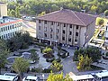 The city hall
 -
 Siirt Tillo
 -
 Siirt Street scene
 -
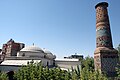
 Siirt Saat Kulesi
 -
 Siirt Market area
 -
 Siirt Ulu Camii
 -
 Hacı Abdulhakim Sancak Çarşı Camii
 -
 Hacı Abdulhakim Sancak Çarşı Camii Minber


.jpg)


References[edit]
- ^ a b c "31 ARALIK 2021 TARİHLİ ADRESE DAYALI NÜFUS KAYIT SİSTEMİ (ADNKS) SONUÇLARI" (XLS). TÜİK (in Turkish). Retrieved 16 December 2022.
- ^ Thomas A. Carlson et al., “Siirt — ܣܥܪܬ ” in The Syriac Gazetteer last modified December 9, 2016, http://syriaca.org/place/188.
- ^ Adem Avcıkıran (2009). Kürtçe Anamnez Anamneza bi Kurmancî (PDF) (in Turkish and Kurdish). p. 57. Retrieved 17 December 2019.
- ^ "Türkiye Mülki İdare Bölümleri Envanteri". T.C. İçişleri Bakanlığı (in Turkish). Retrieved 19 December 2022.
- ^ Sinclair, T. A. (1989-12-31). Eastern Turkey: An Architectural & Archaeological Survey, Volume III. Pindar Press. p. 295. ISBN 978-0-907132-34-9.
- ^ Gaunt, David; Beṯ-Şawoce, Jan (2006), Massacres, resistance, protectors: Muslim-Christian relations in Eastern Anatolia during World War I, Gorgias Press LLC, pp. 251–253, ISBN 978-1593333010
- ^ Kevorkian, Raymond (2016-01-25). "The Extermination of Ottoman Armenians by the Young Turk Regime (1915-1916) | Sciences Po Mass Violence and Resistance - Research Network". extermination-ottoman-armenians-young-turk-regime-1915-1916.html. Retrieved 2021-01-31.
- ^ Sykes, Mark (1904). Dar-ul-Islam: A Record of a Journey Through Ten of the Asiatic Provinces of Turkey. Bickers & Son. p. 264.
- ^ a b c d e f g "Kaza Siirt / ܣܥܪܬ Siʿret / Sa'irt / Սղերդ - Sġerd / Sgherd". Virtual Genocide Memorial. Retrieved 2023-09-17.
- ^ "Sancak Siirt / ܣܥܪܬ Siʿret / Sa'irt / Սղերդ - Sġerd / Sgherd". Virtual Genocide Memorial. Retrieved 2023-09-17.
- ^ Umumî Nüfus Tahriri. İstatistik Umum Müdürlüğü. 1927. pp. 223–224. Retrieved 6 July 2022.
- ^ BabaoğLu, Resul (2018-01-01). "CUMHURİYET İDARESİNE GEÇİŞ SÜRECİNDE SİİRT'TE DEMOGRAFİK GÖSTERGELER" (PDF). Journal Of History School. 11 (XXXIV): 529–563. doi:10.14225/Joh1285. ISSN 1308-5298.
- ^ Mumcu, Uğur (August 1993). Kürt Dosyası (42 ed.). Ankara: Uğur Mumcu Araştırmacı Gazetecilik Vakfı. p. 72. ISBN 9786054274512. Retrieved 17 September 2022.
- ^ Taş, Latif (2016). Legal Pluralism in Action: Dispute Resolution and the Kurdish Peace Committee. Routledge. p. 33. ISBN 9781317106159.
- ^ Akay, Sedat (September 2, 2021). Geçmişten Günümüze Siirt Arapçası. DBY Yayınları. p. 33. ISBN 9786257471053. Retrieved 17 September 2022.
- ^ "Siirt halkı: Kürtçe yok sayılırken 'biz kardeşiz' denilmesi bir anlam ifade etmiyor". İLKHA. Retrieved 29 October 2022.
- ^ Mendeş, Hurşit Baran (2022). Ertoşîler (in Turkish). Doz. p. 33.
- ^ "Siirt Seçim Sonuçları - 31 Mart 2019 Yerel Seçimleri". www.sabah.com.tr. Retrieved 2020-05-15.
- ^ "Four mayors detained over alleged terror links - Turkey News". Hürriyet Daily News. 15 May 2020. Retrieved 2020-05-15.
- ^ Siirt in South East Turkey Photo Gallery by Dick Osseman at. Pbase.com. Retrieved on 2011-04-16.
- ^ "Resmi İstatistikler: İllerimize Ait Mevism Normalleri (1991–2020)" (in Turkish). Turkish State Meteorological Service. Retrieved 3 May 2021.
- ^ "Siirt, Turkey Travel Weather Averages (Weatherbase)". Weatherbase. Retrieved 28 August 2021.
External links[edit]
| International | |
|---|---|
| National | |