
File:Chester - Shropshire Union Canal at Abbot's Meads - geograph.org.uk - 793784.jpg
No higher resolution available.
Chester_-_Shropshire_Union_Canal_at_Abbot's_Meads_-_geograph.org.uk_-_793784.jpg (640 × 426 pixels, file size: 190 KB, MIME type: image/jpeg)
| This is a file from the Wikimedia Commons. Information from its description page there is shown below. Commons is a freely licensed media file repository. You can help. |
Summary
| Description |
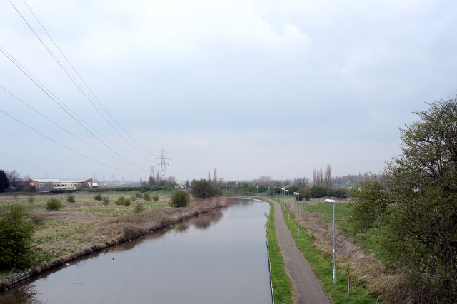
English: Chester - Shropshire Union Canal at Abbot's Meads Chester. View north along the Shropshire Union Canal (Ellesmere branch), seen from the disused Mickle Trafford railway bridge at Abbot's Meads, near Blacon. The rail track carries National Cycleway 5. At this bridge the Longster Trail extension (from Guilden Sutton to the east) leaves the cycleway to join the North Cheshire Way (Chester branch) on the towpath below; this runs north (as in the image) towards Stoak and south into Chester itself. The towpath also carries a branch of Cycleway 5 as the 'Canalside Trail'. The large Blacon housing estates lie out of sight to the left. |
| Date | |
| Source | From geograph.org.uk |
| Author | Mike Harris |
| Attribution (required by the license) | Mike Harris / Chester - Shropshire Union Canal at Abbot's Meads / |
| Camera location | | View this and other nearby images on: OpenStreetMap |
|---|
_heading:0.00&language=en)
| Object location | | View this and other nearby images on: OpenStreetMap |
|---|
_heading:0.00&language=en)
Licensing

|
This image was taken from the Geograph project collection. See this photograph's page on the Geograph website for the photographer's contact details. The copyright on this image is owned by Mike Harris and is licensed for reuse under the Creative Commons Attribution-ShareAlike 2.0 license.
|
This file is licensed under the Creative Commons Attribution-Share Alike 2.0 Generic license.
Attribution: Mike Harris
- You are free:
- to share – to copy, distribute and transmit the work
- to remix – to adapt the work
- Under the following conditions:
- attribution – You must give appropriate credit, provide a link to the license, and indicate if changes were made. You may do so in any reasonable manner, but not in any way that suggests the licensor endorses you or your use.
- share alike – If you remix, transform, or build upon the material, you must distribute your contributions under the same or compatible license as the original.
File history
Click on a date/time to view the file as it appeared at that time.
| Date/Time | Thumbnail | Dimensions | User | Comment | |
|---|---|---|---|---|---|
| current | 04:23, 20 February 2011 | | 640 × 426 (190 KB) | GeographBot | == {{int:filedesc}} == {{Information |description={{en|1=Chester - Shropshire Union Canal at Abbot's Meads Chester. View north along the Shropshire Union Canal (Ellesmere branch), seen from the disused Mickle Trafford railway bridge at Abbot's Meads, near |
File usage
The following pages on the English Wikipedia use this file (pages on other projects are not listed):