
File:Map of Coahuila and Texas in 1833.jpg

Size of this preview: 778 × 599 pixels. Other resolutions: 312 × 240 pixels | 623 × 480 pixels | 997 × 768 pixels | 1,280 × 986 pixels | 2,560 × 1,972 pixels | 3,313 × 2,552 pixels.
Original file (3,313 × 2,552 pixels, file size: 1.16 MB, MIME type: image/jpeg)
| This is a file from the Wikimedia Commons. Information from its description page there is shown below. Commons is a freely licensed media file repository. You can help. |
Summary
| Description |
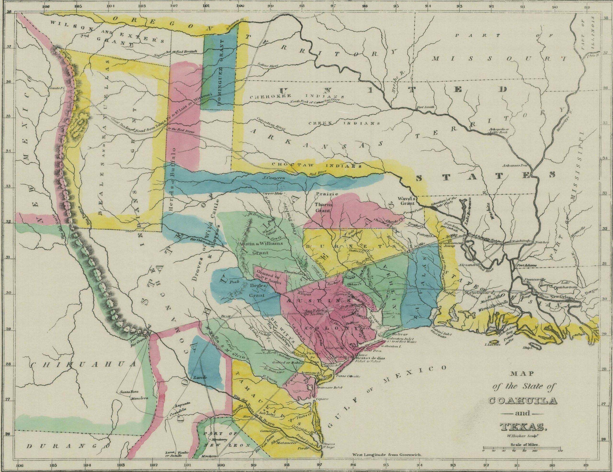
English: This is a map showing the Mexican province of Coahuila and Texas in 1833. |
||||||
| Date | First published in 1833. | ||||||
| Source | The scanned image is taken from https://www.tsl.texas.gov/cgi-bin/aris/maps/maplookup.php?mapnum=1607b, where it says the map was originally published in Texas, by Mary Austin Holley (Armstrong & Plaskitt, Baltimore, 1833). Uploaded to en:Wikipedia by Karanacs (log). | ||||||
| Author | Holley (Armstrong & Plaskitt) | ||||||
| Permission (Reusing this file) |
|


File history
Click on a date/time to view the file as it appeared at that time.
| Date/Time | Thumbnail | Dimensions | User | Comment | |
|---|---|---|---|---|---|
| current | 15:50, 17 September 2008 | | 3,313 × 2,552 (1.16 MB) | Urban~commonswiki | category:maps of Texas category:history of Texas from : http://en.wikipedia.org/wiki/Image:Map_of_Coahuila_and_Texas_in_1833.jpg == Summary == This is a map showing the Mexican province of Coahuila and Texas in 1833. The scanned image is taken |
File usage
The following pages on the English Wikipedia use this file (pages on other projects are not listed):
Global file usage
The following other wikis use this file:
- Usage on es.wikipedia.org
- Usage on fr.wikipedia.org
- Usage on it.wikipedia.org
- Usage on ko.wikipedia.org
- Usage on pt.wikipedia.org
- Usage on ro.wikipedia.org
- Usage on ru.wikipedia.org