
File:Relief Map of Metro Manila and nearby provinces showing the West and East Valley Fault Line (cropped).jpg
Size of this preview: 372 × 599 pixels. Other resolutions: 149 × 240 pixels | 560 × 902 pixels.
Original file (560 × 902 pixels, file size: 355 KB, MIME type: image/jpeg)
| This is a file from the Wikimedia Commons. Information from its description page there is shown below. Commons is a freely licensed media file repository. You can help. |
Summary
| Description |
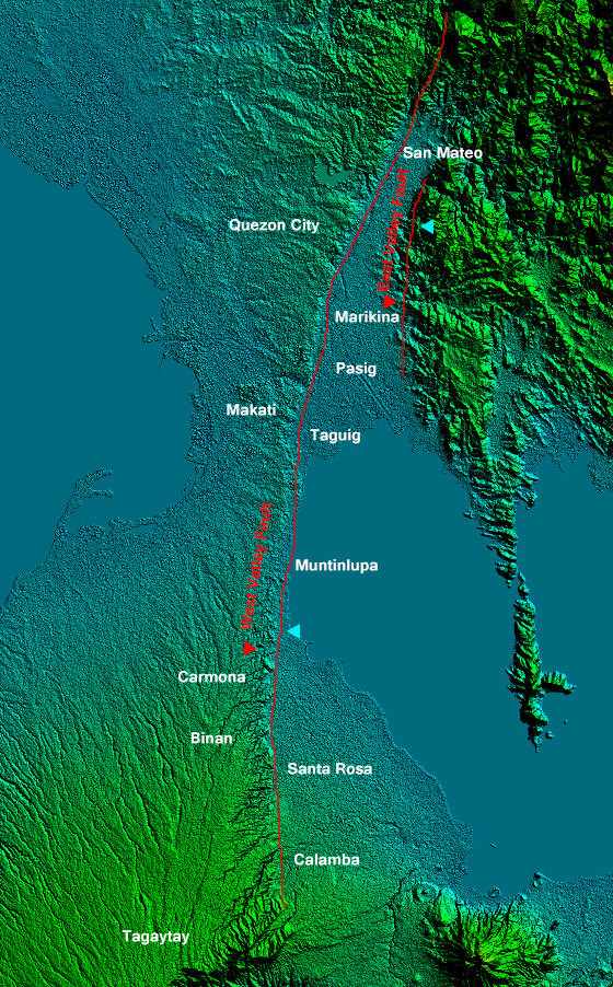
English: Metro Manila and nearby provinces relief map on 1 arc second/30-meter resolution from SRTM released September 23, 2014
Rectangular Projection based on coordinates
|
||||
| Date | |||||
| Source | Own work | ||||
| Author | Ervin Malicdem | ||||
| Permission (Reusing this file) |
I, the copyright holder of this work, hereby publish it under the following licenses:
This file is licensed under the Creative Commons Attribution-Share Alike 4.0 International license.
You may select the license of your choice.
|
||||
| Other versions |


.jpg)
Initially published at Schadow1 Expeditions article available at http://www.s1expeditions.com/2015/01/177-srtm1-philippine-elevation-map.html
File history
Click on a date/time to view the file as it appeared at that time.
| Date/Time | Thumbnail | Dimensions | User | Comment | |
|---|---|---|---|---|---|
| current | 03:42, 15 September 2017 | | 560 × 902 (355 KB) | Schadow1 | File:Relief Map of Metro Manila and nearby provinces showing the West and East Valley Fault Line.jpg cropped 71 % horizontally and 12 % vertically using CropTool with precise mode. |
File usage
The following pages on the English Wikipedia use this file (pages on other projects are not listed):
.jpg)