
File:Stadtteile von Cottbus.svg

Size of this PNG preview of this SVG file: 673 × 600 pixels. Other resolutions: 269 × 240 pixels | 539 × 480 pixels | 862 × 768 pixels | 1,149 × 1,024 pixels | 2,299 × 2,048 pixels | 1,100 × 980 pixels.
Original file (SVG file, nominally 1,100 × 980 pixels, file size: 80 KB)
| This is a file from the Wikimedia Commons. Information from its description page there is shown below. Commons is a freely licensed media file repository. You can help. |
Summary
| Description |
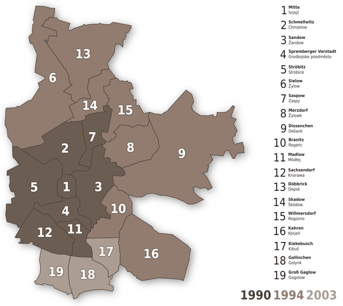
English: Districts of Cottbus
Deutsch: Die Ortsteile von Cottbus |
| Date | |
| Source | Own work |
| Author |
Licensing
This file is licensed under the Creative Commons Attribution-Share Alike 3.0 Unported license.
- You are free:
- to share – to copy, distribute and transmit the work
- to remix – to adapt the work
- Under the following conditions:
- attribution – You must give appropriate credit, provide a link to the license, and indicate if changes were made. You may do so in any reasonable manner, but not in any way that suggests the licensor endorses you or your use.
- share alike – If you remix, transform, or build upon the material, you must distribute your contributions under the same or compatible license as the original.
History
Filehistory@Commons:

Filename changed from Image:Cottbus's Stadtteile.svg to "Image:Stadtteile von Cottbus.svg" This Version
21:40, Jan 15., 2006 . . Stefan-Xp (Talk) . . 800x980 (11035 Byte) (Added Numb3rs and other color)
15:10, Jan 15., 2006 . . Stefan-Xp (Talk) . . 800x980 (4802 Byte) (New)
| Annotations | This image is annotated: View the annotations at Commons |
File history
Click on a date/time to view the file as it appeared at that time.
| Date/Time | Thumbnail | Dimensions | User | Comment | |
|---|---|---|---|---|---|
| current | 20:09, 13 August 2012 | | 1,100 × 980 (80 KB) | Svolks | Zahlen auf der Karte eingeweißt, um größeren Kontrast zu erzielen und um bei kleineren Auflösungen Lesbarkeit erst zu ermöglichen. |
| 18:05, 28 April 2011 |  | 1,100 × 980 (80 KB) | OttoKrüja | Updated, district's names, changed colors and appearance. | |
| 18:53, 4 August 2010 |  | 1,100 × 980 (46 KB) | OttoKrüja | Legende hinzugefügt, jeder Stadtteil ist nun ein Element, neu koloriert (nach Eingemeindungen) | |
| 18:31, 1 February 2006 |  | 800 × 980 (11 KB) | Stefan-Xp | =History= Filename changed.. |
File usage
No pages on the English Wikipedia use this file (pages on other projects are not listed).
Global file usage
The following other wikis use this file:
- Usage on azb.wikipedia.org
- Usage on ca.wikipedia.org
- Usage on cs.wikipedia.org
- Usage on de.wikipedia.org
- Usage on dsb.wikipedia.org
- Usage on eo.wikipedia.org
- Usage on fy.wikipedia.org
- Usage on hu.wikipedia.org
- Usage on it.wikipedia.org
- Usage on nds.wikipedia.org
- Usage on nl.wikipedia.org