
File:Trowell Junction - geograph.org.uk - 1109970.jpg
No higher resolution available.
Trowell_Junction_-_geograph.org.uk_-_1109970.jpg (640 × 428 pixels, file size: 106 KB, MIME type: image/jpeg)
| This is a file from the Wikimedia Commons. Information from its description page there is shown below. Commons is a freely licensed media file repository. You can help. |
Summary
| Description |
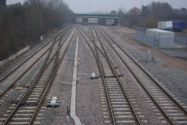
English: Trowell Junction This was once the site of Trowell station - closed in January 1967. The track here was relaid in 2007; just beyond the road bridge a branch diverges to the left to Nottingham; the main line continues ahead to Toton Yard and Trent Junction, nowadays normally only used for freight. |
| Date | |
| Source | From geograph.org.uk |
| Author | Stephen McKay |
| Attribution (required by the license) | Stephen McKay / Trowell Junction / |
| Camera location | | View this and other nearby images on: OpenStreetMap |
|---|
_heading:180.00&language=en)
| Object location | | View this and other nearby images on: OpenStreetMap |
|---|
_heading:180.00&language=en)
Licensing

|
This image was taken from the Geograph project collection. See this photograph's page on the Geograph website for the photographer's contact details. The copyright on this image is owned by Stephen McKay and is licensed for reuse under the Creative Commons Attribution-ShareAlike 2.0 license.
|
This file is licensed under the Creative Commons Attribution-Share Alike 2.0 Generic license.
Attribution: Stephen McKay
- You are free:
- to share – to copy, distribute and transmit the work
- to remix – to adapt the work
- Under the following conditions:
- attribution – You must give appropriate credit, provide a link to the license, and indicate if changes were made. You may do so in any reasonable manner, but not in any way that suggests the licensor endorses you or your use.
- share alike – If you remix, transform, or build upon the material, you must distribute your contributions under the same or compatible license as the original.
File history
Click on a date/time to view the file as it appeared at that time.
| Date/Time | Thumbnail | Dimensions | User | Comment | |
|---|---|---|---|---|---|
| current | 19:22, 24 February 2011 | | 640 × 428 (106 KB) | GeographBot | == {{int:filedesc}} == {{Information |description={{en|1=Trowell Junction This was once the site of Trowell station - closed in January 1967. The track here was relaid in 2007; just beyond the road bridge a branch diverges to the left to Nottingham; the m |
File usage
The following pages on the English Wikipedia use this file (pages on other projects are not listed):