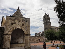
Calpan
Calpan Municipality | |
|---|---|
Municipality and town | |
 | |
 Location of the municipality in Puebla | |
| Country | |
| State | Puebla |
| Time zone | UTC-6 (Central Standard Time) |
| • Summer (DST) | UTC-5 (Central Daylight Time) |
Calpan Municipality is a municipality in the Mexican state of Puebla in south-eastern Mexico.[1]
History[edit]
Calpan was a Nahuatl-speaking community prior to the Spanish incursion. During the era of New Spain it was Corregidor of Atrisco.[2]
References[edit]
- ^ "-". Enciclopedia de los Municipios de México. Instituto Nacional para el Federalismo y el Desarrollo Municipal. Archived from the original on April 5, 2007. Retrieved January 4, 2010.
- ^ Peter Gerhard, Guide to the Historical Geography of New Spain (Cambridge: Cambridge University Press, 1972) p. 55-56.
19°06′N 98°27′W / 19.100°N 98.450°W


