Chychyklia
| Chychyklia | |
|---|---|
 Chychyklia in Odesa Oblast | |
| Location | |
| Country | Ukraine |
| Physical characteristics | |
| Source | |
| • location | Liubashivka, Odesa Oblast |
| • coordinates | 47°51′07″N 30°09′07″E / 47.85194°N 30.15194°E |
| Mouth | Southern Bug |
• coordinates | 47°22′35″N 31°34′05″E / 47.3765°N 31.568°E |
| Length | 156 km (97 mi) |
| Basin size | 2,120 km2 (819 sq mi) |
| Basin features | |
| Progression | Southern Bug→ Dnieper–Bug estuary→ Black Sea |
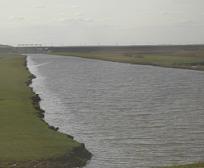
The Chychyklia (Ukrainian: Чичиклія) is a river in Ukraine and a right tributary of the Southern Bug that flows through Odesa Oblast and Mykolaiv Oblast at the border between the Podolian Upland and Black Sea Lowland within the Ukrainian steppe.[1] The river often dries away for up to six months.[1]
It is 156 kilometres (97 mi) long and its basin area is 2,120 square kilometres (819 sq mi).[2]
References[edit]
Wikimedia Commons has media related to Chychyklia River.
