Coayllo District
Coayllo
Quwayllu | |
|---|---|
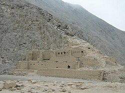
 The ruins of Uquira | |
| Country | |
| Region | Lima |
| Province | Cañete |
| Founded | July 28, 1821 |
| Capital | Coayllo |
| Government | |
| • Mayor | Alexander Chuquizuta Huapaya |
| Area | |
| • Total | 590.99 km2 (228.18 sq mi) |
| Elevation | 225 m (738 ft) |
| Population (2017) | |
| • Total | 1,043 |
| • Density | 1.8/km2 (4.6/sq mi) |
| Time zone | UTC-5 (PET) |
| UBIGEO | 150506 |
Coayllo District is one of sixteen districts of the province Cañete in Peru.[1]
References[edit]
- ^ (in Spanish) Instituto Nacional de Estadística e Informática. Banco de Información Distrital Archived April 23, 2008, at the Wayback Machine. Retrieved April 11, 2008.


