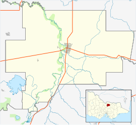
Dhurringile, Victoria
This article needs additional citations for verification. (August 2019) |
| Dhurringile Victoria | |
|---|---|
 Langham Road, with the primary school and community centre on the left | |
| Coordinates | 36°32′34″S 145°13′21″E / 36.54278°S 145.22250°E |
| Population | 369 (2021 census)[1] |
| Postcode(s) | 3610 |
| LGA(s) | City of Greater Shepparton |
| State electorate(s) | Euroa |
| Federal division(s) | Nicholls |
Dhurringile is a small town in Victoria, Australia. 10 km north of Murchison and approximately the same distance east of the Waranga Basin reservoir.[2] It is located in the City of Greater Shepparton. At the 2021 census, Dhurringile had a population of 369.[1]
The historic Dhurringile mansion (now part of HM Prison Dhurringile) is located in the town. Dhurringile was the name of a 65 room mansion built in 1875 by James Winter, a wealthy squatter. The name is thought to have an Aboriginal origin meaning emu’s back, which the hill on which the mansion is built is said to resemble.
The town has a small primary school. In 2023 just three students were enrolled.[3]
References[edit]
- ^ a b Australian Bureau of Statistics (28 June 2022). "Dhurringile (State Suburb)". 2021 Census QuickStats. Retrieved 17 September 2017.
- ^ "Dhurringile | Victorian Places". www.victorianplaces.com.au. Retrieved 25 June 2023.
- ^ https://www.heraldsun.com.au/news/victoria/revealed-victorias-smallest-schools-deliver-big-benefits/news-story/db864a5c5b52ad1bfa1448448b6a6483
External links[edit]
![]() Media related to Dhurringile at Wikimedia Commons
Media related to Dhurringile at Wikimedia Commons


