
Embalam
This article has multiple issues. Please help improve it or discuss these issues on the talk page. (Learn how and when to remove these template messages)
|
Embalam | |
|---|---|
Village | |
 Embalam Location in Puducherry, India  Embalam Embalam (India) | |
| Coordinates: 11°52′16″N 79°42′49″E / 11.871215°N 79.713514°E | |
| Country | |
| State | Puducherry |
| District | Pondicherry |
| Taluk | Bahour |
| Commune | Nettapakkam |
| Languages | |
| • Official | French, Tamil, English |
| Time zone | UTC+5:30 (IST) |
| PIN | 605 106 |
| Telephone code | 0413 |
| Vehicle registration | PY-01 |
| Sex ratio | 50% ♂/♀ |

Embalam is a panchayat village[1] in Nettapakkam Commune in the Union Territory of Puducherry, India.
Geography[edit]
Embalam is bordered by Nallathur village (Tamil nadu) in the west, Sathamangalam in the north, Sembiapalayam in the east and Manaveli village (Tamil nadu) in the south and south-west.
Transport[edit]
Embalam is located at 18 km. from Pondicherry. Embalam can be reached directly by any bus running between Pondicherry and Maducarai via. Embalam.
Road Network[edit]
Embalam is connected to Pondicherry by Thavalakuppam-Embalam (RC-20) State Highway. Also Mangalam-Maducarai State Highway (RC-19) passes through Embalam
Politics[edit]
Embalam is a part of Embalam (Union Territory Assembly constituency) which comes under Puducherry (Lok Sabha constituency)
Gallery[edit]
-
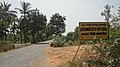
 Way to Embalam
 -
 Embalam Village Panchayat


References[edit]
- ^ "Archived copy" (PDF). Archived from the original (PDF) on 27 September 2013. Retrieved 5 March 2013.
{{cite web}}: CS1 maint: archived copy as title (link)
External links[edit]