
File:DETAIL VIEW OF "ROEBLING" REEL AT WEST END - John A. Roebling's Sons Company, Kinkora Works, Wire Product Facilities, Roebling, Burlington County, NJ HAER NJ,3-ROEBL,1D-13 (CT).tif

Size of this JPG preview of this TIF file: 800 × 600 pixels. Other resolutions: 320 × 240 pixels | 640 × 480 pixels | 1,024 × 768 pixels | 1,280 × 959 pixels | 2,560 × 1,919 pixels | 4,715 × 3,534 pixels.
Original file (4,715 × 3,534 pixels, file size: 47.67 MB, MIME type: image/tiff)
| This is a file from the Wikimedia Commons. Information from its description page there is shown below. Commons is a freely licensed media file repository. You can help. |
Summary
| DETAIL VIEW OF "ROEBLING" REEL AT WEST END - John A. Roebling's Sons Company, Kinkora Works, Wire Product Facilities, Roebling, Burlington County, NJ | ||||
|---|---|---|---|---|
| Photographer |
Elliott, Joseph, creator |
|||
| Title |
DETAIL VIEW OF "ROEBLING" REEL AT WEST END - John A. Roebling's Sons Company, Kinkora Works, Wire Product Facilities, Roebling, Burlington County, NJ |
|||
| Depicted place | New Jersey; Burlington County; Roebling | |||
| Date | 1997 | |||
| Dimensions | 4 x 5 in. | |||
| Current location |
Library of Congress Prints and Photographs Division Washington, D.C. 20540 USA http://hdl.loc.gov/loc.pnp/pp.print |
|||
| Accession number |
HAER NJ,3-ROEBL,1D-13 (CT) |
|||
| Credit line |
|
|||
| Source | https://www.loc.gov/pictures/item/nj1655.color.376520c | |||
| Permission (Reusing this file) |
|
|||

File history
Click on a date/time to view the file as it appeared at that time.
| Date/Time | Thumbnail | Dimensions | User | Comment | |
|---|---|---|---|---|---|
| current | 12:34, 19 November 2021 | 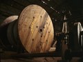 | 4,715 × 3,534 (47.67 MB) | Zeete | Cropped 6 % horizontally, 13 % vertically using CropTool with precise mode. |
| 20:42, 28 July 2014 |  | 5,000 × 4,054 (58 MB) | Fæ | GWToolset: Creating mediafile for Fæ. HABS 24 July 2014 (2301:2600) |
File usage
The following pages on the English Wikipedia use this file (pages on other projects are not listed):