
File:KRNT airport diagram.pdf

Size of this JPG preview of this PDF file: 390 × 599 pixels. Other resolutions: 156 × 240 pixels | 313 × 480 pixels | 806 × 1,237 pixels.
Original file (806 × 1,237 pixels, file size: 121 KB, MIME type: application/pdf)
| This is a file from the Wikimedia Commons. Information from its description page there is shown below. Commons is a freely licensed media file repository. You can help. |
Summary
| Description |
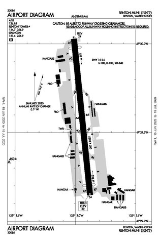
English: Renton Municipal Airport (KRNT) airport diagram, valid 18 June 2020 to 16 July 2020 |
| Date | |
| Source | https://aeronav.faa.gov/d-tpp/2007/05396ad.pdf#nameddest=(RNT) |
| Author | Federal Aviation Administration |
Licensing
This image or file is a work of a Federal Aviation Administration employee, taken or made as part of that person's official duties. As a work of the U.S. federal government, the image is in the public domain in the United States.
|
 |
File history
Click on a date/time to view the file as it appeared at that time.
| Date/Time | Thumbnail | Dimensions | User | Comment | |
|---|---|---|---|---|---|
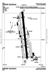
| current | 16:39, 21 June 2020 |  | 806 × 1,237 (121 KB) | HGK745 | Uploaded a work by Federal Aviation Administration from https://aeronav.faa.gov/d-tpp/2007/05396ad.pdf#nameddest=(RNT) with UploadWizard |
File usage
The following pages on the English Wikipedia use this file (pages on other projects are not listed):