
File:Map of Australia's north-south rail corridor (Adelaide to Darwin).tiff

Original file (817 × 2,189 pixels, file size: 6.83 MB, MIME type: image/tiff)
| This is a file from the Wikimedia Commons. Information from its description page there is shown below. Commons is a freely licensed media file repository. You can help. |
Summary
| Description |
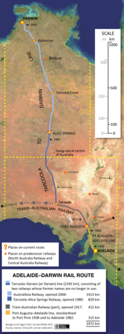
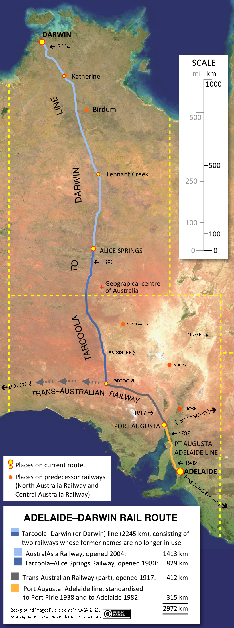
English: A satellite image of South Australia and the Northern Territory superimposed with the routes of the four railways comprising Australia's north–south rail corridor that connects Adelaide and Darwin. More details are shown below. |
| Date | |
| Source |
Background satellite image: NASA (Visible Earth -- public domain). Artwork: SCHolar44 (public domain dedication, CC0). Data sources: numerous South Australian Railways and Commonwealth Railways documents including maps and Working Timetables; SA Track and Signal ( ). |
| Author | NASA and SCHolar44 |
The map shows the continuous north–south standard-gauge rail corridor through the centre of the Australian continent that was finally completed in 2004, 126 years after construction of its two narrow-gauge predecessors – never completed – was started in 1878.
The line has one passenger service: the weekly (as of 2019) Adelaide–Darwin luxury passenger train, The Ghan. Far more significant for revenue is freight haulage.
Each of the five railways constituting the route has a separate, distinctive history and identity, with their opening dates spanning 87 years. From Darwin southwards, they are:
- the Alice Springs–Darwin railway, consisting of the AustralAsia Railway (no longer named as such), opened in 2004
- the Tarcoola–Alice Springs Railway (also no longer named as such), opened in 1980
- the eastern end of the Trans-Australian Railway, opened in 1917
- the Port Augusta–Port Pirie line, built in 1937
- the Port Pirie–Adelaide line, converted from broad gauge in 1982.
Collectively, these are most commonly referred to as the Adelaide–Darwin rail corridor or the north–south rail corridor.
Because five railways make up the transcontinental corridor, the name "Adelaide–Darwin Railway" does not exist in formal use, although the descriptive term "Adelaide–Darwin railway" (or "line" or "route") – with a lower-case "r" – is widely used. However, it can have various meanings: the news media in particular variously use it to refer to:
- the entire route
- or the Tarcoola–Darwin railway
- or the Tarcoola–Darwin railway plus the Tarcoola–Port Augusta part of the Trans-Australian Railway.
The satellite image captures the region in winter, when rain falls in the southern temperate areas and the northern tropical wet season is yet to start. The centre of the continent is arid all year around.
Licensing
Background map:
| This file is in the public domain in the United States because it was solely created by NASA. NASA copyright policy states that "NASA material is not protected by copyright unless noted". (See Template:PD-USGov, NASA copyright policy page or JPL Image Use Policy.) | ||
 |
Warnings:
|
Artwork:
| This file is made available under the Creative Commons CC0 1.0 Universal Public Domain Dedication. | |
| The person who associated a work with this deed has dedicated the work to the public domain by waiving all of their rights to the work worldwide under copyright law, including all related and neighboring rights, to the extent allowed by law. You can copy, modify, distribute and perform the work, even for commercial purposes, all without asking permission.
|
File history
Click on a date/time to view the file as it appeared at that time.
| Date/Time | Thumbnail | Dimensions | User | Comment | |
|---|---|---|---|---|---|
| current | 02:14, 18 January 2023 | 817 × 2,189 (6.83 MB) | SCHolar44 | (By original uploader): Changed geographical centre to position defined by Geoscience Australia (Lambert gravitational centre) | |
| 13:46, 18 August 2020 |  | 819 × 1,943 (6.07 MB) | SCHolar44 | Added North Australia Railway and Central Australia Railway routes; rationalisation of terminology; minor fixes. | |
| 04:51, 15 July 2020 | 817 × 2,191 (6.83 MB) | SCHolar44 | Improvements to route colours and nomenclature. | ||
| 13:27, 8 July 2020 | 819 × 2,050 (6.41 MB) | SCHolar44 | I am the original uploader. I updated some details in this version. PD-USGov-NASA | ||
| 11:43, 29 June 2020 | 818 × 2,007 (6.27 MB) | SCHolar44 | Uploaded a work by NASA and SCHolar44 from Background satellite image: NASA (Visible Earth -- public domain). Other artwork: SCHolar44 with UploadWizard |