
File:PIA Airport Diagram.pdf

Size of this JPG preview of this PDF file: 390 × 599 pixels. Other resolutions: 156 × 240 pixels | 313 × 480 pixels | 806 × 1,237 pixels.
Original file (806 × 1,237 pixels, file size: 123 KB, MIME type: application/pdf)
| This is a file from the Wikimedia Commons. Information from its description page there is shown below. Commons is a freely licensed media file repository. You can help. |
Summary
| Description |
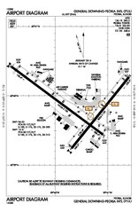
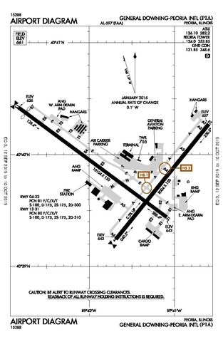
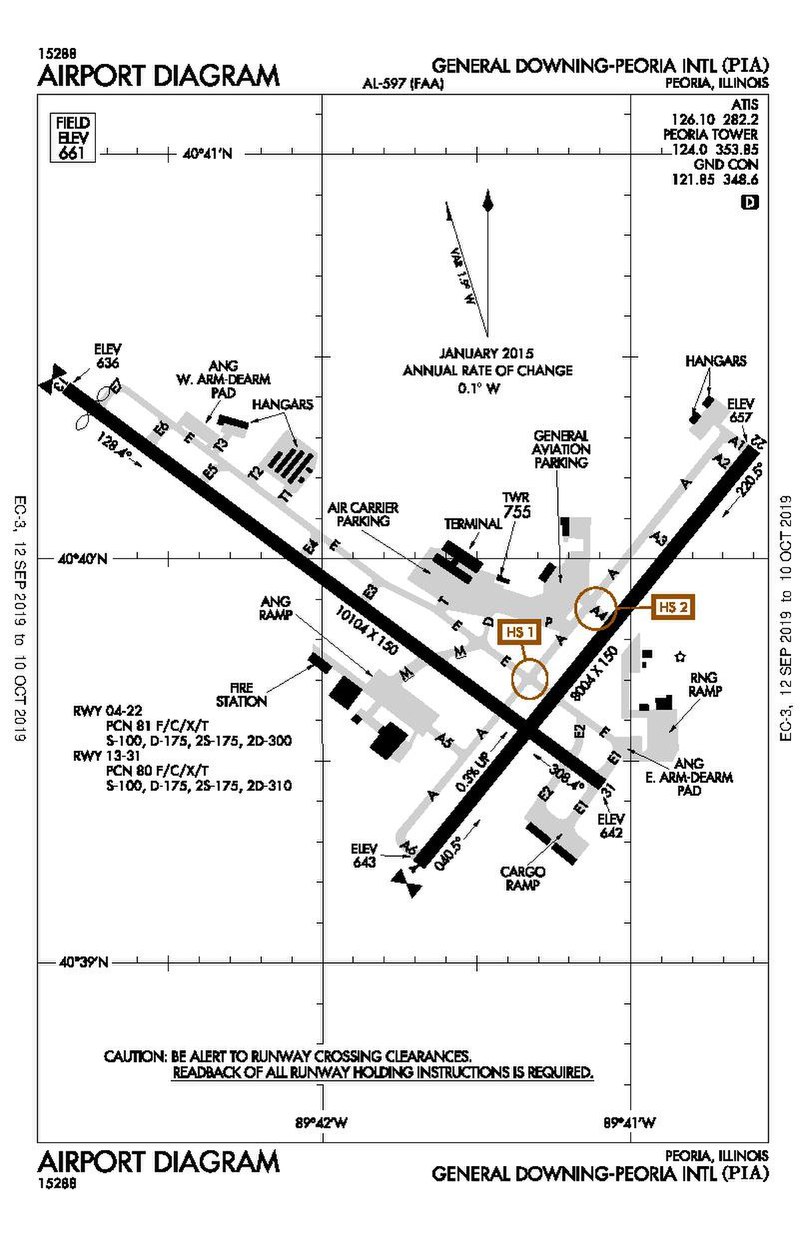
English: FAA diagram for General Wayne A. Downing Peoria International Airport (FAA: PIA, IATA: PIA, ICAO: KPIA) in Peoria, Illinois, United States. |
| Date | |
| Source | https://aeronav.faa.gov/d-tpp/1910/00597ad.pdf#nameddest=(PIA) |
| Author | Federal Aviation Administration |
Licensing
This image or file is a work of a Federal Aviation Administration employee, taken or made as part of that person's official duties. As a work of the U.S. federal government, the image is in the public domain in the United States.
|
 |
File history
Click on a date/time to view the file as it appeared at that time.
| Date/Time | Thumbnail | Dimensions | User | Comment | |
|---|---|---|---|---|---|
| current | 19:56, 29 September 2019 |  | 806 × 1,237 (123 KB) | MarcelX42 | User created page with UploadWizard |
File usage
The following pages on the English Wikipedia use this file (pages on other projects are not listed):
Global file usage
The following other wikis use this file:
- Usage on de.wikipedia.org
- Usage on www.wikidata.org