Gapsville, Pennsylvania
Gapsville, Pennsylvania | |
|---|---|
 Gapsville, facing southeast on South Breezewood Road in November 2011. Breezewood Post of VFW on left. | |
| Coordinates: 39°57′12″N 78°14′30″W / 39.95333°N 78.24167°W | |
| Country | United States |
| State | Pennsylvania |
| County | Bedford |
| Township | East Providence |
| Elevation | 1,148 ft (350 m) |
| Time zone | UTC-5 (Eastern (EST)) |
| • Summer (DST) | UTC-4 (EDT) |
| ZIP codes | 15533 |
| Area code | 814 |
| GNIS feature ID | 1175425[2] |
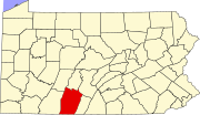
Gapsville is an unincorporated community in East Providence Township, Bedford County, Pennsylvania, United States, south of Breezewood.
Geography[edit]
Gapsville is located on South Breezewood Road (State Route 2024). Just to the east, across the county line in Fulton County, is Crystal Spring.
The community lies west of a water gap, where Brush Creek passes through Rays Hill, which forms the eastern border of Bedford County.
Notable features[edit]
The Breezewood Post of the VFW is located in the town, as is the Brush Creek Campground.


