
Groede
Groede | |
|---|---|
Village | |
 Monumental houses in 2011 | |
 Coat of arms | |
 Groede Location of Groede in Zeeland in the Netherlands  Groede Groede (Netherlands) | |
| Coordinates: 51°22′44″N 3°30′25″E / 51.37889°N 3.50694°E | |
| Country | Netherlands |
| Province | Zeeland |
| Municipality | Sluis |
| Area | |
| • Total | 19.60 km2 (7.57 sq mi) |
| Elevation | 1.6 m (5.2 ft) |
| Population (2021)[1] | |
| • Total | 940 |
| • Density | 48/km2 (120/sq mi) |
| Time zone | UTC+1 (CET) |
| • Summer (DST) | UTC+2 (CEST) |
| Postal code | 4503[1] |
| Dialing code | 0117 |
Groede (Dutch pronunciation: [ˈɣrudə]) is a village in the Dutch province of Zeeland. It is located about 5 km north of Oostburg in the municipality of Sluis.
History[edit]
The village was first mentioned in 1133 as Groede, and means "land accretion".[3] The oldest village was lost in a flood in 1375. It was later polder, but inundated in 1583.[4] In 1604, the area was conquered by the Dutch Republic.[5] In 1612, it was a rediked, and a planned settlement with a large square containing the church in the middle was constructed.[4]
The Dutch Reformed church is a three-aisled church with 13th century elements. The church was severely damaged during the inundation of 1583 to 1613. Restoration started in 1619. From 1618 until 1808, the southern part of the church was a Walloon church. The tower was struck by lightning in 1949 and restored in 1950.[4][5]
Groede was home to 2,408 people in 1840.[6] The village was spared during World War II, because it was a Red Cross village.[4]
Groede was a separate municipality until 1970.[7] In 2003, Groede became part of the municipality of Sluis.[6] The Slijkstraat in the centre of the village was transformed into a Flemish heritage street in 1985.[5]
Gallery[edit]
-
 Groede, church: de Grote Kerk
 -
 Groede, catholic church
 -
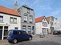 Groede, monumental houses


References[edit]
- ^ a b c "Kerncijfers wijken en buurten 2021". Central Bureau of Statistics. Retrieved 21 April 2022.
- ^ "Postcodetool for 4503AA". Actueel Hoogtebestand Nederland (in Dutch). Het Waterschapshuis. 24 July 2019. Retrieved 21 April 2022.
- ^ "Groede - (geografische naam)". Etymologiebank (in Dutch). Retrieved 21 April 2022.
- ^ a b c d Piet van Cruyningen & Ronald Stenvert (2003). Haamstede (in Dutch). Zwolle: Waanders. ISBN 90-400-8830-6. Retrieved 21 April 2022.
- ^ a b c "Groede". Zalig Zeeland (in Dutch). Retrieved 21 April 2022.
- ^ a b "Groede". Plaatsengids (in Dutch). Retrieved 21 April 2022.
- ^ Ad van der Meer and Onno Boonstra, "Repertorium van Nederlandse gemeenten", KNAW, 2006. "KNAW > Publicaties > Detailpagina". Archived from the original on 2007-02-20. Retrieved 2009-12-03.
External links[edit]
 Media related to Groede at Wikimedia Commons