
Harmelerwaard
Harmelerwaard | |
|---|---|
Hamlet | |
 Draw bridge in Harmerlerwaard | |
 Harmelerwaard Location in the Netherlands  Harmelerwaard Harmelerwaard (Netherlands) | |
| Coordinates: 52°05′19″N 4°58′55″E / 52.08861°N 4.98194°E | |
| Country | Netherlands |
| Province | Utrecht |
| Municipality | Woerden |
| Time zone | UTC+1 (CET) |
| • Summer (DST) | UTC+2 (CEST) |
| Postal code | 3481[1] |
| Dialing code | 0348[1] |
Harmelerwaard is a hamlet in the Dutch province of Utrecht. It is a part of the municipality of Woerden, and lies about 9 km west of Utrecht.
The hamlet was first mentioned between 1280 and 1287 as Hermaelrewart, and means "land near water belonging to Harmelen".[2] It is not a statistical entity,[3] and the postal authorities have placed it under Harmelen.[1] It has no place name signs. In 1840, Harmelerwaard was home to 40 people. Nowadays, it consists of about 80 houses.[4]
Gallery[edit]
-
 Street view
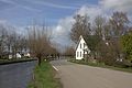
 -
 Street view


References[edit]
- ^ a b c "Postcode Harmelerwaard in Harmelen". Postcode bij adres (in Dutch). Retrieved 26 March 2022.
- ^ "Harmelerwaard - (geografische naam)". Etymologiebank (in Dutch). Retrieved 24 March 2022.
- ^ "Kerncijfers wijken en buurten 2021". Central Bureau of Statistics. Retrieved 26 March 2022.
not found
- ^ "Harmerlerwaard". Plaatsengids (in Dutch). Retrieved 26 March 2022.
This Utrecht location article is a stub. You can help Wikipedia by expanding it. |