La Cellera de Ter
La Cellera de Ter | |
|---|---|
 Santa Maria de Sales church | |
| Coordinates: 41°58′06″N 2°37′15″E / 41.968291°N 2.620736°E | |
| Country | |
| Community | |
| Province | |
| Comarca | Selva |
| Government | |
| • Mayor | David Sarsanedas Serrat (2015)[1] |
| Area | |
| • Total | 14.6 km2 (5.6 sq mi) |
| Population (2018)[3] | |
| • Total | 1,976 |
| • Density | 140/km2 (350/sq mi) |
| Website | www |
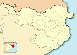
La Cellera de Ter, also locally known simply as La Cellera, is a village in the county of La Selva, province of Girona and autonomous community of Catalonia, Spain. More than half of the area is mountainous and is part of the eastern ridge of the Guilleries massif. The municipality covers an area of 14.6 square kilometres (5.6 sq mi) and the population in 2014 was 2,071 and, in 2020, 1.950.[2] The population density is 133,56 hab/km².
The village is 166 m above sea level. The highest mountain in the village is Sant Gregori (1088m) but the most representative one is Puigdefrou (843m).
Electronic music Sak Noel was born in the village in 1983.
References[edit]
- ^ "Ajuntament de la Cellera de Ter". Generalitat of Catalonia. Retrieved 2015-11-13.
- ^ a b "El municipi en xifres: La Cellera de Ter". Statistical Institute of Catalonia. Retrieved 2015-11-23.
- ^ Municipal Register of Spain 2018. National Statistics Institute.
External links[edit]
- Government data pages (in Catalan)


