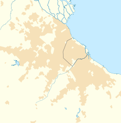
La Lucila
La Lucila | |
|---|---|
District | |
 La Lucila train station. | |
Location in Greater Buenos Aires | |
| Coordinates: 34°29′S 58°29′W / 34.483°S 58.483°W | |
| Country | |
| Province | |
| Partido | |
| Founded | 1856 |
| Elevation | 18 m (59 ft) |
| Population | |
| • Total | 15,844 |
| CPA Base | B 1636 |
| Area code | +54 11 |
La Lucila is a neighborhood in Vicente López Partido, Buenos Aires Province, Argentina. The community is a suburb in the Buenos Aires metropolitan area.
It has a light railway station (La Lucila) on the Retiro-Tigre line - north on the line is Martínez and south is Olivos. It is also close to the Tren de la Costa.
The name comes from a large mansion that was named for the owner's wife. He was teniente coronel Alfredo F. de Urquiza and his wife was named Lucila Marcelina Anchorena de Urquiza.[1][circular reference]
Education[edit]
This section needs expansion. You can help by adding to it. (February 2015) |
Asociación Escuelas Lincoln, an American international school, is in La Lucila.[2]
References[edit]
- ^ es:La Lucila
- ^ "Home." Asociación Escuelas Lincoln. Retrieved on February 9, 2015. "Andrés Ferreyra 4073 B1637 AOS La Lucila Buenos Aires, Argentina"
External links[edit]
- Municipal information: Municipal Affairs Federal Institute (IFAM), Municipal Affairs Secretariat, Ministry of Interior, Argentina. (in Spanish)

