Lampa, Peru
This article needs additional citations for verification. (February 2024) |
Lampa, Peru | |
|---|---|
Town | |
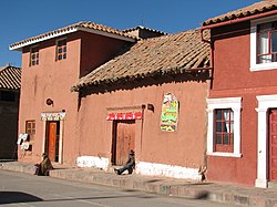
From top, left to right: Santiago Apostol church in Lampa, mosaic in the entrance to the cathedral, Plaza Grau, Lampa's town hall, 4 de Junio Park and some pink-painted houses | |
| Nickname: La Ciudad Rosada (The Pink City) | |
| Coordinates: 15°21′49″S 70°21′56″W / 15.36361°S 70.36556°W | |
| Country | |
| Region | Puno |
| Province | Lampa |
| District | Lampa |
| Government | |
| • Mayor | Ciriaco Isidro Diaz Arestegui (2019-2022) |
| Elevation | 3,892 m (12,769 ft) |
| Population | |
| • Total | 14,780 |
| Time zone | UTC-5 (PET) |
Lampa is a town in Southern Peru.[1] It is the capital of the Lampa Province in the Puno Region. Lampa is situated near the lake Pukaqucha.
-
The town of Lampa and parts of the lake Pukaqucha as seen from the air
References[edit]
- ^ Barnbaum, Bruce (11 December 2020). The Essence of Photography, 2nd Edition. Rocky Nook, Inc. ISBN 978-1-68198-637-1.
External links[edit]
Wikimedia Commons has media related to Lampa.
15°21′49″S 70°21′56″W / 15.36361°S 70.36556°W


