Laurel and Prospect District
Laurel and Prospect District | |
 Laurel and Prospect District, July 2011 | |
| Location | 1335 to 1419 E. Prospect St., Indianapolis, Indiana |
|---|---|
| Coordinates | 39°45′8″N 86°8′7″W / 39.75222°N 86.13528°W |
| Area | 1 acre (0.40 ha) |
| Built | 1870 |
| MPS | Fountain Square Commercial Areas TR |
| NRHP reference No. | 83000132[1] |
| Added to NRHP | June 30, 1983 |
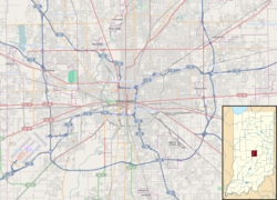
Laurel and Prospect District is a national historic district located at Indianapolis, Indiana. The district encompasses three contributing buildings in the Fountain Square Commercial Areas of Indianapolis. It developed between about 1871 and 1932, and notable buildings include the Mangold / Roepke Saloon (1885, 1910) and Buddenbaum Grocery (1879).[2]: 32
It was listed on the National Register of Historic Places in 1983.[1]
References[edit]
- ^ a b "National Register Information System". National Register of Historic Places. National Park Service. July 9, 2010.
- ^ "Indiana State Historic Architectural and Archaeological Research Database (SHAARD)" (Searchable database). Department of Natural Resources, Division of Historic Preservation and Archaeology. Retrieved August 1, 2016. Note: This includes Mary Toshach; Mary Ellen Gadski; James Reed; Cecelia Boggs (February 1983). "National Register of Historic Places Inventory Nomination Form: Fountain Square Commercial Historic District" (PDF). Retrieved August 1, 2016. and Accompanying photographs
Wikimedia Commons has media related to Laurel and Prospect District.
Categories:
- Historic districts on the National Register of Historic Places in Indiana
- Commercial buildings on the National Register of Historic Places in Indiana
- Historic districts in Indianapolis
- National Register of Historic Places in Indianapolis
- 1983 establishments in Indiana
- Fountain Square, Indianapolis
- Indianapolis-Anderson-Columbus geography stubs
- Marion County, Indiana Registered Historic Place stubs


