
List of districts and sub-districts in Badung Regency
| This article is part of a series on |
| Subdivisions of Indonesia |
|---|
| Level 1 |
|
| Level 2 |
|
| Level 3 |
| (kecamatan, distrik, kapanewon, or kemantren) |
| Level 4 |
| (desa or kelurahan) |
| Others |
The following is a list of districts and sub-districts in Badung Regency. Badung Regency comprises 6 districts, sub-divided into 16 urban (kelurahan) and 46 rural (desa) villages.[1][2] As at mid 2022, the population was officially estimated at 549,251,[3] with an area of 418.522 km² and a density of 1,312 people/km².[3]
-
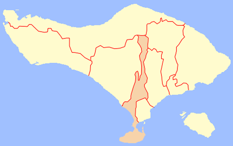 Map of Badung Regency in Bali
 -
 Map of districts in Badung Regency


List of districts and sub-districts in Badung Regency as follows:
| Code | Districts | Urban villages |
Rural villages |
Status | List |
|---|---|---|---|---|---|
| 51.03.03 | Abiansemal | - | 18 | Rural villages |
|
| 51.03.01 | Kuta | 5 | - | Urban villages |
|
| 51.03.05 | South Kuta | 3 | 3 | Rural villages |
|
| Urban villages |
|||||
| 51.03.06 | North Kuta | 3 | 3 | Rural villages |
|
| Urban villages |
|||||
| 51.03.02 | Mengwi | 5 | 15 | Rural villages |
|
| Urban villages |
|||||
| 51.03.04 | Petang | 7 | Rural villages |
||
| TOTAL | 16 | 46 |
References[edit]
- ^ "Peraturan Menteri Dalam Negeri Nomor 137 Tahun 2017 tentang Kode dan Data Wilayah Administrasi Pemerintahan". Kementerian Dalam Negeri Republik Indonesia. Archived from the original on 29 December 2018. Retrieved 3 October 2019.
- ^ "Peraturan Menteri Dalam Negeri Nomor 72 Tahun 2019 tentang Perubahan atas Permendagri nomor 137 Tahun 2017 tentang Kode dan Data Wilayah Administrasi Pemerintahan". Kementerian Dalam Negeri Republik Indonesia. Archived from the original (PDF) on 25 October 2019. Retrieved 15 January 2020.
- ^ a b Badan Pusat Statistik, Jakarta, 2023, Kabupaten Badung Dalam Angka 2023 (Katalog-BPS 1102001.5103)
See also[edit]
External links[edit]
- (in Indonesian) Official Website Statistical Bureau of Badung Regency
- (in Indonesian) Official Website Bali Province
- (in Indonesian) Official Website Badung Regency