
List of towns in Andhra Pradesh
This article's use of external links may not follow Wikipedia's policies or guidelines. (June 2022) |
Towns in Andhra Pradesh, India, are as follows.
The 2011 Census of India, conducted by The Office of the Registrar General and Census Commissioner, under the Ministry of Home Affairs, Government of India, determined that settlements with a population of less than 100,000 are called towns.[1]
Yemmiganur is the most populated town with a population of 95,149.[2][3][4]
List of towns[edit]
The towns written in bold are the headquarters of their respective district.[5][6]
| S.No. | Name of the Town | District | Population 2011 Census |
Area (km2) |
Density (/km2) |
Population 2001 Census |
Growth Rate |
Settlement Type |
Formation | Number of wards[7] | |
|---|---|---|---|---|---|---|---|---|---|---|---|
| 1 | Yemmiganur | Kurnool | 95,149 | 14.50 | 6,600 | Municipality | 1965 | ||||
| 2 | Chirala | Bapatla | 92,942 | 13.26 | 7,000 | Municipality | 1948 | ||||
| 3 | Rayachoti | Annamayya | 91,234 | 39.78 | 2,300 | Municipality | |||||
| 4 | Kavali | SPSR Nellore | 90,099 | 22.95 | 3,900 | 79,682 | 20.90% | Municipality | 1967 | 40 | |
| 5 | Kadiri | Sri Sathya Sai | 89,429 | 25.88 | 3,500 | Municipality | |||||
| 6 | Anakapalli | Anakapalli | 86,519 | 23.28 | 3,700 | Municipality | |||||
| 7 | Palakollu | West Godavari | 81,199 | 19.49 | 4,200 | Municipality | |||||
| 8 | Srikalahasti | Tirupati | 80,056 | 12.92 | 6,200 | Municipality | |||||
| 9 | Tanuku | West Godavari | 77,962 | 16.78 | 4,600 | Municipality | |||||
| 10 | Gudur | Tirupati | 74,037 | 57.48 | 1,300 | Municipality | |||||
| 11 | Markapuram | Prakasam | 71,092 | 22.85 | 3,100 | Municipality | |||||
| 12 | Bapatla | Bapatla | 70,777 | 17.92 | 3,900 | Municipality | 1951 | ||||
| 13 | Badvel | YSR | 70,626 | 60.93 | 1,200 | Municipality | |||||
| 14 | Pulivendula | YSR | 65,706 | 58.69 | 1,100 | Municipality | |||||
| 15 | Tadepalle | Guntur | 64,149 | 25.45 | 2,500 | Municipality | |||||
| 16 | Piduguralla | Palnadu | 63,103 | 31.49 | 2,000 | Municipality | |||||
| 17 | Vinukonda | Palnadu | 62,550 | 37.53 | 1,700 | Municipality | |||||
| 18 | Nagari | Chittoor | 62,253 | 29.86 | 2,100 | Municipality | |||||
| 19 | Rayadurgam | Anantapuram | 61,749 | 49.73 | 1,200 | Municipality | |||||
| 20 | Pileru | Annamayya | 60,253 | 5.85 | 10,000 | Panchayath | |||||
| 21 | Ponnur | Guntur | 59,913 | 26.14 | 2,300 | Municipality | |||||
| 22 | Dhone | Nandyal | 59,272 | 5 | 12,000 | Municipality | 2005 | 32 | |||
| 23 | Narasapuram | West Godavari | 58,770 | 11.32 | 5,200 | Municipality | |||||
| 24 | Nuzvid | Eluru | 58,590 | 8.69 | 6,700 | Municipality | |||||
| 25 | Palasa | Srikakulam | 57,507 | 32.75 | 1,800 | 49,899 | 15.25 | Municipality | 2000 | 23 | |
| 26 | Macherla | Palnadu | 57,290 | 13.48 | 4,300 | Municipality | |||||
| 27 | Kandukuru | SPSR Nellore | 57,246 | 33.06 | 1,700 | 50,326 | 13.75% | Municipality | 1987 | 30 | |
| 28 | Samarlakota | Kakinada | 56,864 | 14.08 | 4,000 | Municipality | |||||
| 29 | Bobbili | Vizianagaram | 56,819 | 25.60 | 2,200 | 50,096 | 13.42 | Municipality | 1956 | 30 | |
| 30 | Sattenapalle | Palnadu | 56,721 | 21.88 | 2,600 | Municipality | |||||
| 31 | Mandapeta | East Godavari | 56,063 | 21.65 | 2,600 | Municipality | |||||
| 32 | Bheemunipatnam | Visakhapatnam | 55,082 | 18.90 | 2,900 | Municipality | |||||
| 33 | Pithapuram | Kakinada | 54,859 | 22.71 | 2,400 | Municipality | |||||
| 34 | Punganur | Chittoor | 54,746 | 32.28 | 1,700 | Municipality | |||||
| 35 | Puttur | Tirupati | 54.092 | 43.29 | 1,200 | Municipality | |||||
| 36 | Rajampet | Annamayya | 54,050 | 10 | 5,400 | Municipality | 2017 | 20 | |||
| 37 | Palamaner | Chittoor | 54,035 | 17.69 | 3,100 | Municipality | |||||
| 38 | Parvathipuram | Parvathipuram Manyam | 53,844 | 11.24 | 4,800 | Municipality | |||||
| 39 | Jaggayyapeta | NTR | 53,530 | 23.50 | 2,300 | Municipality | |||||
| 40 | Payakaraopeta | Anakapalli | 52,458 | 48.02 | 7,600 | 83,589 | Panchayath | 1950 | 40 | ||
| 41 | Amalapuram | Konaseema | 53,231 | 7.02 | 7,600 | Municipality | |||||
| 42 | Venkatagiri | Tirupati | 52,688 | 25.89 | 2,000 | Municipality | |||||
| 43 | Repalle | Bapatla | 50,866 | 10.97 | 4,600 | Municipality | 1965 |
Gallery[edit]
-
 Visakhapatnam view from Kailasagiri Hill
 -
 Prakasam Barrage, Vijayawada
 -
 Konda Reddy Buruju, Kurnool
 -
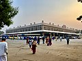 NTR Bus Station, Guntur
 -
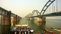 Godavari Bridge, Rajahmundry
 -
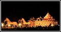
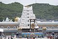 Tirumala Tirupati Devasthanam, Tirupati
 -
 Coringa Wildlife Sanctuary, Kakinada
 -
 Annamacharya statue, Tallapaka, Rajampet, Annamayya district
 -
 Kanipakam Temple, Kanipakam, Chittoor
 -
 Raghavendra Swamy Temple, Mantralayam, Kurnool
 -
 Kodanda Ramaswamy Temple, Vontimitta, Kadapa
 -
 Ongole Bull
 -
![Ganta Stambham [Clock Tower], Vizianagaram](//upload.wikimedia.org/wikipedia/commons/thumb/2/25/Ganta_stambham_%28clock_tower%29_in_Vizianagaram.jpg/93px-Ganta_stambham_%28clock_tower%29_in_Vizianagaram.jpg) Ganta Stambham [Clock Tower], Vizianagaram
Ganta Stambham [Clock Tower], Vizianagaram -
 Nagarjuna Sagar
 -
 Kondapalli Fort, Vijayawada
 -
 Lepakshi, Hindupuram, Sri Sathya Sai district
 -
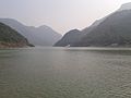 Papikondalu, Godavari River
 -
 Nallamalla Forest, Srisailam,Nandyal
 -
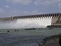
 Srisailam Dam, Nandyal
 -
 ISKON Temple, Anantapuram
 -
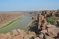 Grand Canyon of India, Chitravathi River, Gandikota, Kadapa
 -
![Satish Dhawan Space Centre [SDSC], Sriharikota, Tirupati](//upload.wikimedia.org/wikipedia/commons/thumb/b/b6/Chandrayaan_2_Module_on_GSLV_MK_III_at_Satish_Dhawan_Space_Centre_Second_Launch_Pad.jpg/80px-Chandrayaan_2_Module_on_GSLV_MK_III_at_Satish_Dhawan_Space_Centre_Second_Launch_Pad.jpg) Satish Dhawan Space Centre [SDSC], Sriharikota, Tirupati
Satish Dhawan Space Centre [SDSC], Sriharikota, Tirupati -
 Varaha Lakshmi Narasimha swamy Temple, Simhachalam, Visakhapatnam
 -
 Konaseema, Amalapuram
 -
 INS Kursura Submarine Museum, Visakhapatnam
 -
 Araku Valley, Araku
 -
 Clock Tower, Anantapuram
 -
 Sri Mukhalingam Temple, Srikakulam
 -
 Horsley hills, Madanapalli, Annamayya district
 -
 Panakala Lakshmi Narasimha swamy Temple, Mangalagiri, Guntur
 -
 Chandragiri Fort, Chandragiri, Tirupati
 -
 Paderu Agency Area, Visakhapatnam
 -
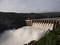
 Polavaram Dam, Polavaram, West Godavari
 -
 Mypadu Beach, Nellore
 -
 Belum Caves, Banaganapalli, Nandyal
 -
 Undavalli Caves, Amaravati, Guntur
 -
 Yarada Beach, Visakhapatnam
 -
 Talakona Waterfalls, Tirupati
 -
 Satyanarayana Swamy Temple, Annavaram, East Godavari
 -
 Puttaparthi, Sri Sathya Sai district
 -
 Sri Surya Narayana Swamy Temple, Arasavalli, Srikakulam


_7.jpg)


![Ganta Stambham [Clock Tower], Vizianagaram](/wiki/File:Ganta_stambham_(clock_tower)_in_Vizianagaram.jpg)


![Satish Dhawan Space Centre [SDSC], Sriharikota, Tirupati](/wiki/File:Chandrayaan_2_Module_on_GSLV_MK_III_at_Satish_Dhawan_Space_Centre_Second_Launch_Pad.jpg)


.jpg)
See also[edit]
- List of urban agglomerations in Andhra Pradesh
- List of cities in India by population
- List of urban local bodies in Andhra Pradesh
- ]]List of cities in Andhra Pradesh by population]]
Notes[edit]
Sources[edit]
Source: STATISTICAL INFORMATION OF ULBs & UDAs also Office of the Registrar General and Census Commissioner (web), Delimitation Commission of India (web), Rand McNally International Atlas 1994, School of Planning & Architecture (web) - https://www.citypopulation.de/php/india-andhrapradesh.php
https://censusindia.gov.in/2011census/dchb/2811_PART_A_DCHB_SRIKAKULAM.pdf
https://censusindia.gov.in/2011census/dchb/2812_PART_A_DCHB_VIZIANAGARAM.pdf
https://censusindia.gov.in/2011census/dchb/2813_PART_A_DCHB_VISAKHAPATNAM.pdf
https://censusindia.gov.in/2011census/dchb/2814_PART_A_DCHB_EAST%20GODAVARI.pdf
https://censusindia.gov.in/2011census/dchb/2815_PART_A_DCHB_WEST%20GODAVARI.pdf
https://censusindia.gov.in/2011census/dchb/2816_PART_A_DCHB_KRISHNA.pdf
https://censusindia.gov.in/2011census/dchb/2817_PART_A_DCHB_GUNTUR.pdf
https://censusindia.gov.in/2011census/dchb/2818_PART_A_DCHB_PRAKASAM.pdf
https://censusindia.gov.in/2011census/dchb/2819_PART_A_DCHB_SRI%20POTTI%20SRIIAMULU%20NELLORE.pdf
https://censusindia.gov.in/2011census/dchb/2823_PART_A_DCHB_CHITTOOR.pdf
https://censusindia.gov.in/2011census/dchb/2820_PART_A_DCHB_YSR.pdf
https://censusindia.gov.in/2011census/dchb/2821_PART_A_DCHB_KURNOOL.pdf
https://censusindia.gov.in/2011census/dchb/2822_PART_A_DCHB_ANANTAPUR.pdf
http://smartcities.gov.in/upload/uploadfiles/files/AndraPradesh_Kakinada.pdf
References[edit]
- ^ "Census Data 2011 / Metadata". The Registrar General & Census Commissioner, India. Archived from the original on 17 June 2007. Retrieved 10 August 2014.
- ^ Rajahmundry, Greater (1 March 2017). "Greater Rajahmundry: Revised Master Plan for Kakinada also ready". Greater Rajahmundry. Retrieved 28 August 2020.
- ^ Venu Lanka (28 December 2019). "Greater Vijayawada likely to include only 29 villages | Vijayawada News - Times of India". The Times of India. Retrieved 28 August 2020.
- ^ https://1.bp.blogspot.com/-SGSwwKD2Aa4/XjWP__GF17I/AAAAAAAAF3M/Q7-z3QXc2OwKgIxHzIIFLhCk41PazKfVACNcBGAsYHQ/s1600/01.jpg.
{{cite web}}: Missing or empty|title=(help) - ^ "Cities Profile of Round 1 Smart Cities :: SMART CITIES MISSION, Government of India". smartcities.gov.in. Retrieved 29 August 2020.
- ^ Umamaheswara Rao (25 January 2020). "Barely a city now, Amaravati tops smart city spend | Amaravati News - Times of India". The Times of India. Retrieved 29 August 2020.
- ^ "Municipal Corporations | Commissioner and Director of Municipal Administration". cdma.ap.gov.in. Retrieved 21 March 2021.