Mường Chà district
You can help expand this article with text translated from the corresponding article in Vietnamese. (March 2009) Click [show] for important translation instructions.
|
Mường Chà District
Huyện Mường Chà | |
|---|---|
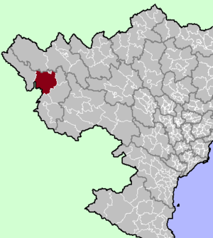
 Mường Chà district location in northern Vietnam | |
| Country | |
| Region | Northwest |
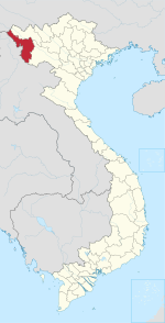
| Province | Điện Biên |
| Capital | Mường Chà |
| Area | |
| • Total | 463.10 sq mi (1,199.42 km2) |
| Population (2012) | |
| • Total | 39,456 |
| • Density | 90/sq mi (33/km2) |
| Time zone | UTC+7 (Indochina Time) |
Mường Chà is a rural district of Điện Biên province in the Northwest region of Vietnam. As of 2012 the district had a population of 39,456.[1] The district covers an area of 1,199.42 km². The district capital lies at Mường Chà.[1]
On 25 August 2012, the western portion of the district was carved out to form Nậm Pồ district.
Geography[edit]
Administrative divisions[edit]
Mường Chà has 12 administrative units, including 1 town and 11 communes:
References[edit]
- ^ a b "Districts of Vietnam". Statoids. Retrieved 13 March 2009.


