
Machhike
This article needs additional citations for verification. (February 2017) |
Machhike | |
|---|---|
 | |
| Coordinates: 30°33′25″N 75°22′52″E / 30.557°N 75.381°E | |
| Country | India |
| State | Punjab |
| District | Moga |
Machhike is a village in the Moga District of the Indian state of Punjab. It is part of the Nihal Singh Wala Assembly Constituency.
Geography[edit]
It is located 10 km southeast of Nihal Singh Wala, 38 km southeast of Moga, and 60 km southwest of Ludhiana. The Machhike local language is Punjabi.
Demographics[edit]
In the 2011 census, the population was 6,411. There is a 56.6% literacy rate with a 24.3% female literacy rate.
| Total | Male | Female | |
|---|---|---|---|
| Population | 6,411 | 3,411 | 3,000 |
| 0–6 years old | 661 | 347 | 314 |
| Scheduled Castes | 2,695 | 1,420 | 1,275 |
| Scheduled Tribes | 0 | 0 | 0 |
| Literates | 3,627 | 2,071 | 1,556 |
| Illiterate | 2,784 | 1,340 | 1,444 |
| Total Workers | 1,936 | 1,771 | 165 |
| Main Worker | 1,880 | 1,722 | 158 |
| Main Worker - Cultivators | 758 | 734 | 24 |
| Main Worker - Agriculture Labourers | 613 | 597 | 16 |
| Main Worker - Household Industries | 22 | 19 | 3 |
| Main Worker - Other | 487 | 372 | 115 |
| Marginal Worker (total) | 56 | 49 | 7 |
| Non Worker | 4,475 | 1,640 | 2,835 |
Images[edit]
-
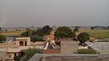 Machhike
 -
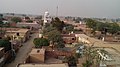 Machhike


References[edit]
- ^ "Census of India: Search Details". www.censusindia.gov.in. Retrieved 20 February 2019.
This article about a location in the Indian state of Punjab is a stub. You can help Wikipedia by expanding it. |