Masters, Colorado
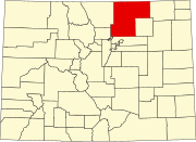
Masters is an extinct town in Weld County, in the U.S. state of Colorado. The GNIS classifies it as a populated place.[1]
History[edit]
A post office called Masters was established in 1900 and remained in operation until 1967.[2] The community was named for a local rancher, who owned the land the town was built on.[3]
Masters was located on a rail line from LaSalle to Julesburg, which was built by the Colorado Central Railroad.[4] A siding was built to the north of the post office, near the banks of the South Platte River.[5] The rail line was abandoned by the Union Pacific Railroad in the 1990s.[6]
References[edit]
- ^ U.S. Geological Survey Geographic Names Information System: Masters, Colorado
- ^ "Post offices". Jim Forte Postal History. Retrieved July 1, 2016.
- ^ Dawson, John Frank. Place names in Colorado: why 700 communities were so named, 150 of Spanish or Indian origin. Denver, CO: The J. Frank Dawson Publishing Co. p. 34.
- ^ Fraser, Clayton, B. (August 31, 1997), The History and Evolution of Colorado's Railroads: 1858-1948 (PDF), Loveland: United States Department of the Interior, p. 98
{{citation}}: CS1 maint: multiple names: authors list (link) - ^ United States Geological Survey (1951). Masters Quadrangle, Colorado (Map). United States Department of the Interior. Retrieved September 9, 2021.
- ^ United States Geological Survey (2010). Masters Quadrangle, Colorado (Map). United States Department of the Interior. Retrieved September 9, 2021.
40°18′34″N 104°14′42″W / 40.30944°N 104.24500°W

