
Morehead Township, Guilford County, North Carolina
Morehead Township | |
|---|---|
 Morehead Township in Guilford County | |
 Morehead Township  Morehead Township | |
| Coordinates: 36°04′10″N 79°49′50″W / 36.06944°N 79.83056°W | |
| Country | United States |
| State | North Carolina |
| County | Guilford |
| Established | 1868 |
| Government | |
| • Type | non-functioning county subdivision |
| Time zone | UTC-5 (Eastern (EST)) |
| • Summer (DST) | UTC-4 (EDT) |
Morehead Township is a rural, non-functioning county subdivision established in 1868 in Guilford County, North Carolina, United States.. The population at the 2010 census was 195,218.[1][2]
History[edit]
Morehead Township was created as an administrative division of Guilford County in 1868, as required by the North Carolina Constitution as re-written in 1868.[2]
Other facts[edit]
- Metro Area: Greensboro Area
- ZIP Codes: 27235, 27265, 27282, 27358, 27401, 27403, 27405, 27406, 27407, 27408, 27409, 27410, 27455
- Unified School District: Guilford County
- Congressional Districts: NC-6, NC-12
- State Senate Districts: NC-26, NC-27, NC-28
- State House Districts: NC-57, NC-58, NC-59, NC-60, NC-61, NC-62
Neighboring Townships:
Nearby Townships:
- Abbotts Creek
- Abbotts Creek
- Belews Creek
| Census | Pop. | Note | %± |
|---|---|---|---|
| 1870 | 2,104 | — | |
| 1880 | 2,699 | 28.3% | |
| 1890 | 2,331 | −13.6% | |
| 1900 | 6,802 | 191.8% | |
| 1910 | 12,340 | 81.4% | |
| 1920 | 17,621 | 42.8% | |
| 1930 | 31,225 | 77.2% | |
| 1940 | 36,800 | 17.9% | |
| 1950 | 52,728 | 43.3% | |
| 1960 | 70,689 | 34.1% | |
| 1970 | 91,177 | 29.0% | |
| 1980 | 102,082 | 12.0% | |
| 1990 | 129,955 | 27.3% | |
| 2000 | 165,130 | 27.1% | |
| 2010 | 195,218 | 18.2% |
- Clay
- High Point
- Jefferson
- Kernersville
- Level Cross
- Madison
- Oak Ridge
References[edit]
- ^ "Morehead-Guilford North Carolina". city-data.com.
- ^ a b "North Carolina Constitution of 1868" (PDF). Retrieved May 10, 2019.
Municipalities and communities of Guilford County, North Carolina, United States | ||
|---|---|---|
| Cities | 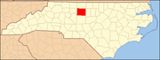 | |
| Towns | ||
| CDPs | ||
| Unincorporated communities | ||
| Footnotes | ‡This populated place also has portions in an adjacent county or counties | |
This North Carolina–related article is a stub. You can help Wikipedia by expanding it. |