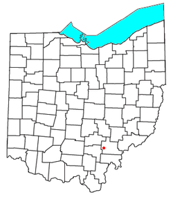
New Marshfield, Ohio
New Marshfield, Ohio | |
|---|---|
 Location of New Marshfield, Ohio | |
| Coordinates: 39°19′31″N 82°12′59″W / 39.32528°N 82.21639°W | |
| Country | United States |
| State | Ohio |
| County | Athens |
| Elevation | 843 ft (257 m) |
| Population (2020) | |
| • Total | 316 |
| Time zone | UTC-5 (Eastern (EST)) |
| • Summer (DST) | UTC-4 (EDT) |
| ZIP code | 45766 |
| Area code | 740 |
| GNIS feature ID | 2628942[1] |
New Marshfield is a census-designated place in central Waterloo Township, Athens County, Ohio, United States. The population was 316 at the 2020 census.[3] It has a post office with the ZIP code 45766.[4] It is located along State Route 56 west of the county seat of Athens.

History[edit]
The B&O Railroad formerly passed through the community, but the line was abandoned in the 1980s.[citation needed]
A post office called Marshfield was established in 1857, and the post office was renamed New Marshfield in 1909.[5] By the 1880s, (New) Marshfield had a train station and several stores.[6]
Education[edit]
Public Education in the community of New Marshfield is provided by the Alexander Local School District. Campuses serving the community include Alexander Elementary School] (Grades PK-5), Alexander Middle School] (Grades 6–8), and Alexander High School (Grades 9–12).
References[edit]
- ^ a b U.S. Geological Survey Geographic Names Information System: New Marshfield, Ohio
- ^ "ArcGIS REST Services Directory". United States Census Bureau. Retrieved September 20, 2022.
- ^ "New Marshfield CPD, Ohio - Census Bureau Profile". United States Census Bureau. Retrieved May 20, 2023.
- ^ USPS – Cities by ZIP Code
- ^ "Athens County". Jim Forte Postal History. Retrieved December 31, 2015.
- ^ History of Hocking Valley, Ohio: together with sketches of its cities, villages and townships. Chicago: Inter-State Pub. Co. 1883. p. 691.

