
Palm Harbor, Texas
Palm Harbor, Texas | |
|---|---|
 Palm Harbor  Palm Harbor | |
| Coordinates: 27°58′14″N 97°05′38″W / 27.9705758°N 97.0938786°W | |
| Country | United States |
| State | Texas |
| County | Aransas |
| Elevation | 3 ft (0.9 m) |
| Time zone | UTC-6 (Central (CST)) |
| • Summer (DST) | UTC-5 (CDT) |
| Area code | 361 |
| GNIS feature ID | 1343461[1] |
Palm Harbor is an unincorporated community in Aransas County, in the U.S. state of Texas.[1] According to the Handbook of Texas, its population was 125 in 2000. It is located within the Corpus Christi metropolitan area.
History[edit]
Palm Harbor was founded in 1960 when land developers Raulie Irwin, Sr., and Doyle Brashear wanted to build rental properties along Redfish Bay in an area in nearby Estes. A sales office opened in 1961, but business was halted when Hurricane Carla struck in September of that year. The houses in the community were small in size; only 900 square feet (8.4×10⁻⁵ km2) or less. A long canal was built with lots on each side to link with the Gulf Intracoastal Waterway. It had a population of 125 in 1990 through 2000.[2] Residents of the community worked and shopped in nearby Rockport, and is considered a bedroom community of Rockport.[3]
Geography[edit]
Palm Harbor is located on Texas State Highway 35, 3 mi (4.8 km) southwest of Rockport in southern Aransas County.[2]
Education[edit]
Today, the community is served by the Aransas County Independent School District.
References[edit]
- ^ a b U.S. Geological Survey Geographic Names Information System: Palm Harbor, Texas
- ^ a b Jasinski, Laurie E. (July 22, 2004). "Palm Harbor, TX". tshaonline.org.
- ^ "Palm Harbor, Texas". Texas Escapes Online Magazine. Retrieved January 9, 2022.
Municipalities and communities of Aransas County, Texas, United States | ||
|---|---|---|
| Cities | 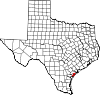 | |
| Town | ||
| CDPs | ||
| Unincorporated communities | ||
| Ghost town | ||
| Footnotes | ‡This populated place also has portions in an adjacent county or counties | |