Portal:Scottish islands/Island group
The following articles are currently featured as the Selected island group at the Scottish Islands Portal. To suggest an article for inclusion, use the talk page
The Flannan Isles (Scottish Gaelic: Na h-Eileanan Flannach) or the Seven Hunters are a small island group in the Outer Hebrides of Scotland, approximately 32 kilometres (17+1⁄2 nautical miles) west of the Isle of Lewis. They may take their name from Saint Flannan, the 7th century Irish preacher and abbot.
The islands have been devoid of permanent residents since the automation of Flannan Isles Lighthouse in 1971. (Full article...)

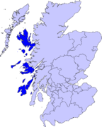
The Hebrides (/ˈhɛbrɪdiːz/ HEB-rid-eez; Scottish Gaelic: Innse Gall, pronounced [ˈĩːʃə ˈkaul̪ˠ]; Old Norse: Suðreyjar, lit. 'Southern isles') are an archipelago off the west coast of the Scottish mainland. The islands fall into two main groups, based on their proximity to the mainland: the Inner and Outer Hebrides.
These islands have a long history of occupation (dating back to the Mesolithic period), and the culture of the inhabitants has been successively influenced by the cultures of Celtic-speaking, Norse-speaking, and English-speaking peoples. This diversity is reflected in the various names given to the islands, which are derived from the different languages that have been spoken there at various points in their history.
The Hebrides are where much of Scottish Gaelic literature and Gaelic music has historically originated. Today, the economy of the islands is dependent on crofting, fishing, tourism, the oil industry, and renewable energy. The Hebrides have less biodiversity than mainland Scotland, but a significant number of seals and seabirds.
The islands have a combined area of 7,285 km2 (2,813 sq mi), and, as of 2011[update], a combined population of around 45,000. (Full article...)

The Inner Hebrides (/ˈhɛbrɪdiːz/ HEB-rid-eez; Scottish Gaelic: na h-Eileanan a-staigh, lit. 'the Inner Isles') is an archipelago off the west coast of mainland Scotland, to the south east of the Outer Hebrides. Together these two island chains form the Hebrides, which experience a mild oceanic climate. The Inner Hebrides comprise 35 inhabited islands as well as 44 uninhabited islands with an area greater than 30 hectares (74 acres). Skye, Mull, and Islay are the three largest, and also have the highest populations. The main commercial activities are tourism, crofting, fishing and whisky distilling. In modern times the Inner Hebrides have formed part of two separate local government jurisdictions, one to the north and the other to the south. Together, the islands have an area of about 4,130 km2 (1,594 sq mi), and had a population of 18,948 in 2011. The population density is therefore about 4.6 inhabitants per square kilometre (12 inhabitants per square mile).
There are various important prehistoric structures, many of which pre-date the first written references to the islands by Roman and Greek authors. In the historic period the earliest known settlers were Picts to the north and Gaels in the southern kingdom of Dál Riada prior to the islands becoming part of the Suðreyjar kingdom of the Norse, who ruled for over 400 years until sovereignty was transferred to Scotland by the Treaty of Perth in 1266. Control of the islands was then held by various clan chiefs, principally the MacLeans, MacLeods and MacDonalds. The Highland Clearances of the 19th century had a devastating effect on many communities and it is only in recent years that population levels have ceased to decline.
Sea transport is crucial and a variety of ferry services operate to mainland Scotland and between the islands. The Gaelic language remains strong in some areas; the landscapes have inspired a variety of artists; and there is a diversity of wildlife. (Full article...)

The Islands of the Firth of Clyde are the fifth largest of the major Scottish island groups after the Inner and Outer Hebrides, Orkney and Shetland. They are situated in the Firth of Clyde between Ayrshire and Argyll and Bute. There are about forty islands and skerries. Only four are inhabited, and only nine are larger than 40 hectares (99 acres). The largest and most populous are Arran and Bute. They are served by dedicated ferry routes, as are Great Cumbrae and Holy Island. Unlike the isles in the four larger Scottish archipelagos, none of the isles in this group are connected to one another or to the mainland by bridges.
The geology and geomorphology of the area is complex, and the islands and the surrounding sea lochs each have distinctive features. The influence of the Atlantic Ocean and the North Atlantic Drift create a mild, damp oceanic climate. There is a diversity of wildlife, including three species of rare endemic trees.
The larger islands have been continuously inhabited since Neolithic times. The cultures of their inhabitants were influenced by the emergence of the kingdom of Dál Riata, beginning in 500 AD. The islands were then politically absorbed into the emerging kingdom of Alba, led by Kenneth MacAlpin. During the early Middle Ages, the islands experienced Viking incursions. In the 13th century, they became part of the Kingdom of Scotland. (Full article...)

The Islands of the Forth are a group of small islands located in the Firth of Forth and in the estuary of the River Forth on the east coast of Scotland. Most of the group lie in the open waters of the firth, between the Lothians and Fife, with the majority to the east of the city of Edinburgh. Two islands lie further west in the river estuary.
The islands have a varied geology and history; over the centuries, several have had both ecclesiastical connections and a history of involvement in military occupations. Various lighthouses and other aids to navigation have been erected on the islands and skerries — one of these dates to the 17th century. But only one of the islands still has year-round human inhabitants. The area has diverse bird and sea life. The scientific name for the northern gannet was chosen in recognition of this bird's connection with the Bass Rock.
There are only a few islands off the coast of eastern Scotland, and most of them of any significant size are included in this group. (Full article...)

The Northern Isles (Scots: Northern Isles; Scottish Gaelic: Na h-Eileanan a Tuath; Old Norse: Norðreyjar; Norn: Nordøjar) are a chain (or archipelago) of islands off the north coast of mainland Scotland. The climate is cool and temperate and highly influenced by the surrounding seas. There are two main island groups: Shetland and Orkney. There are a total of 36 inhabited islands, with the fertile agricultural islands of Orkney contrasting with the more rugged Shetland islands to the north, where the economy is more dependent on fishing and the oil wealth of the surrounding seas. Both archipelagos have a developing renewable energy industry. They share a common Pictish and Norse history, and were part of the Kingdom of Norway before being absorbed into the Kingdom of Scotland in the 15th century. The islands played a significant naval role during the world wars of the 20th century.
Tourism is important to both archipelagos, with their distinctive prehistoric ruins playing a key part in their attraction, and there are regular ferry and air connections with mainland Scotland. The Scandinavian influence remains strong, especially in local folklore and both island chains have strong, though distinct local cultures. The names of the islands are dominated by the Norse heritage, although some may retain pre-Celtic elements. (Full article...)
Orkney (/ˈɔːrkni/; Scots: Orkney; Old Norse: Orkneyjar; Norn: Orknøjar), also known as the Orkney Islands (archaically "The Orkneys"), is an archipelago in the Northern Isles of Scotland, situated off the north coast of the island of Great Britain. Orkney is 10 miles (16 km) north of the coast of Caithness and has about 70 islands, of which 20 are inhabited. The largest island, the Mainland, has an area of 523 square kilometres (202 sq mi), making it the sixth-largest Scottish island and the tenth-largest island in the British Isles. Orkney's largest settlement, and also its administrative centre, is Kirkwall.
Orkney is one of the 32 council areas of Scotland, as well as a constituency of the Scottish Parliament, a lieutenancy area, and an historic county. The local council is Orkney Islands Council, one of only three councils in Scotland with a majority of elected members who are independents.
The islands have been inhabited for at least 8,500 years, originally occupied by Mesolithic and Neolithic tribes and then by the Picts. Orkney was colonised and later annexed by the Kingdom of Norway in 875 and settled by the Norsemen. In 1472, the Parliament of Scotland absorbed the Earldom of Orkney into the Kingdom of Scotland, following failure to pay a dowry promised to James III of Scotland by the family of his bride, Margaret of Denmark.
In addition to the Mainland, most of the remaining islands are divided into two groups: the North Isles and the South Isles. The local climate is relatively mild and the soils are extremely fertile; most of the land is farmed, and agriculture is the most important sector of the economy. The significant wind and marine energy resources are of growing importance; the amount of electricity that Orkney generates annually from renewable energy sources exceeds its demand. Daytime temperatures generally range between 7 °C (45 °F) in winter and 16 °C (61 °F) in summer. (Full article...)
The Outer Hebrides (/ˈhɛbrɪdiːz/ HEB-rid-eez) or Western Isles (Scottish Gaelic: na h-Eileanan Siar [nə ˈhelanən ˈʃiəɾ] ⓘ, na h-Eileanan an Iar [nə ˈhelanən əɲ ˈiəɾ] ⓘ or na h-Innse Gall, 'Islands of the Strangers'; Scots: Waster Isles), sometimes known as the Long Isle or Long Island (Scottish Gaelic: an t-Eilean Fada), is an island chain off the west coast of mainland Scotland. The islands are geographically coextensive with Comhairle nan Eilean Siar, one of the 32 unitary council areas of Scotland. They form part of the archipelago of the Hebrides, separated from the Scottish mainland and from the Inner Hebrides by the waters of the Minch, the Little Minch, and the Sea of the Hebrides.
Most of the islands have a bedrock formed from ancient metamorphic rocks, and the climate is mild and oceanic. The 15 inhabited islands have a total population of 26,120 and there are more than 50 substantial uninhabited islands. The distance from Barra Head to the Butt of Lewis is roughly 210 kilometres (130 mi).
There are various important prehistoric structures, many of which pre-date the first written references to the islands by Roman and Greek authors. The Western Isles became part of the Norse kingdom of the Suðreyjar, which lasted for over 400 years, until sovereignty over the Outer Hebrides was transferred to Scotland by the Treaty of Perth in 1266. Control of the islands was then held by clan chiefs, principal amongst whom were the MacLeods, MacDonalds, Mackenzies and MacNeils. The Highland Clearances of the 19th century had a devastating effect on many communities, and it is only in recent years that population levels have ceased to decline. Much of the land is now under local control, and commercial activity is based on tourism, crofting, fishing, and weaving.
Sea transport is crucial, and a variety of ferry services operate between the islands and to mainland Scotland. Modern navigation systems now minimise the dangers, but in the past the stormy seas have claimed many ships. Religion, music and sport are important aspects of local culture, and there are numerous designated conservation areas to protect the natural environment. (Full article...)
Shetland, also called the Shetland Islands, is an archipelago in Scotland lying between Orkney, the Faroe Islands, and Norway. It is the northernmost region of the United Kingdom.
The islands lie about 80 km (50 mi) to the northeast of Orkney, 170 km (110 mi) from mainland Scotland and 220 km (140 mi) west of Norway. They form part of the border between the Atlantic Ocean to the west and the North Sea to the east. Their total area is 1,466 km2 (566 sq mi), and the population totalled 22,920 in 2019. The islands comprise the Shetland constituency of the Scottish Parliament. The local authority, the Shetland Islands Council, is one of the 32 council areas of Scotland. The islands' administrative centre, largest settlement and only burgh is Lerwick, which has been the capital of Shetland since 1708, before which time the capital was Scalloway.
The archipelago has an oceanic climate, complex geology, rugged coastline, and many low, rolling hills. The largest island, known as "the Mainland", has an area of 967 km2 (373 sq mi), and is the fifth-largest island in the British Isles. It is one of 16 inhabited islands in Shetland.
Humans have lived in Shetland since the Mesolithic period. Picts are known to have been the original inhabitants of the islands, before the Norse conquest and subsequent colonisation in the Early Middle Ages. During the 10th to 15th centuries, the islands formed part of the Kingdom of Norway until they were annexed into the Kingdom of Scotland due to a royal dispute involving the payment of a dowry. In 1707, when Scotland and England united to form the Kingdom of Great Britain, trade between Shetland and continental Northern Europe decreased. The discovery of North Sea oil in the 1970s significantly boosted Shetland's economy, employment and public-sector revenues. Fishing has always been an important part of the islands' economy. (Full article...)
St Kilda (Scottish Gaelic: Hiort) is a remote archipelago situated 64 kilometres (40 mi) west-northwest of North Uist in the North Atlantic Ocean. It contains the westernmost islands of the Outer Hebrides of Scotland. The largest island is Hirta, whose sea cliffs are the highest in the United Kingdom; three other islands (Dùn, Soay and Boreray) were also used for grazing and seabird hunting. The islands are administratively a part of the Comhairle nan Eilean Siar local authority area.
The origin of the name St Kilda is a matter of conjecture. The islands' human heritage includes numerous unique architectural features from the historic and prehistoric periods, although the earliest written records of island life date from the Late Middle Ages. The medieval village on Hirta was rebuilt in the 19th century, but illnesses brought by increased external contacts through tourism, and the upheaval of the First World War, contributed to the island's evacuation in 1930. The story of St Kilda has attracted artistic interpretations, including Michael Powell's film The Edge of the World and an opera.
Permanent habitation on the islands possibly extends back two millennia, the population probably never exceeding 180; its peak was in the late 17th century. The population was 112 in 1851. According to the 1861 census, there were 71 inhabitants at that time; over subsequent years, the population ebbed and waned, eventually dropping to 36 as of May 1930. Virtually all of the population lived on Hirta. The entire remaining population was evacuated from Hirta, by then the only inhabited island, in 1930.
The islands house a unique form of stone structure known as cleitean. A cleit is a stone storage hut or bothy; while many still exist, they are slowly falling into disrepair. There are known to be 1,260 cleitean on Hirta and a further 170 on the other group islands. Currently, the only year-round residents are military personnel; a variety of conservation workers, volunteers and scientists spend time there in the summer months. (Full article...)


