
Puymiclan
Puymiclan | |
|---|---|
Location of Puymiclan  | |
 Puymiclan  Puymiclan | |
| Coordinates: 44°30′46″N 0°19′00″E / 44.5128°N 0.3167°E | |
| Country | France |
| Region | Nouvelle-Aquitaine |
| Department | Lot-et-Garonne |
| Arrondissement | Marmande |
| Canton | Les Coteaux de Guyenne |
| Intercommunality | Val de Garonne Agglomération |
| Government | |
| • Mayor (2020–2026) | Christine de Nadaï (née Saudel)[1] |
| Area 1 | 25.74 km2 (9.94 sq mi) |
| Population (2021)[2] | 692 |
| • Density | 27/km2 (70/sq mi) |
| Time zone | UTC+01:00 (CET) |
| • Summer (DST) | UTC+02:00 (CEST) |
| INSEE/Postal code | 47216 /47350 |
| Elevation | 42–126 m (138–413 ft) (avg. 85 m or 279 ft) |
| 1 French Land Register data, which excludes lakes, ponds, glaciers > 1 km2 (0.386 sq mi or 247 acres) and river estuaries. | |
Puymiclan (French pronunciation: [pɥimiklɑ̃]; Occitan: Pugmiclan) is a landlocked commune in the Lot-et-Garonne department in south-western France.
-
 Church Notre-Dame-des-Pins
 -
 Church of SaintPierre-de-Londres
 -
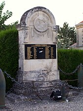 war Memorial

.jpg)

See also[edit]
References[edit]
- ^ "Répertoire national des élus: les maires" (in French). data.gouv.fr, Plateforme ouverte des données publiques françaises. 13 September 2022.
- ^ "Populations légales 2021". The National Institute of Statistics and Economic Studies. 28 December 2023.
Wikimedia Commons has media related to Puymiclan.
| Authority control databases: National |
|---|
This Lot-et-Garonne geographical article is a stub. You can help Wikipedia by expanding it. |