
Roanoke City Market Historic District
Roanoke City Market Historic District | |
 Roanoke City Market Historic District as seen from above | |
  | |
| Location | Roughly bounded by Williamson Rd., Norfolk Ave., S. Jefferson St., and Church Ave.; 302 Campbell Ave., SE; 9 Church Ave, SE, Roanoke, Virginia |
|---|---|
| Coordinates | 37°16′18″N 79°56′21″W / 37.27167°N 79.93917°W |
| Area | 16 acres (6.5 ha) |
| Architectural style | Late 19th And 20th Century Revivals, Late Victorian (original) Early Commercial (increase) |
| NRHP reference No. | 83003312, 02000622 (increase)[1] |
| VLR No. | 128-0045 |
| Significant dates | |
| Added to NRHP | April 20, 1983 (original) June 6, 2002 (increase)[3] |
| Designated VLR | September 16, 1982, September 12, 2001[2] |
Roanoke City Market Historic District, also known as City Market District, is a national historic district located in the Downtown Roanoke area of Roanoke, Virginia.
The district's history dates to 1882, when the Norfok and Western Railway (N&W) began the process of locating its headquarters to the small town of Big Lick.[4] That decision precipitated a name change for the town to Roanoke, as well as a migration of the town's business district southeast towards the new railroad depot and hotel being built by the N&W.[4] A town square along Campbell Avenue began seeing use as a makeshift open-air market, and in 1884 the new City of Roanoke's original charter provided for the construction of a municipal market.[5][6] Completed in 1886, the original market building occupied the northwestern portion of the square; when that building was destroyed by fire it was replaced in 1922 with the current building and its centered arrangement.[5][7]
It was listed on the National Register of Historic Places in 1983, with an area roughly bounded by Williamson Rd., Norfolk Ave., S. Jefferson St., and Church Ave. The district area was increased to include 302 Campbell Ave., SE, and 9 Church Ave, SE, in 2002.[1] The district encompasses 51 contributing buildings and 1 contributing object. The focal point of the area's grid-plan is the City Market Building (1922) set in the middle of the central Market Square. Other notable buildings include the Hartsook Building (1897), Lampros Building (1909), the McGuire Building (1914), and the Goria Brothers Grocery Building (1924).[6] Located in the district is the separately listed Fire Station No. 1.[6][8]
Gallery[edit]
-
 Roanoke City Market Historic District, June 2010
 -
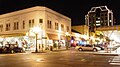 Roanoke City Market Historic District at Night


References[edit]
- ^ a b "National Register Information System". National Register of Historic Places. National Park Service. July 9, 2010.
- ^ "Virginia Landmarks Register". Virginia Department of Historic Resources. Retrieved March 19, 2013.
- ^ "National Register Information System". National Register of Historic Places. National Park Service. April 15, 2008.
- ^ a b White, Clare (1982). Roanoke 1740 – 1982. Roanoke Valley Historical Society.
- ^ a b "History of the Market | Farmer's Market | Explore | Downtown Roanoke". www.downtownroanoke.org. Retrieved August 7, 2023.
- ^ a b c Virginia Historic Landmarks Commission Staff (September 1982). "National Register of Historic Places Inventory/Nomination: Roanoke City Market Historic District". Virginia Department of Historic Resources.
- ^ "Roanoke City Market, 1915 - A photographic negative of the view of the Roanoke City Market looking north on First (Nelson) Street toward Campbell Avenue". Historical Society of Western Virginia. Retrieved August 7, 2023.
- ^ Nancy Kraus (June 2001). "National Register of Historic Places Inventory/Nomination: Roanoke City Market Historic District (Boundary Increase)" (PDF). Virginia Department of Historic Resources.
External links[edit]
![]() Media related to Roanoke City Market Historic District at Wikimedia Commons
Media related to Roanoke City Market Historic District at Wikimedia Commons
- City Market Building, Market Street & Campbell Avenue, Roanoke, Roanoke City, VA: 1 photo and 1 photo caption page at Historic American Buildings Survey

- Historic American Buildings Survey in Virginia
- Historic districts on the National Register of Historic Places in Virginia
- National Register of Historic Places in Roanoke, Virginia
- Buildings and structures in Roanoke, Virginia
- Victorian architecture in Virginia
- Shenandoah Valley, Virginia Registered Historic Place stubs