Rulison, Colorado

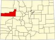
Rulison is an unincorporated community in Garfield County, Colorado, United States.[1] It is most notable for being the location of the Project Rulison nuclear test on September 10, 1969. The town of Parachute, Colorado is nearby, and Rulison is accessible from Interstate 70/U.S. Route 6.[2][3]
See also[edit]
References[edit]
- ^ "Rulison, Colorado". Geographic Names Information System. United States Geological Survey, United States Department of the Interior. Retrieved February 13, 2015.
- ^ January 2005 DOE report Rulison Site Environmental Management End State Vision
- ^ "Office of Legacy Management".
External links[edit]
![]() Media related to Rulison, Colorado at Wikimedia Commons
Media related to Rulison, Colorado at Wikimedia Commons
39°29′50″N 107°56′26″W / 39.49722°N 107.94056°W

