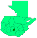
San Bartolomé Milpas Altas
San Bartolomé Milpas Altas | |
|---|---|
| Coordinates: 14°36′26″N 90°40′41″W / 14.60722°N 90.67806°W | |
| Country | |
| Department | |
| Foundation | Unknown |
| Government | |
| • Type | Municipality[1] |
| • Mayor (2016-2020) | Rosalío Aspuac Martínez (LIDER) |
| Area | |
| • Municipality | 5.18 km2 (2.00 sq mi) |
| • Urban | 5.18 km2 (2.00 sq mi) |
| Elevation | 2,090 m (6,860 ft) |
| Population (2018 census)[2] | |
| • Municipality | 7,816 |
| • Density | 1,500/km2 (3,900/sq mi) |
| • Urban | 7,816 |
| Time zone | UTC-6 (Central America) |
| Climate | Cwb |
San Bartolomé Milpas Altas is a town and municipality in the Guatemalan department of Sacatepéquez.
History[edit]
In the 1540s, bishop Francisco Marroquín split the ecclesiastical administration of the central valley of Guatemala between the Order of Preachers and the Franciscans, assigning Sumpango's curato to the former.[3] In 1638, the Dominicans separated their large doctrines in groups revolving around six convents:
| Convent | Doctrines or curatos | Convent | Doctrines or curatos |
|---|---|---|---|
| Guatemala |
|
Amatitlán | |
| Verapaz | |||
| Sonsonate |
| ||
| San Salvador |
|
Sacapulas |
Ecclesiastic historian Domingo Juarros wrote that in 1754, by virtue of a royal order of the borbon reforms of king Carlos III all curatos and doctrines of the regular clergy were moved on to the secular clergy.[5]
Climate[edit]
San Bartolomé Milpas Altas has temperate climate (Köppen: Cwb).
| Climate data for San Bartolomé Milpas Altas | |||||||||||||
|---|---|---|---|---|---|---|---|---|---|---|---|---|---|
| Month | Jan | Feb | Mar | Apr | May | Jun | Jul | Aug | Sep | Oct | Nov | Dec | Year |
| Mean daily maximum °C (°F) | 19.5 (67.1) |
20.6 (69.1) |
21.9 (71.4) |
22.8 (73.0) |
21.9 (71.4) |
20.4 (68.7) |
20.4 (68.7) |
21.0 (69.8) |
20.2 (68.4) |
19.7 (67.5) |
19.6 (67.3) |
19.6 (67.3) |
20.6 (69.1) |
| Daily mean °C (°F) | 14.1 (57.4) |
14.8 (58.6) |
15.9 (60.6) |
17.0 (62.6) |
17.1 (62.8) |
16.5 (61.7) |
16.2 (61.2) |
16.4 (61.5) |
16.0 (60.8) |
15.6 (60.1) |
14.8 (58.6) |
14.3 (57.7) |
15.7 (60.3) |
| Mean daily minimum °C (°F) | 8.7 (47.7) |
9.0 (48.2) |
10.0 (50.0) |
11.3 (52.3) |
12.3 (54.1) |
12.6 (54.7) |
12.1 (53.8) |
11.8 (53.2) |
11.9 (53.4) |
11.5 (52.7) |
10.1 (50.2) |
9.1 (48.4) |
10.9 (51.6) |
| Average precipitation mm (inches) | 7 (0.3) |
6 (0.2) |
7 (0.3) |
42 (1.7) |
140 (5.5) |
301 (11.9) |
233 (9.2) |
212 (8.3) |
277 (10.9) |
154 (6.1) |
39 (1.5) |
11 (0.4) |
1,429 (56.3) |
| Source: Climate-Data.org[6] | |||||||||||||
See also[edit]
Notes and references[edit]
References[edit]
- ^ "Alcaldes electos en el departamento de Sacatepéquez". Municipalidades de Guatemala (in Spanish). Guatemala. 8 September 2015. Archived from the original on October 28, 2015. Retrieved 28 October 2015.
- ^ Citypopulation.de Population of departments and municipalities in Guatemala!
- ^ Juarros 1818, p. 336.
- ^ Belaubre 2001, p. 39.
- ^ Juarros 1818, p. 338.
- ^ "Climate: San Bartolomé Milpas Altas". Climate-Data.org. Retrieved 19 August 2015.
- ^ a b SEGEPLAN. "Municipios de Sacatepéquez, Guatemala". Secretaría de Planificación y Programación de la Presidencia (in Spanish). Guatemala. Archived from the original on 29 June 2015. Retrieved 29 June 2015.
Bibliography[edit]
- Belaubre, Christopohe (2001). "Poder y redes sociales en Centroamérica: el caso de la Orden de los Dominicos (1757-1829)" (PDF). Mesoamérica (in Spanish). 41. Archived from the original (PDF) on 21 January 2015.
- Cortés y Larraz, Pedro (2001) [1770]. García, Jesús María; Blasco, Julio Martín (eds.). Descripción Geográfico-Moral de la Diócesis de Goathemala. Corpus Hispanorum de Pace. Segunda Serie (in Spanish). Consejo Superior de Investigaciones Científicas. ISBN 9788400080013. ISSN 0589-8056.
- Escalante Herrera, Marco Antonio (2007). "Breve información del municipio de San Bartolomé Milpas Altas". Pbase (in Spanish). Guatemala. Archived from the original on July 10, 2010. Retrieved 28 October 2015.
- Fuentes y Guzmán, Francisco Antonio de (1883) [1690]. Zaragoza, Justo; Navarro, Luis (eds.). Recordación Florida. Discurso historial y demostración natural, material, militar y política del Reyno de Guatemala (in Spanish). Vol. II. Madrid, Spain: Central.
- Juarros, Domingo (1818). Compendio de la historia de la Ciudad de Guatemala (in Spanish). Guatemala: Ignacio Beteta.
- van Oss, Adriaan C. (1986). Catholic Colonialism: A Parish History of Guatemala, 1524-1821. Cambridge, UK: Cambridge University Press. ISBN 9780521527125.


