Shiro, Texas
Shiro, Texas | |
|---|---|
 Roadside tire shop in Shiro | |
| Coordinates: 30°36′31″N 95°53′11″W / 30.60861°N 95.88639°W | |
| Country | United States |
| State | |
| County | Grimes |
| Elevation | 341 ft (104 m) |
| Population (2000) | |
| • Total | 211 |
| Time zone | UTC-6 (Central (CST)) |
| • Summer (DST) | UTC-5 (CDT) |
| Area code | 936 |
| GNIS feature ID | 2805784[1] |

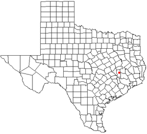
Shiro is an unincorporated community and census-designated place (CDP) in Grimes County, Texas, United States located on State Highway 30 and the Burlington-Rock Island Railroad in east central Grimes County.
Education[edit]
Public education in the community of Shiro is provided by the Anderson-Shiro Consolidated Independent School District. The district has two campuses, Anderson-Shiro Elementary School (grades PK-5) and Anderson-Shiro Junior/Senior High School (grades 6–12)
References[edit]
External links[edit]
- Shiro, Texas from the Handbook of Texas Online

