
Spurgeon, Tennessee
Spurgeon | |
|---|---|
 Location of Spurgeon, Tennessee | |
| Coordinates: 36°26′36″N 82°27′41″W / 36.44333°N 82.46139°W | |
| Country | United States |
| State | Tennessee |
| Counties | Washington, Sullivan |
| Area | |
| • Total | 4.19 sq mi (10.86 km2) |
| • Land | 4.09 sq mi (10.59 km2) |
| • Water | 0.11 sq mi (0.28 km2) |
| Elevation | 1,414 ft (431 m) |
| Population | |
| • Total | 3,978 |
| • Density | 973.33/sq mi (375.78/km2) |
| Time zone | UTC-5 (Eastern (EST)) |
| • Summer (DST) | UTC-4 (EDT) |
| Zip codes | 37615 & 37663 |
| FIPS code | 47-70680[3] |
| GNIS feature ID | 1271165[4] |
Spurgeon is a census-designated place (CDP) in Sullivan and Washington counties in the U.S. state of Tennessee. The population was 3,957 at the 2010 census.[5]
The Washington County portion of Spurgeon is part of the Johnson City Metropolitan Statistical Area, while the Sullivan County portion is part of the Kingsport-Bristol-Bristol, TN-VA Metropolitan Statistical Area. Those two metropolitan areas are components of the larger Johnson City-Kingsport-Bristol, TN-VA Combined Statistical Area – commonly known as the "Tri-Cities" region. During the American Civil War, a small conflict known as the Battle of Spurgeon’s Mill happened here.
Geography[edit]
Spurgeon is located at 36°26′36″N 82°27′41″W / 36.44333°N 82.46139°W (36.443236, -82.461335).[6]
According to the United States Census Bureau, the CDP has a total area of 4.2 square miles (10.9 km2), of which 4.1 square miles (10.6 km2) is land and 0.1 square mile (0.3 km2) (2.38%) is water.
Demographics[edit]
| Census | Pop. | Note | %± |
|---|---|---|---|
| 2020 | 3,978 | — | |
| U.S. Decennial Census[7] | |||
As of the census[3] of 2000, there were 3,460 people, 1,425 households, and 1,061 families residing in the CDP. The population density was 840.9 inhabitants per square mile (324.7/km2). There were 1,502 housing units at an average density of 365.0 per square mile (140.9/km2). The racial makeup of the CDP was 97.98% White, 0.55% African American, 0.20% Native American, 0.17% Asian, 0.06% Pacific Islander, 0.06% from other races, and 0.98% from two or more races. Hispanic or Latino of any race were 0.52% of the population.
There were 1,425 households, out of which 31.4% had children under the age of 18 living with them, 61.0% were married couples living together, 10.5% had a female householder with no husband present, and 25.5% were non-families. 21.8% of all households were made up of individuals, and 6.0% had someone living alone who was 65 years of age or older. The average household size was 2.42 and the average family size was 2.81.
In the CDP, the population was spread out, with 22.3% under the age of 18, 8.4% from 18 to 24, 32.0% from 25 to 44, 26.0% from 45 to 64, and 11.4% who were 65 years of age or older. The median age was 37 years. For every 100 females, there were 97.6 males. For every 100 females age 18 and over, there were 92.2 males.
The median income for a household in the CDP was $34,316, and the median income for a family was $41,899. Males had a median income of $30,512 versus $21,703 for females. The per capita income for the CDP was $17,004. About 8.5% of families and 11.2% of the population were below the poverty line, including 14.1% of those under age 18 and 5.2% of those age 65 or over.
References[edit]
- ^ "ArcGIS REST Services Directory". United States Census Bureau. Retrieved October 15, 2022.
- ^ "Census Population API". United States Census Bureau. Retrieved October 15, 2022.
- ^ a b "U.S. Census website". United States Census Bureau. Retrieved January 31, 2008.
- ^ "US Board on Geographic Names". United States Geological Survey. October 25, 2007. Retrieved January 31, 2008.
- ^ "U.S. Census website". United States Census Bureau. Retrieved May 14, 2011.
- ^ "US Gazetteer files: 2010, 2000, and 1990". United States Census Bureau. February 12, 2011. Retrieved April 23, 2011.
- ^ "Census of Population and Housing". Census.gov. Retrieved June 4, 2016.
Municipalities and communities of Sullivan County, Tennessee, United States | ||
|---|---|---|
| Cities | 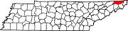 | |
| CDPs | ||
| Other communities | ||
| Footnotes | ‡This populated place also has portions in an adjacent county or counties | |
Municipalities and communities of Washington County, Tennessee, United States | ||
|---|---|---|
| Cities |  | |
| Town | ||
| CDPs | ||
| Other communities | ||
| Footnotes | ‡This populated place also has portions in an adjacent county or counties | |