
Taliwin Mountain
| Taliwin Mountain | |
|---|---|
 Taliwin Moutnain | |
| Highest point | |
| Elevation | 1,698 m (5,571 ft) |
| Listing | Babor Mountains - Tell Atlas |
| Coordinates | 36°30′41″N 5°03′34″E / 36.5114557°N 5.0594186°E |
| Geography | |
| Parent range | Babor Mountains - Tell Atlas |
| Geology | |
| Age of rock | Quaternary |
Taliwin Mountain is a mountain peak in the Babor mountain range within the Atlas Hill in Algeria, located in the municipality of Kendira in the Barbacha district in Béjaïa Province.[1]
Description[edit]
Taliwin Mountain is the fourth highest mountain peak in Béjaïa, with an elevation of 1,698 m (5,571 ft), right after Babor Mountain (2,004 m (6,575 ft)) thenTakintosht (1,874 m (6,148 ft)), followed by Isak Mountain (1,742 m (5,715 ft)), and it overlooks the eastern Gulf of Béjaïa and the Soummam Basin, and facing the Babor and Djurdjura Mountains.[2]
In the opposite direction is Takintosht in the south of the Soummam Basin, and Yma Quraya Mountain in the west of Bejaia Bay, where the city of Béjaïa was established.[3]
The summit of this mountain can be reached via a single national road, National Road 75.[4]
The mountain overlooks the municipality of Aokas and the municipality of Tichy, among other coastal municipalities.[5]
Geology[edit]
The formation of Taliwin Mountain dates back to the Quaternary of the Cenozoic on the geologic time scale[6]
The surrounding terrain is covered with gray marble, connected by paths of reddish siderite and iron ore.[7]
The composition of this terrain is also characterized by an amount of crystalline schist and mica-schist.[8]

Quarries[edit]
Around the foothills of Taliwin Mountain are several quarries that specialize in the extraction of:[9]

Valleys[edit]
Many valleys originate and surround Taliwin Mountain, including:[12]
- Aqrion Valley.
- Bou Sellam Valley .
- Amasin Valley.

Dams and lakes[edit]
- Egil Amda Dam
- Egzer Oftis Dam
- Sheabat el Akhira Dam
Ecological diversity[edit]
Barbary macaque[edit]

The Barbary macaque is found near Taliwin Mountain.[13]
Photos gallery[edit]
-
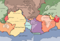
 Location of Taliwin Mountain in Kendira Municipality
 -


See also[edit]
Related topics[edit]
References[edit]
- ^ Google Maps Archived December 06, 2017 at the Wayback Machine.
- ^ Le Bois de Ben Haroun Archived September 23, 2016 at the Wayback Machine.
- ^ Djazairess : Ruée sur les monts Takoucht et Adhrar N'fadh Archived December 06, 2017, at the Wayback Machine.
- ^ Activités de developpement 2013 - fassmdz Archived December 06, 2017, at the Wayback Machine.
- ^ Les montagnes de Kabylie sécurisées du jour au lendemain ? - Tamurt.info Archived December 21, 2017, at the Wayback Machine.
- ^ (PDF) https://web.archive.org/web/20170329145903/http://www.pap-thecoastcentre.org/pdfs/Urbanisation-artificialisation%20des%20sols.pdf. Archived from the original (PDF) on 2017-03-29. {{citation
- ^ Bulletin de la Société géologique de France Archived December 17, 2019, at the Wayback Machine.
- ^ (PDF) https://web.archive.org/web/20160303234621/http://storage.lib.uchicago.edu/pres/2014/pres2014-0313.pdf. Archived from the original (PDF) in 2016-
- ^ Entre les Babors et les Bibans : Haltes sur les monts de Sétif Archived December 06, 2017, at the Wayback Machine.
- ^ (PDF) https://web.archive.org/web/20170202061718/http://biblio.univ-alger.dz/jspui/bitstream/1635/387/1/33166%20T4.pdf. Archived from the original (PDF) on 2017-02-02.
- ^ (PDF) https://web.archive.org/web/20170202094957/http://193.194.83.98/jspui/bitstream/1635/178/1/22381.pdf. Archived from the original (PDF) on 2017-02-
- ^ http://www.univ-bejaia.dz/dspace/bitstream/handle/123456789/5096/R%C3%A9gime%20alimentaire%20du%20Crapaud%20berb%C3%A8re%20%28Amietophrynus%20mauritanicus%29%20dans%20la%20r%C3%A9gion%20des%20Babors.pdf?sequence=1&isAllowed=y Archvied 2020-03-11 on Wayback Machine.
- ^ https://web.archive.org/web/20191224201909/http://www.lesoirdalgerie.com/articles/2016/10/10/article.php?sid=203108&cid=51. Archived from the original on 2019-12-24.
External links[edit]
| Tell Atlas | |
|---|---|
| Saharan Atlas | |
| Saharan massifs | |
| Peaks | |