
Talk:Lowpoint, Illinois
| This article is rated Stub-class on Wikipedia's content assessment scale. It is of interest to the following WikiProjects: | ||||||||||||||||||
| ||||||||||||||||||


History note[edit]
- Page Lowpoint, Illinois was started at this edit by copy-and-paste from this edit of page Low Point, Illinois. Anthony Appleyard (talk) 11:48, 20 November 2016 (UTC)
Move to Lowpoint[edit]
I propose moving "Low Point, Illinois" to "Lowpoint, Illinois" (and keeping a redirect, of course), based on the weight of contemporary usage, as mentioned by Mia2kl (talk · contribs) in the article history.
This is an unincorporated place and so has no charter or other legal identity of its own. It appears that the name was originally "Low Point" but that "Lowpoint" now is the most common name in use in the place itself, so I propose removing the space, giving weight to the most common and visible usage: The Post Office has long used "Lowpoint", including on its building; and it appears, from documentation from the 1960s to the present, that the local school system has now used "Lowpoint" consistently for at least a few decades.
Some research:
- In favor of "Low Point":
- USGS GNIS for the populated place itself (ID 424444) shows "Low Point" as head name. (Note that USGS GNIS uses names from its old topographic maps; many of those maps were only updated every 20 or 40 years, and there are lots of man-made entities, whose feature names are registered in GNIS, that have long since become "historic" yet have not been caught yet. Also note that lots of other map sources, such as DeLorme, Google, etc. used USGS maps as their name source, so they will simply mimic USGS except when informed otherwise.)
- State directional road signs on Illinois Route 89 use "Low Point" as of 2010: see [1].
- This Is Woodford County, Illinois (by John Drury, published by Lorree Co. of Chicago, 1955) uses "Low Point" throughout (at least according to this transcription), including for the grade school and high schools
- 2010 Woodford County Highway Map uses "Low Point"
- Older maps use "Low Point": e.g. 1873 Cazenovia Township; 1875; 1892 railroad map; 1954 Cazenovia Township. The original plat maps in the 19th century probably laid the subdivision out as "Low Point" as well.
- The now-defunct high school in town (McKinley Street at Cedar Street) has "Low Point High School District 118" in concrete over the entrance.
- USGS GNIS for the post office (ID 1824283) shows "Low Point Post Office" as variant name, citing US Postal Guide from 1887.
- In favor of "Lowpoint":
- U.S. Postal Service official postal city is now "Lowpoint"
- Lowpoint-Washburn school district and school names use "Lowpoint" exclusively
- USGS GNIS for the populated place itself (ID 424444) shows "Lowpoint" as a variant name, citing the Rand McNally Commercial Atlas & Marketing Guide
- USGS GNIS for the high school (ID 1824284) and post office (ID 1824283) both show "Lowpoint" as head name
- Genealogy Trails resources show "Lowpoint" consistently in news articles, at least as transcribed at http://genealogytrails.com/ill/woodford/lowpointnews.html
- Genealogy Trails history of Woodford County (unsourced) uses "Lowpoint" consistently
- We have a user, claiming to be from this place, that says it is "Lowpoint": see Low Point, Illinois page history
- Ambiguous:
- Modern county road signs seem to use either one arbitrarily for County Road 1035 East. For example, Washburn Road jogs from 2250 North to 2265 North: at 2250 North, 1035 East is signed as "N Lowpoint Rd 1035 E", but only a few hundred feet to the north, at 2265 North, the same road is signed as "N Low Point Road 1035 E". But Woodford County's rural street signs occasionally have these kinds of problems in general; "Cemetery Rd" is misspelled as "Cemetary Rd" on county signs in Spring Bay, for example.
- The Woodford County History (commissioned by the county board in 1968; Library of Congress Catalog Number 68-8885) shows "Low Point" on the title page map, but "Lowpoint" consistently in the text about Cazenovia Township including pages 1, 4, 5 (where the Lowpoint schools and Lowpoint-Washburn school district are discussed in detail), 6, 8, etc. It also shows another community as "Bay View Garden" when the name is usually written as "Bayview Gardens" or "Bay View Gardens".
--Closeapple (talk) 05:21, 8 May 2013 (UTC)
- Comment The state highway map also uses "Low Point", which just means IDOT is being consistent with its names. News sources (from two Google News searches) are ambiguous but seem to lean toward "Lowpoint"; see [2] [3] [4] for Lowpoint, [5] for Low Point. (Note that The Pantagraph uses both, that I couldn't link several articles because of paywalls, and that the "Low Point" turns up a lot of false positives). It would seem that outside of the GNIS and IDOT, and perhaps the occasional inconsistent newspaper, modern usage favors Lowpoint, so I have no objection to the move. (While the GNIS and IDOT are two of the more important sources, the GNIS is often out of date, and I wouldn't be surprised if IDOT is getting its information from USGS maps anyway.) TheCatalyst31 Reaction•Creation 06:02, 8 May 2013 (UTC)
- I just noticed the state highway maps. Also, on the subject of newspapers, some from the Peoria Journal Star:
- 149 Google hits for site:pjstar.com "lowpoint" -"Lowpoint-Washburn" -yellowpages (i.e. recent Peoria Journal Star articles that appear to be for the town, not the unified schools, and not the irrelevant autogenerated business directory)
- 5 Google hits for site:pjstar.com "low point" -"the low point" -"a low point" -"its low point" -yellowpages (though, to be fair, that's excluding a lot of sentences that are using "Low Point" as an adjective for the next word).
- 1460 Google hits for site:pjstar.com "lowpoint-washburn" -yellowpages (but we knew how how the school name was going to turn out)
- Then we have allegedly 2 hits for site:pjstar.com "low-point-washburn" -yellowpages. The first is just the typical PJS "copy editing" lately: "Finley, 23, of Low-Point Washburn ... booked into the Peoria County Jail on a single charge of armed robbery"; the other supposed hit doesn't actually have "low point" as two separate words.
- Also, User talk:Mia2kl#Lowpoint expounds further on that user's sources. --Closeapple (talk) 00:11, 10 May 2013 (UTC)
- I just noticed the state highway maps. Also, on the subject of newspapers, some from the Peoria Journal Star:
- Comment The state highway map also uses "Low Point", which just means IDOT is being consistent with its names. News sources (from two Google News searches) are ambiguous but seem to lean toward "Lowpoint"; see [2] [3] [4] for Lowpoint, [5] for Low Point. (Note that The Pantagraph uses both, that I couldn't link several articles because of paywalls, and that the "Low Point" turns up a lot of false positives). It would seem that outside of the GNIS and IDOT, and perhaps the occasional inconsistent newspaper, modern usage favors Lowpoint, so I have no objection to the move. (While the GNIS and IDOT are two of the more important sources, the GNIS is often out of date, and I wouldn't be surprised if IDOT is getting its information from USGS maps anyway.) TheCatalyst31 Reaction•Creation 06:02, 8 May 2013 (UTC)
Thank you for your attention to this. It is a very small town, and unincorporated, so some would think it isn't very important how it is spelled. I was raised there since I was born, in 1951, and haven't lived there since 1972 when I was married. The problem with the spelling only arose because there is apparently a sort of GPS to Facebook which only allows a user to post their home town IF it is an official entry in Wikipedia!
I have known about this spelling tug-of-war most of my life, and it seems people can be quite stubborn and/or ignorant about these issues, which explains why there are still so many instances of both spellings. In this book, on page 16, there is documentation that the spelling was changed in 1895 to Lowpoint: http://archive.org/stream/woodfordcountyhi00wood#page/n0/mode/2up
I propose, in order to avoid a Wiki-war in which users constantly move the information back and forth from Lowpoint to Low Point, that we keep both pages, WITH the first paragraph explaining when and why the spelling was changed. If this is done, would Facebook and other websites then allow each person from Lowpoint to spell it the way he or she chooses to spell it? If so, it seems to me that would be a win-win situation, and also explain any confusion that may arise in the near or distant future. What say you?
Mia2kl (talk) 02:36, 10 May 2013 (UTC)
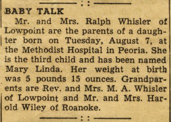
RE: the comment that this user claims to be from this place: http://photos.imageevent.com/mia2kl/treasures/Birth%20Announcement.jpg https://www.facebook.com/mia2kl?ref=tn_tnmn
Mia2kl (talk) 02:51, 10 May 2013 (UTC)
- I redirected Low Point, Illinois to Lowpoint, Illinois :: see Wikipedia:Requests for history merge#Rejected requests November 2016. Anthony Appleyard (talk) 10:10, 20 November 2016 (UTC)
The Story Behind the Name[edit]
Why is it called Low Point? Is it physically lower than the surrounding countryside? 73.45.133.142 (talk) 23:50, 2 March 2018 (UTC)
- Don't know about the name, but it doesn't seem particularly low to me, when I look at The National Map advanced viewer: On IL 89 (which mostly follows the old railroad) from Metamora at 820 feet, Cazenovia is at about 778 feet, which is the highest spot out there; then Richland Creek dips down to 699; within a quarter mile it goes back up to 730, then back down to 690 at the creek that runs along the south side of Lowpoint, then back up again to 714 just past Clark Street in Lowpoint. Except for the creek valleys, it's more or less a slow slide from Banta Road to Washburn; Lowpoint isn't particularly high or low. By the time you get north Washburn, the curve into town is about 710 feet, Snag Creek is 668 feet at the bridge, and downtown Washburn is 680-690 feet; so Lowpoint is higher than Washburn. And the same is about true going east to west: It's about in the middle; the real drop is at the river valley of course: IL 26 is around 470 feet. For the name, a schoolhouse (don't know what name) was built in 1848 and post office (don't know under which name) was established in 1849 according to http://genealogytrails.com/ill/woodford/WoodfordHistory.html (which you can probably find a more original source for). The page doesn't say if the school, post office, or original town plat in 1871 had the name Lowpoint. --Closeapple (talk) 04:21, 3 March 2018 (UTC)
- Closeapple....I have been through Lowpoint many times...had relatives there a number of years ago.......I can tell you with some authority that "Lowpoint" is more of an "emotion" than it is a
- place...so, the name should be and remain "Lowpoint" .. it is certainly not a High point....in topographical terms...and terms of emotion...it is more of a "depression". 67.172.94.75 (talk) 20:25, 26 November 2023 (UTC)