Talk:National Register of Historic Places listings in Center City, Philadelphia
| This article is rated List-class on Wikipedia's content assessment scale. It is of interest to the following WikiProjects: | ||||||||||||||||||||||||||||||||||||||||||||
| ||||||||||||||||||||||||||||||||||||||||||||
new site pic[edit]
Not yet on our list

Photo retries?[edit]
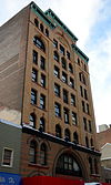
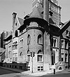
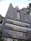
These are photos (many my own) for sites that I'm interested in getting other pix for. Smallbones(smalltalk) 18:13, 11 February 2014 (UTC)
| [1] | Name on the Register | Image | Date listed[2] | Location | Neighborhood[3] | Description |
|---|---|---|---|---|---|---|
| 1 | 1616 Walnut Street Building |  |
October 17, 1983 (#83004247) |
1616 Walnut Street 39°56′59″N 75°10′6.5″W / 39.94972°N 75.168472°W Coordinates missing | Rittenhouse Square East | |
| 2 | Arch Street Opera House |  |
June 13, 1978 (#78002442) |
1003–1005 Arch Street 39°57′13″N 75°9′25″W / 39.95361°N 75.15694°W Coordinates missing | Chinatown | Edwin Forrest Durang, architect |
| 3 | Oliver H. Bair Funeral Home |  |
November 14, 1982 (#82001542) |
1818–1820 Chestnut Street 39°57′6″N 75°10′16″W / 39.95167°N 75.17111°W Coordinates missing | Rittenhouse Square East | |
| 4 | Belgravia Hotel |  |
November 14, 1982 (#82001543) |
1811 Chestnut Street 39°57′7″N 75°10′15″W / 39.95194°N 75.17083°W Coordinates missing | Rittenhouse Square West | Samuel Webber, architect |
| 23 | Cathedral of Saints Peter and Paul |  |
June 24, 1971 (#71000720) |
18th Street and Benjamin Franklin Parkway 39°57′26″N 75°10′7″W / 39.95722°N 75.16861°W Coordinates missing | Logan Square | Napoleon LeBrun, architect |
| 24 | Center City West Commercial Historic District |  |
January 7, 1988 (#87002203) |
Roughly bounded by Chestnut, 15th, Walnut, Sansom, and 21st Streets; also roughly bounded by the Center City West Historic District, S. 15th, Locust St., and S. Sydenham St. 39°56′45″N 75°10′20″W / 39.94583°N 75.17222°W Coordinates missing | Rittenhouse Square | |
| 28 | Church of the Holy Trinity |  |
February 6, 1973 (#73001660) |
19th and Walnut Streets, facing Rittenhouse Square 39°57′1″N 75°10′23″W / 39.95028°N 75.17306°W Coordinates missing | Rittenhouse Square | John Notman, architect |
| 36 | East Center City Commercial Historic District |  |
July 5, 1984 (#84003531) |
Roughly bounded by 6th, Juniper, Market and Locust Streets 39°57′5″N 75°9′33″W / 39.95139°N 75.15917°W Coordinates missing | Washington Square | |
| 44 | First Unitarian Church |  |
May 27, 1971 (#71000724) |
2121 Chestnut Street 39°57′9″N 75°10′35″W / 39.95250°N 75.17639°W Coordinates missing | Rittenhouse Square West | Frank Furness, architect (1883-86). |
| 50 | Globe Ticket Company Building |  |
November 1, 1984 (#84000268) |
112 North 12th Street 39°57′11″N 75°9′28″W / 39.95306°N 75.15778°W Coordinates missing | Chinatown | Destroyed to build the Pennsylvania Convention Center |
| 53 | Heywood Chair Factory |  |
August 23, 1984 (#84003541) |
1010–1014 Race Street 39°57′19″N 75°9′23″W / 39.95528°N 75.15639°W Coordinates missing | Chinatown | Willis G. Hale, architect (1892). |
| 56 | A.J. Holman and Company |  |
May 17, 1984 (#84003544) |
1222–1226 Arch Street 39°57′14″N 75°9′38″W / 39.95389°N 75.16056°W Coordinates missing | Chinatown | |
| 59 | Insurance Company of North America Building |  |
June 2, 1978 (#78002449) |
1600 Arch Street 39°57′16″N 75°10′2″W / 39.95444°N 75.16722°W Coordinates missing | Logan Square | |
| 63 | Larkin-Belber Building |  |
February 27, 2003 (#03000077) |
2200–2218 Arch Street 39°57′20.5″N 75°10′36″W / 39.955694°N 75.17667°W Coordinates missing | Logan Square | |
| 67 | Logan Square |  |
September 14, 1981 (#81000555) |
18th and Race Streets 39°57′28″N 75°10′15″W / 39.95778°N 75.17083°W Coordinates missing | Logan Square | Eyre & McIlvaine, architects. Alexander Stirling Calder, sculptor |
| 68 | Mask and Wig Club of the University of Pennsylvania |  |
November 20, 1979 (#79002323) |
310 South Quince Street 39°56′45.6″N 75°9′37.5″W / 39.946000°N 75.160417°W Coordinates missing | Washington Square West | Wilson Eyre, architect |
| 73 | Clarence B. Moore House |  |
May 8, 1973 (#73001664) |
1321 Locust Street 39°56′53.5″N 75°9′52.5″W / 39.948194°N 75.164583°W Coordinates missing | Washington Square West | Wilson Eyre, architect |
| 75 | Musical Fund Hall |  |
March 11, 1971 (#71000730) |
808 Locust Street 39°56′49″N 75°9′18″W / 39.94694°N 75.15500°W Coordinates missing | Washington Square West | William Strickland, architect of alterations into concert hall. |
| 79 | New York Mutual Life Insurance Company Building |  |
June 6, 1980 (#80003615) |
1001–1005 Chestnut Street 39°57′1″N 75°9′26″W / 39.95028°N 75.15722°W Coordinates missing | Market East | Henry Fernbach, architect (1873-75). |
| 80 | Old City Historic District |  |
May 5, 1972 (#72000093) |
Old city area including parts of Washington Square East Development Area and Franklin Square East Development Area 39°56′58″N 75°8′44″W / 39.94944°N 75.14556°W Coordinates missing | Old City | |
| 89 | Philadelphia Racquet Club |  |
August 1, 1979 (#79002326) |
213–225 South 16th Street 39°56′56″N 75°10′5″W / 39.94889°N 75.16806°W Coordinates missing | Rittenhouse Square East | Horace Trumbauer, architect |
| 92 | Philadelphia Stock Exchange |  |
August 31, 1982 (#82003812) |
1409–1411 Walnut Street 39°56′58.5″N 75°9′54″W / 39.949583°N 75.16500°W Coordinates missing | Rittenhouse Square East | Horace Trumbauer, architects |
| 93 | Physicians and Dentists Building |  |
November 5, 1987 (#87001968) |
1831–1833 Chestnut Street 39°57′7″N 75°10′17.5″W / 39.95194°N 75.171528°W Coordinates missing | Rittenhouse Square West | Wilson Brothers & Company, architects |
| 94 | Pitcairn Building |  |
January 7, 1988 (#87002209) |
1027 Arch Street 39°57′14″N 75°9′27″W / 39.95389°N 75.15750°W Coordinates missing | Chinatown | G. W. & W. D. Hewitt, architects |
| 104 | Ringgold Place |  |
August 29, 1978 (#78002453) |
1900 block of Waverly Street 39°56′46″N 75°10′28″W / 39.94611°N 75.17444°W Coordinates missing | Rittenhouse Square West | |
| 105 | Rittenhouse Historic District |  |
August 25, 1983 (#83002277) |
Roughly bounded by Waverly, 15th, Sanson, Ludlow, 23rd, and 25th Streets; also roughly bounded by the Center City West Historic District, South Twenty-first Street, the original Rittenhouse Historic District, and South Seventeenth Street 39°56′54″N 75°10′15″W / 39.94833°N 75.17083°W Coordinates missing | Rittenhouse Square | Second set of boundaries represents a boundary increase of December 27, 2010 |
| 106 | Rittenhouse Square |  |
September 14, 1981 (#81000557) |
Rittenhouse Square and 18th Street 39°56′57″N 75°10′20″W / 39.94917°N 75.17222°W Coordinates missing | Rittenhouse Square | |
| 110 | St. Clement's Protestant Episcopal Church |  |
November 20, 1970 (#70000555) |
Southwestern corner of 20th and Cherry Streets 39°57′23″N 75°10′23″W / 39.95639°N 75.17306°W Coordinates missing | Logan Square | John Notman, architect |
| 113 | St. Mark's Episcopal Church |  |
April 19, 1982 (#82003815) |
1607–1627 Locust Street 39°56′56″N 75°10′7″W / 39.94889°N 75.16861°W Coordinates missing | Rittenhouse Square East | John Notman, architect |
| 143 | Smyth Young Field Company Building |  |
December 24, 1992 (#92001720) |
1216–1220 Arch Street 39°57′14″N 75°9′37″W / 39.95389°N 75.16028°W Coordinates missing | Chinatown | |
| 117 | Social Service Building |  |
February 20, 2002 (#02000063) |
311 South Juniper Street 39°56′46″N 75°9′49″W / 39.94611°N 75.16361°W Coordinates missing | Washington Square West | Horace Trumbauer, architect |
| 118 | Society Hill Historic District |  |
June 23, 1971 (#71000065) |
Bounded on the north by Walnut St., on the south by Lombard St., on the east by the pier line of the Delaware River, and on the west by 8th 39°56′42″N 75°8′58″W / 39.94500°N 75.14944°W Coordinates missing | Society Hill | |
| 121 | William Strickland Row |  |
September 14, 1977 (#77001192) |
215–227 South 9th Street 39°56′50.5″N 75°9′21″W / 39.947361°N 75.15583°W Coordinates missing | Washington Square West | William Strickland, architect |
| 123 | Thomas Sully Residence |  |
October 15, 1966 (#66000691) |
530 Spruce Street 39°56′42″N 75°9′5″W / 39.94500°N 75.15139°W Coordinates missing | Society Hill | |
| 124 | Sun Oil Building |  |
August 25, 1983 (#83002280) |
1608–1610 Walnut Street 39°56′59″N 75°10′5″W / 39.94972°N 75.16806°W Coordinates missing | Rittenhouse Square East | |
| 135 | The Warwick |  |
August 10, 1978 (#78002460) |
1701 Locust Street 39°56′56″N 75°10′10″W / 39.94889°N 75.16944°W Coordinates missing | Rittenhouse Square East | |
| 137 | Washington Square West Historic District |  |
September 20, 1984 (#84003563) |
Roughly bounded by 8th, Locust, Broad, and Lombard Streets 39°56′44″N 75°9′40″W / 39.94556°N 75.16111°W Coordinates missing | Washington Square West | |
| 138 | WCAU Studios |  |
January 27, 1983 (#83002281) |
1618–1622 Chestnut Street 39°57′4″N 75°10′5″W / 39.95111°N 75.16806°W Coordinates missing | Rittenhouse Square East | |
| 140 | Wesley Building |  |
May 10, 1984 (#84003581) |
1701–1709 Arch Street 39°57′18″N 75°10′5.5″W / 39.95500°N 75.168194°W Coordinates missing | Logan Square | |
| 141 | Witherspoon Building |  |
September 18, 1978 (#78002462) |
1319–1323 Walnut Street 39°56′58″N 75°9′48″W / 39.94944°N 75.16333°W Coordinates missing | Market East | Joseph Miller Huston, architect (1895-97). |
References
- ^ Numbers represent an alphabetical ordering by significant words. Various colorings, defined here, differentiate National Historic Landmarks and historic districts from other NRHP buildings, structures, sites or objects.
- ^ The eight-digit number below each date is the number assigned to each location in the National Register Information System database, which can be viewed by clicking the number.
- ^ "The Political and Community Service Boundaries of Philadelphia" (PDF). Philadelphia City Planning Commission. June 2004.
External links modified (February 2018)[edit]
Hello fellow Wikipedians,
I have just modified one external link on National Register of Historic Places listings in Center City, Philadelphia. Please take a moment to review my edit. If you have any questions, or need the bot to ignore the links, or the page altogether, please visit this simple FaQ for additional information. I made the following changes:
- Added archive https://web.archive.org/web/20110307203302/http://www.philaplanning.org/data/boundaries.pdf to http://www.philaplanning.org/data/boundaries.pdf
When you have finished reviewing my changes, you may follow the instructions on the template below to fix any issues with the URLs.
This message was posted before February 2018. After February 2018, "External links modified" talk page sections are no longer generated or monitored by InternetArchiveBot. No special action is required regarding these talk page notices, other than regular verification using the archive tool instructions below. Editors have permission to delete these "External links modified" talk page sections if they want to de-clutter talk pages, but see the RfC before doing mass systematic removals. This message is updated dynamically through the template {{source check}} (last update: 18 January 2022).
- If you have discovered URLs which were erroneously considered dead by the bot, you can report them with this tool.
- If you found an error with any archives or the URLs themselves, you can fix them with this tool.
Cheers.—InternetArchiveBot (Report bug) 04:45, 14 February 2018 (UTC)
Philadelphia Mint[edit]
The third Philadelphia Mint building, at 17th and Spring Garden, was recently added to this article. This building is not located in Center City (which, according to the Center City, Philadelphia, article, is bounded to the north by Vine Street). The listing belongs in the National Register of Historic Places listings in North Philadelphia article, like other buildings on the south side of Spring Garden, such as the Northern Saving Fund and Safe Deposit Company building (a.k.a. "Banca") and the Pennsylvania State Office Building. TypoBoy (talk) 21:03, 9 June 2021 (UTC)
- I reverted this addition, removing the mint building from the article. I hesitate to add it to the National Register of Historic Places listings in North Philadelphia article, because the cite link didn't work. TypoBoy (talk) 12:35, 12 June 2021 (UTC)
Neighborhood Boundaries[edit]
I've just finished a series of edits fixing some of the neighborhood listings that were off or inconsistent with surrounding buildings. Some remaining edge cases for the neighborhood boundaries:
- Washington Square is listed as Independence Mall, but the Athenaeum (building on the square) is listed as Society Hill. Should we list both as Society Hill (which seems to be often taken to extend to around 8th street) or both as Independence Mall?
- The two listings in Callowhill are not actually in Center City, same with the Juvenile and Domestic Branches of the Municipal Court and Park Towne Place next to Logan Square, as these buildings are all north of Vine Street. I think the thought including them was that they are adjacent to Vine Street, but I would prefer to remove out of consistency (the other Center City district boundaries are respected strictly, including the South Street boundary without any buildings on the other side). Any input on that?
- Broad street is now a clear boundary between Washington Square West and Rittenhouse Square East, but Market East is a little funny -- it includes City Hall and three buildings (Land Title, Witherspoon, and Fidelity-Philadelphia Trust) that are south of Chestnut, while not also including American Baptist Publication Society which is on the same block as Land Title. An alternative is to designate all of these to Rittenhouse Square East or Washington Square West, leaving only City Hall and Broad Street Historic District part of Market East.
- Finally, we need a clear boundary between West/East Rittenhouse Square, currently I used 20th street, placing the square itself in East. Some maps place the boundary around 18th instead, which instead places the square in West. There are 13 buildings on the list on the blocks between 18th and 20th streets.
- Actually, we could rename Rittenhouse Square East to just Rittenhouse Square, and Rittenhouse Square West to Fitler Square? That's more consistent with current usage, in my experience. The only problem is it leaves out the few northern buildings from around Chestnut to Market west of 21st (e.g. First Troop Philadelphia Cavalry Armory), I'm not sure if there is a common name for that neighborhood.
Please post any thoughts here! Cheers Cstanford.math (talk) 06:06, 20 September 2021 (UTC)
- List-Class List articles
- Unknown-importance List articles
- WikiProject Lists articles
- List-Class Pennsylvania articles
- Mid-importance Pennsylvania articles
- List-Class National Register of Historic Places articles
- Mid-importance National Register of Historic Places articles
- List-Class National Register of Historic Places articles of Mid-importance
- List-Class Philadelphia articles
- High-importance Philadelphia articles
- Automatically assessed Philadelphia articles


